Benthic images collected at coral reef sites in Timor-Leste from 2012-2014
Data Set (DS) | Pacific Islands Fisheries Science Center (PIFSC)GUID: gov.noaa.nmfs.inport:46160 | Updated: October 17, 2023 | Published / External
Summary
Short Citation
Pacific Islands Fisheries Science Center, 2024: Benthic images collected at coral reef sites in Timor-Leste from 2012-2014, https://www.fisheries.noaa.gov/inport/item/46160.
Full Citation Examples
Photographs of the seafloor were collected during benthic photo-quadrat surveys conducted by the NOAA Coral Reef Ecosystem Program (CREP) in hard bottom shallow water (< 15 m) habitats in Timor-Leste. Photographs were collected along transects at fixed climate survey sites in October 2012 and September-October 2014 (10 sites and 8 sites, respectively), and during reef fish surveys surveys at 150 sites that were selected using a stratified random sampling design in June 2013.
Climate sites were established by CREP to establish ecological baselines for climate change by measuring multiple features of the coral reef environment (in addition to the data described herein) over time. The reef fish surveys were conducted to generate baseline data on the nearshore coral reef fish assemblages and associated benthic communities around Timor-Leste's north coast and Atauro Island. The photographs can be accessed online via the NOAA National Centers for Environmental Information (NCEI) Ocean Archive.
The imagery from 2013 and 2014 has been quantitatively analyzed using image analysis software to derive an estimate of percent benthic cover. The benthic cover data, and the associated reef fish survey data and parameters measured to establish ecological baselines for climate change are documented separately.
Distribution Information
-
JPEG
Photoquadrat benthic photographs (*.jpg) collected by the NOAA Coral Reef Ecosystem Program (CREP) at survey sites in Timor-Leste in 2012, 2013, and 2014.
-
CSV - Comma Separated Values (Text)
The list of survey sites, including site id, location (latitude/longitude), and survey date, where photoquads were collected in Timor-Leste in 2012.
-
CSV - Comma Separated Values (Text)
The list of survey sites, including site id, location (latitude/longitude), and survey date, where photoquads were collected in Timor-Leste in 2013.
-
CSV - Comma Separated Values (Text)
The list of survey sites, including site id, location (latitude/longitude), and survey date, where photoquads were collected in Timor-Leste in 2014.
None
Please cite NOAA Coral Reef Ecosystem Program (CREP) when using the data.
Suggested citation:
Coral Reef Ecosystem Program; Pacific Islands Fisheries Science Center (2017). Benthic images collected at coral reef sites in Timor-Leste from 2012-2014. NOAA's National Center for Environmental Information, https://www.fisheries.noaa.gov/inport/item/46160
Controlled Theme Keywords
biota
Child Items
No Child Items for this record.
URLs
URL 1
| URL: | https://www.pifsc.noaa.gov/cred/coral_triangle_initiative.php |
|---|---|
| URL Type: |
Online Resource
|
| File Resource Format: | PHP |
| Description: |
Information about the NOAA Coral Reef Ecosystem Program's activities in the Coral Triangle. |
URL 2
| URL: | https://pifscblog.wordpress.com/2012/11/20/final-count-timor-leste/ |
|---|---|
| URL Type: |
Online Resource
|
| File Resource Format: | HTML |
| Description: |
PIFSC CREP blog post, 2012: The final count: Timor-Leste expedition completed |
URL 3
| URL: | https://www.coris.noaa.gov/activities/projects/timor-leste/ |
|---|---|
| URL Type: |
Online Resource
|
| File Resource Format: | HTML |
| Description: |
Timor-Leste project portal on the NOAA Coral Reef Information Service website where NOAA's final report for Timor-Leste and the datasets generated by NOAA CREP as part of the project can be downloaded. |
URL 4
| URL: | https://www.coris.noaa.gov/activities/projects/timor-leste/images/benthic_images_s.jpg |
|---|---|
| URL Type: |
Browse Graphic
|
| File Resource Format: | jpg |
| Description: |
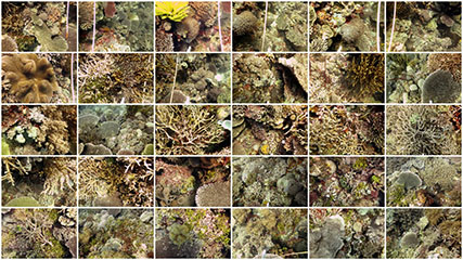
A sample collage of photoquadrat benthic images for one survey site. |
URL 5
| URL: | https://pifscblog.wordpress.com/2013/08/13/final-count-timor-leste-2/ |
|---|---|
| URL Type: |
Online Resource
|
| File Resource Format: | html |
| Description: |
PIFSC CREP blog post, 2013: The final count: summary of mission to assess reef fish assemblages, build capacity in Timor-Leste. |
URL 6
| URL: | https://pifscblog.wordpress.com/2014/09/30/timor-leste-atauro/ |
|---|---|
| URL Type: |
Online Resource
|
| File Resource Format: | HTML |
| Description: |
PIFSC CREP blog post, 2014: Scientists return to Timor-Leste for reef monitoring mission. |