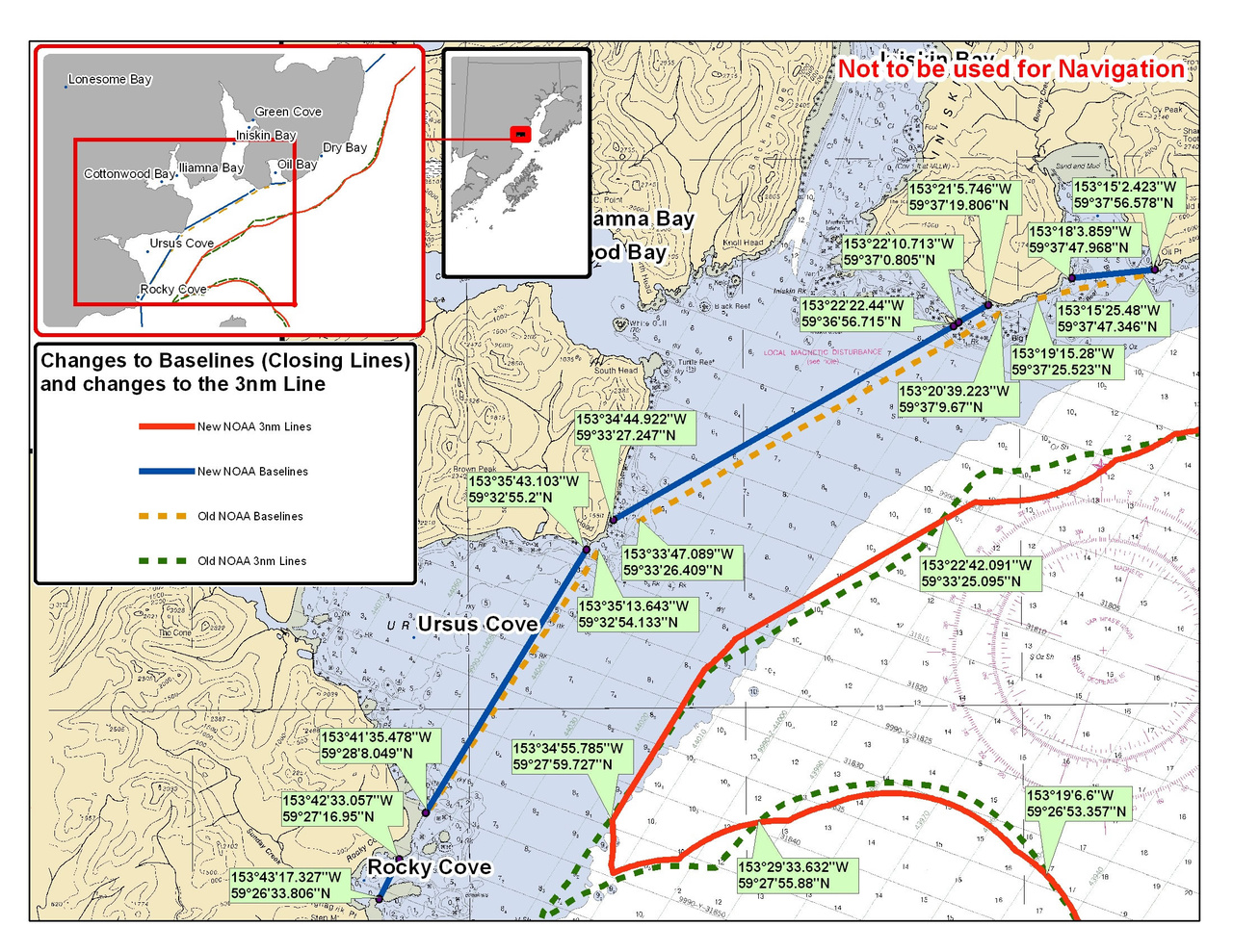
Chart for Iliamna Bay - Cook Inlet - 3nm Line
NOAA navigation charts published between 2006 and October 2011 show changes in the 3 nautical mile (nm) line. The State/Federal fishery management boundary is "the old" 3nm line on this chart. Use this chart if you are fishing in this area.

The State/Federal fishery management boundary is "the old" 3 nm line on this chart. Use this chart if you are fishing in this area.