Chart for Imuya Bay - Alaska Peninsula South - 3nm Line
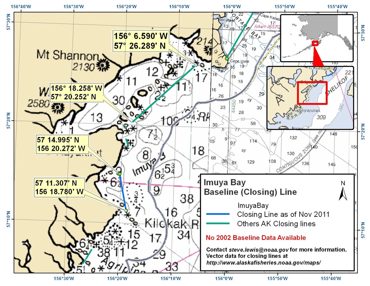
This is an area where the U.S Baseline Committee has made recent recommendations. Use this chartlet if you are fishing in this area.

Imuya Bay is an area where the U.S Baseline Committee has made recent recommendations. Use this chartlet if you are fishing in this area.
NOAA navigation charts published between 2006 and October 2011 show changes in the 3 nautical mile (nm) line. The 3nm line changed because a new method was used to calculate the baseline. For fishery for management and enforcement purposes, the boundary between State of Alaska waters and federal waters is the 3nm line on the pre-2006 NOAA charts, except in specific areas where the U.S Baseline Committee has made recent recommendations.