Displaying 331 - 345 of 1619
Reward Increases to $7,500 For Information on Steller Sea Lions Killed Near Cordova
Cordova District Fishermen United has upped the reward for information leading to a conviction in the case of several deliberately killed Steller sea lions discovered near Cordova last month. The group is adding $5,000 to the $2,500 reward already offered
Vessel Monitoring Systems in Alaska - Federal Register Rules and Notices
Vessel Monitoring System (VMS) requirements in Alaska.
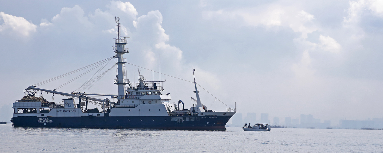
Two-Week Workshop Targets Capacity Building to Prevent IUU Fishing
Combating illegal, unreported, and unregulated fishing is a global responsibility, but many countries lack sufficient knowledge and skills to be an effective partner in the fight against it. In order to address this, the United States has agreed to p
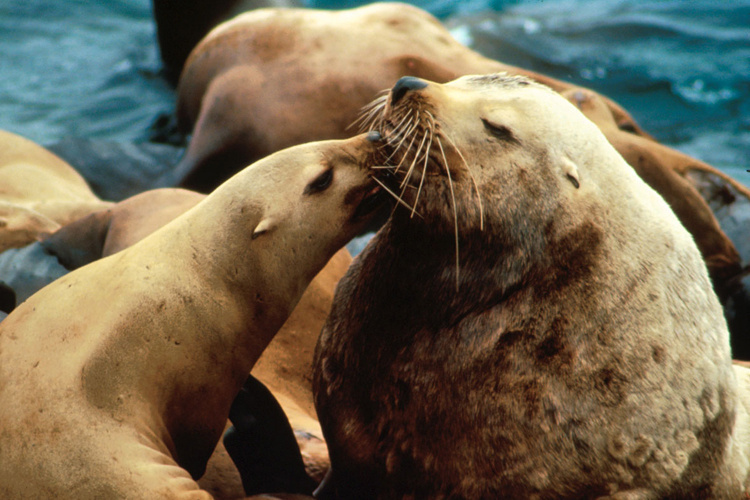
Reward Available for Information About Shooting of Steller Sea Lions in Cordova
Steller Sea Lions are protected under federal law.
Fishers Forum: Climate Change & Fisheries
Join us at the Fishers Forum on Monday, June 24, in Honolulu to learn how climate change is impacting fisheries.
Casey Lohrenz
Casey Lohrenz is the Safety Operations Lead for the Northeast Fishery Observer Program.
Northeast Fisheries Science Center,
Chart for Urilia Bay - Alaska Peninsula North - 3nm Line
NOAA navigation charts published between 2006 and October 2011 show changes in the 3 nautical mile (nm) line. The 3nm line changed because a new method was used to calculate the baseline. For fishery for management and enforcement purposes, the boundary b
Chart for Natoma Bay and Coning Inlet - Southeast - 3nm Line
NOAA navigation charts published between 2006 and October 2011 show changes in the 3 nautical mile (nm) line. The 3nm line changed because a new method was used to calculate the baseline. For fishery for management and enforcement purposes, the boundary b
Chart for Natzuhihi Bay - Southeast - 3nm Line
NOAA navigation charts published between 2006 and October 2011 show changes in the 3 nautical mile (nm) line. The 3nm line changed because a new method was used to calculate the baseline. For fishery for management and enforcement purposes, the boundary b
Chart for Naukati Bay and the Surrounding Area - Southeast - 3nm Line
NOAA navigation charts published between 2006 and October 2011 show changes in the 3 nautical mile (nm) line. The 3nm line changed because a new method was used to calculate the baseline. For fishery for management and enforcement purposes, the boundary b
Chart for Nehenta Bay and Bostwick Inlet and the Surrounding Area - Southeast - 3nm Line
NOAA navigation charts published between 2006 and October 2011 show changes in the 3 nautical mile (nm) line. The 3nm line changed because a new method was used to calculate the baseline. For fishery for management and enforcement purposes, the boundary b
Chart for Nelson Bay and the Surrounding Area - Southeast - 3nm Line
https://www.fisheries.noaa.gov/resource/map/chart-nelson-bay-and-surrounding-area-southeast-3nm-line
NOAA navigation charts published between 2006 and October 2011 show changes in the 3 nautical mile (nm) line. The 3nm line changed because a new method was used to calculate the baseline. For fishery for management and enforcement purposes, the boundary b
Chart for Nichols Bay and the Surrounding Area - Southeast - 3nm Line
NOAA navigation charts published between 2006 and October 2011 show changes in the 3 nautical mile (nm) line. The 3nm line changed because a new method was used to calculate the baseline. For fishery for management and enforcement purposes, the boundary b
Chart for Nossuk Bay and the Surrounding Area - Southeast - 3nm Line
https://www.fisheries.noaa.gov/resource/map/chart-nossuk-bay-and-surrounding-area-southeast-3nm-line
NOAA navigation charts published between 2006 and October 2011 show changes in the 3 nautical mile (nm) line. The 3nm line changed because a new method was used to calculate the baseline. For fishery for management and enforcement purposes, the boundary b
Chart for Patterson Bay - Southeast - 3nm Line
NOAA navigation charts published between 2006 and October 2011 show changes in the 3 nautical mile (nm) line. The 3nm line changed because a new method was used to calculate the baseline. For fishery for management and enforcement purposes, the boundary b