Refine Results
Topic
Species Category
Region

Take Reduction Results

94 results match your filter criteria.

Notice of Intent to Prepare an Environmental Impact Statement on Phase 2 Modifications to the Atlantic Large Whale Take Reduction Plan

NOAA Fisheries intends to begin a rulemaking process to amend the Atlantic Large Whale Take Reduction Plan (Plan) to reduce the risk of mortalities and serious injuries of North Atlantic right whales (Eubalaena glacialis) and other large whales caused…
Published
04/20/2024

South Island Restricted Area

This dataset depicts the boundaries of the South Island Restricted Area in effect annually from February 1-April 30 in ESRI shapefile format for the NOAA Fisheries’ Greater Atlantic Regional Fisheries Office (GARFO).
August 01, 2022 - Map ,

Massachusetts Restricted Area with State Waters Expansion and Wedge Area*

*NOTE: On March 14, 2024, Judge Young of the United States District Court for the District of Massachusetts ruled that the Consolidated Appropriation Act, 2023, bars the Final Wedge Rule until December 31, 2028. The Court determined that the rule is "void and unenforceable." NMFS is reviewing the decision. This dataset depicts the boundaries of the Massachusetts Restricted Area in effect annually from February 1 to April 30 in ESRI shapefile format for the NOAA Fisheries Service’s Greater Atlantic Regional Fisheries Office (GARFO).
August 01, 2022 - Map ,

LMA 1 Restricted Area

This dataset depicts the boundaries of the Lobster Management Area One Restricted Area in effect annually from October 1 to January 31 in ESRI shapefile format for the NOAA Fisheries Service’s Greater Atlantic Regional Fisheries Office (GARFO).
August 01, 2022 - Map ,
Lobster Management Area One Restricted Area

Great South Channel Restricted Area

This dataset depicts the boundaries of the Great South Channel Restricted Area in effect from April 1 to June 30 annually in ESRI shapefile format for the NOAA Fisheries Service’s Greater Atlantic Regional Fisheries Office (GARFO).
August 01, 2022 - Map ,
May
09

Atlantic Large Whale Take Reduction May 2022 Team Meeting

The Atlantic Large Whale Take Reduction Team will hold a virtual meeting from May 9-13 to discuss Phase 2 and Phase 3 amendments to the Take Reduction Plan.

,
Mar
24

Harbor Porpoise Take Reduction Team Meeting

| 4-5:30 p.m.

The Harbor Porpoise Take Reduction Team will meet to review harbor porpoise abundance, bycatch and trends.

,

Northeast Trap/Pot Guide for Atlantic Large Whale Take Reduction Plan

Guide to Atlantic Large Whale Take Reduction Plan regulations for Northeast trap/pot fishermen. Updated March 2022.
March 04, 2022 -

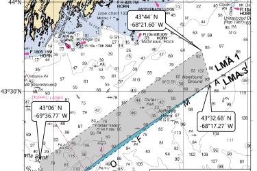
Emergency Restricted Area for the Trap/Pot Fishery: Massachusetts Restricted Area Wedge

NOAA Fisheries is extending a temporary emergency rule to prohibit trap/pot fishery buoy lines between federal and state waters within the Massachusetts Restricted Area (MRA) from February through April 2023 to reduce the incidental mortality and…
,
Effective
04/20/2024

Scoping period for U.S. East Coast gillnet, Atlantic mixed species trap/pot, and Mid-Atlantic lobster and Jonah crab trap/pot fisheries

This scoping period focused on reducing entanglement risk from U.S. East Coast gillnet, Atlantic mixed species trap/pot, and Mid-Atlantic lobster and Jonah crab trap/pot fisheries.