Airborne Gravity Data - Gravity for the Redefinition of the American Vertical Datum (GRAV-D)
Data Set (DS) | National Geodetic Survey (NGS)GUID: gov.noaa.nmfs.inport:39698 | Updated: October 17, 2023 | Published / External
Summary
Short Citation
National Geodetic Survey, 2024: Airborne Gravity Data - Gravity for the Redefinition of the American Vertical Datum (GRAV-D), https://www.fisheries.noaa.gov/inport/item/39698.
Full Citation Examples
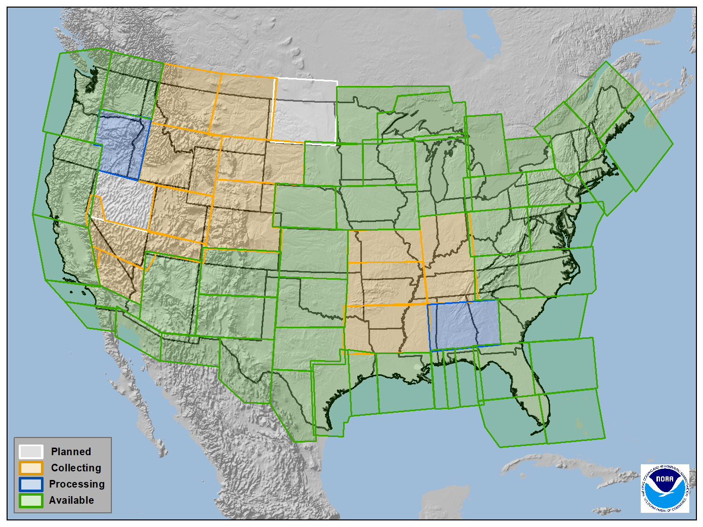
Gravity for the Re-definition of the American Vertical Datum (GRAV-D) is a project initiated by NOAA's National Geodetic Survey to collect and monitor gravity data suitable for the re-definition of the vertical datum for at least the United States and territories. Airborne gravity data will be collected from 2008-2022, processed, and released periodically in geographic blocks. Each block is comprised of one or more surveys. The data will be available at http://www.ngs.noaa.gov/GRAV-D/data_products.shtml in ASCII text format. Some data collection has and will be done in conjunction with partners, such as the US Geological Survey, National Geospatial-Intelligence Agency, Bureau of Land Management, and the Naval Research Laboratory.
Distribution Information
-
Text (Unstructured)
Downloadable Data
None
Must read and fully comprehend the metadata prior to use, acknowledgment of the Originator when using the data set as a source, data should not be used beyond the limits of the source scale
Controlled Theme Keywords
Geodetic Control Theme, GEOID CHARACTERISTICS, GEOPOTENTIAL HEIGHT, geoscientificInformation, GRAVITY/GRAVITATIONAL FIELD, MARINE GRAVITY FIELD, National Geospatial Data Asset, NGDA
Child Items
No Child Items for this record.
URLs
URL 1
| URL: | http://www.ngs.noaa.gov/GRAV-D/data_products.shtml |
|---|---|
| URL Type: |
Online Resource
|
URL 2
| URL: | http://www.ngs.noaa.gov/ |
|---|---|
| URL Type: |
Online Resource
|
URL 3
| URL: | https://geodesy.noaa.gov/GRAV-D/images/GRAVD_thumbnail.png |
|---|---|
| Name: | GRAV-D Blocks Browse Image |
| URL Type: |
Browse Graphic
|
| Description: |
This is a map depicting GRAV-D data collection efforts in CONUS. GRAV-D also has data in or has plans to collect data in Alaska, Hawaii, Puerto Rico, American Samoa, and Guam. Green blocks are complete and data is available for download. Blue blocks are data that is in processing. Orange blocks have partial data collection. White blocks are planned. |