Geodetic Control Information on Passive Marks: Horizontal and Vertical Geodetic Control Data for the United States - National Geospatial Data Asset (NGDA) Geodetic Control Infor...
Data Set (DS) | National Geodetic Survey (NGS)GUID: gov.noaa.nmfs.inport:39738 | Updated: October 17, 2023 | Published / External
Item Identification
| Title: | Geodetic Control Information on Passive Marks: Horizontal and Vertical Geodetic Control Data for the United States - National Geospatial Data Asset (NGDA) Geodetic Control Information on Passive Marks |
|---|---|
| Short Name: | GeodeticControlInformationOnPassiveMarks |
| Status: | Completed |
| Creation Date: | 1746 |
| Revision Date: | 2020 |
| Publication Date: | 2004 |
| Abstract: |
This data contains a set of geodetic control stations maintained by the National Geodetic Survey. Each geodetic control station in this dataset has either a precise Latitude/Longitude used for horizontal control or a precise Orthometric Height used for vertical control, or both.The National Geodetic Survey (NGS) serves as the Nation's depository for geodetic data. The NGS distributes geodetic data worldwide to a variety of users. These geodetic data include the final results of geodetic surveys, software programs to format, compute, verify, and adjust original survey observations or to convert values from one geodetic datum to another, and publications that describe how to obtain and use Geodetic Data products and services. |
| Purpose: |
Provide a base of reference for latitude, longitude and height throughout the United States. |
| Notes: |
1300 |
| Other Citation Details: |
Questions concerning this data may be addressed to the NGS Information Center (ngs.infocenter@noaa.gov) |
Keywords
Theme Keywords
| Thesaurus | Keyword |
|---|---|
| ISO 19115 Topic Category |
elevation
|
| ISO 19115 Topic Category |
location
|
| NGDA Portfolio Themes |
Geodetic Control Theme
|
| NGDA Portfolio Themes |
National Geospatial Data Asset
|
| NGDA Portfolio Themes |
NGDA
|
| UNCONTROLLED | |
| geodesy | benchmark |
| geodesy | ellipsoid height |
| geodesy | geodetic |
| geodesy | Geodetic/Global Positioning |
| geodesy | horizontal control |
| geodesy | latitude |
| geodesy | longitude |
| geodesy | NSRS |
| geodesy | orthometric height |
| geodesy | vertical control |
Spatial Keywords
| Thesaurus | Keyword |
|---|---|
| UNCONTROLLED | |
| None | US |
| None | US Territories |
| None | USA |
Physical Location
| Organization: | National Geodetic Survey |
|---|---|
| City: | Silver Spring |
| State/Province: | MD |
Data Set Information
| Data Set Scope Code: | Data Set |
|---|---|
| Maintenance Frequency: | Continually |
| Data Presentation Form: | diagram |
| Entity Attribute Overview: |
For more information about the datasheet, see this PDF: https://www.ngs.noaa.gov/DATASHEET/dsdata.pdf |
| Entity Attribute Detail Citation: |
All values were obtained from the NGA Datasheetavailable at <https://www.ngs.noaa.gov/datasheets/> |
| Entity Attribute Detail URL: | https://www.ngs.noaa.gov/DATASHEET/dsdata.pdf |
| Distribution Liability: |
The distributor does not assume liability |
| Data Set Credit: | NOAA, National Geodetic Survey and cooperating organizations |
Support Roles
Data Steward
| Date Effective From: | 2004 |
|---|---|
| Date Effective To: | |
| Contact (Organization): | NGS Communications and Outreach Branch |
| Email Address: | ngs.infocenter@noaa.gov |
| Phone: | (301) 713-3242 |
| Fax: | (301) 713-4172 |
Distributor
| Date Effective From: | 2004 |
|---|---|
| Date Effective To: | |
| Contact (Organization): | NGS Communications and Outreach Branch |
| Email Address: | ngs.infocenter@noaa.gov |
| Phone: | (301) 713-3242 |
| Fax: | (301) 713-4172 |
Metadata Contact
| Date Effective From: | 2004 |
|---|---|
| Date Effective To: | |
| Contact (Organization): | NGS Communications and Outreach Branch |
| Email Address: | ngs.infocenter@noaa.gov |
| Phone: | (301) 713-3242 |
| Fax: | (301) 713-4172 |
Point of Contact
| Date Effective From: | 2004 |
|---|---|
| Date Effective To: | |
| Contact (Organization): | NGS Communications and Outreach Branch |
| Email Address: | ngs.infocenter@noaa.gov |
| Phone: | (301) 713-3242 |
| Fax: | (301) 713-4172 |
Extents
| Currentness Reference: | retrieval date |
|---|
Extent Group 1
Extent Group 1 / Geographic Area 1
| W° Bound: | -180 | |
|---|---|---|
| E° Bound: | -60.953117 | |
| N° Bound: | 71.386726 | |
| S° Bound: | 5.330196 |
Spatial Information
Spatial Representation
Representations Used
| Vector: | Yes |
|---|
Vector Representation 1
| Point Object Present?: | Yes |
|---|---|
| Point Object Count: | 1500000 |
Reference Systems
Reference System 1
Coordinate Reference System |
|||||||||||||||||||||||||||||||||||||||||||||||||||||||||||||||||
|
|||||||||||||||||||||||||||||||||||||||||||||||||||||||||||||||||
Reference System 2
Coordinate Reference System |
|||||||||||||||||||||||
|
|||||||||||||||||||||||
Access Information
| Security Class: | Unclassified |
|---|---|
| Security Classification System: |
DOD |
| Security Handling Description: |
none |
| Data Access Procedure: |
These data can be downloaded via several different search methods listed below: PIDs (Permanent IDentifier) - http://www.ngs.noaa.gov/FORMS/help_pid.html CORS SiteID - 4-character identification for a CORS site. Radial Search Rectangular Search Station Name Project Identfier USGS Quad County Load Date; |
| Data Access Constraints: |
Geodetic Data are in the public domain, not restricted from access or distribution. |
| Data Use Constraints: |
Not restricted; Geodetic Data, including software were developed and compiled with U.S. Government funding; no proprietary rights may be attached to them nor may they be sold to the U.S. Government as part of any procurement of ADP products or services. |
| Metadata Access Constraints: |
None |
| Metadata Use Constraints: |
None |
Distribution Information
Distribution 1
| Download URL: | http://www.ngs.noaa.gov/cgi-bin/ds_cors_sf.prl |
|---|---|
| Distributor: | |
| Description: |
Downloadable Data | File Compression: Download options include PC Zip and Unix compressed tar |
| File Type (Deprecated): | ShapeFile |
| Distribution Format: | Shapefile |
| Application Version: | 0.3.0 |
Distribution 2
| Download URL: | http://www.ngs.noaa.gov/cgi-bin/ds_county_sf.prl |
|---|---|
| Distributor: | |
| Description: |
Downloadable Data | File Compression: Download options include PC Zip and Unix compressed tar |
| File Type (Deprecated): | ShapeFile |
| Distribution Format: | Shapefile |
| Application Version: | 0.3.0 |
Distribution 3
| Download URL: | http://www.ngs.noaa.gov/cgi-bin/ds_dates_sf.prl |
|---|---|
| Distributor: | |
| Description: |
Downloadable Data | File Compression: Download options include PC Zip and Unix compressed tar |
| File Type (Deprecated): | ShapeFile |
| Distribution Format: | Shapefile |
| Application Version: | 0.3.0 |
Distribution 4
| Download URL: | http://www.ngs.noaa.gov/cgi-bin/ds_desig_sf.prl |
|---|---|
| Distributor: | |
| Description: |
Downloadable Data | File Compression: Download options include PC Zip and Unix compressed tar |
| File Type (Deprecated): | ShapeFile |
| Distribution Format: | Shapefile |
| Application Version: | 0.3.0 |
Distribution 5
| Download URL: | http://www.ngs.noaa.gov/cgi-bin/ds_mm_sf.prl |
|---|---|
| Distributor: | |
| Description: |
Downloadable Data | File Compression: Download options include PC Zip and Unix compressed tar |
| File Type (Deprecated): | ShapeFile |
| Distribution Format: | Shapefile |
| Application Version: | 0.3.0 |
Distribution 6
| Download URL: | http://www.ngs.noaa.gov/cgi-bin/ds_pid_sf.prl |
|---|---|
| Distributor: | |
| Description: |
Downloadable Data | File Compression: Download options include PC Zip and Unix compressed tar |
| File Type (Deprecated): | ShapeFile |
| Distribution Format: | Shapefile |
| Application Version: | 0.3.0 |
Distribution 7
| Download URL: | http://www.ngs.noaa.gov/cgi-bin/ds_proj_sf.prl |
|---|---|
| Distributor: | |
| Description: |
Downloadable Data | File Compression: Download options include PC Zip and Unix compressed tar |
| File Type (Deprecated): | ShapeFile |
| Distribution Format: | Shapefile |
| Application Version: | 0.3.0 |
Distribution 8
| Download URL: | http://www.ngs.noaa.gov/cgi-bin/ds_quads_sf.prl |
|---|---|
| Distributor: | |
| Description: |
Downloadable Data | File Compression: Download options include PC Zip and Unix compressed tar |
| File Type (Deprecated): | ShapeFile |
| Distribution Format: | Shapefile |
| Application Version: | 0.3.0 |
Distribution 9
| Download URL: | http://www.ngs.noaa.gov/cgi-bin/ds_radius_sf.prl |
|---|---|
| Distributor: | |
| Description: |
Downloadable Data | File Compression: Download options include PC Zip and Unix compressed tar |
| File Type (Deprecated): | ShapeFile |
| Distribution Format: | Shapefile |
| Application Version: | 0.3.0 |
Distribution 10
| Download URL: | https://www.ngs.noaa.gov/datasheets/?Explain=Archived_ShapeFiles |
|---|---|
| Distributor: | |
| Description: |
Downloadable Data | File Compression: Download options include PC Zip and Unix compressed tar |
| File Type (Deprecated): | ShapeFile |
| Distribution Format: | Shapefile |
| Application Version: | 0.3.0 |
URLs
URL 1
| URL: | https://www.ngs.noaa.gov/datasheets/ |
|---|---|
| URL Type: |
Online Resource
|
URL 2
| URL: | https://www.ngs.noaa.gov/datasheets/images/NGSDE2.png |
|---|---|
| Name: | Survey Marks |
| URL Type: |
Browse Graphic
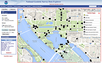
|
Activity Log
Activity Log 1
| Activity Date/Time: | 2014-12-02 |
|---|---|
| Description: |
Date that the source FGDC record was last modified. |
Activity Log 2
| Activity Date/Time: | 2017-04-05 |
|---|---|
| Description: |
Converted from FGDC Content Standards for Digital Geospatial Metadata (version FGDC-STD-001-1998) using 'fgdc_to_inport_xml.pl' script. Contact Tyler Christensen (NOS) for details. |
Activity Log 3
| Activity Date/Time: | 2017-09-13 |
|---|---|
| Description: |
Partial upload of Spatial Info section only. |
Activity Log 4
| Activity Date/Time: | 2017-11-01 |
|---|---|
| Description: |
Replaced entire Lineage section to populate new Source Contribution field. |
Activity Log 5
| Activity Date/Time: | 2018-02-08 |
|---|---|
| Description: |
Partial upload of Positional Accuracy fields only. |
Technical Environment
| Description: |
The data was extracted from NGS datasheets which are available at https://www.ngs.noaa.gov/datasheets/ The NGS datasheet is a text document which summarizes key geodetic information stored in the NGS database. |
|---|
Data Quality
| Accuracy: |
Horizontal control stations (those with precise Latitude, Longitude) were established in accordance with FGDC publications "Standards and Specifications for Geodetic Accuracy Standards" and "Geometric Geodetic Accuracy Standards and Specifications for Using GPS Relative Positioning Techniques" The final Latitude, Longitude of these stations were determined by a least squares adjustments of the horizontal observations. Horizontal control station have Latitude, Longitudes displayed to 5 places and are identified by attribute POS_SRCE = 'ADJUSTED'Lesser quality Latitude, Longitudes may also be preset in the dataset.These are identified by a POS_SRCE attributesHD_HELD1, HD_HELD2, or SCALED.These lesser quality positions are described at:http://www.ngs.noaa.gov/cgi-bin/ds_lookup.prl?Item=SCALEDVertical control stations (those with precise Orthometric Heights) were established in accordance with FGDC publications "Standards and Specifications for Geodetic Accuracy Standards" The final Orthometric Height of these stations were in most cases determined by a least squares adjustments of the vertical observations but in some cases may have been keyed from old survey documents. Vertical control stations have Orthometric Heights displayed to 2 or 3 places and are identified by attribute ELEV_SRCE of ADJUSTED, ADJ UNCH, POSTED,READJUST,N HEIGHT,RESET,COMPUTEDLesser quality Orthometric Heights may also be preset in the dataset.These are identified by a ELEV_SRCE attributesGPS_OBS, VERT_ANG, H_LEVEL, VERTCON, SCALED.These lesser quality orthometric heights are described at:http://www.ngs.noaa.gov/cgi-bin/ds_lookup.prl?Item=SCALEDIMPORTANT - Control stations do not always have both precise Latitude, Longitude AND precise Orthometric Height. A horizontal control station may have a orthometric height associated with it which is of non geodetic quality. These types of heights are displayed to 0, 1, or 2 decimal places. Worst case being off by +/- 1 meter. LIKEWISE - A Vertical control station may have a Latitude, Longitude associated with it which is of non geodetic quality. These types of Latitude, Longitudes are displayed to 0, 1 or 2 decimal places. Worst case being off by +/- 180 meter. Refer to http://www.ngs.noaa.gov/cgi-bin/ds_lookup.prl?Item=SCALEDfor a description of the various type of methods used in determiningthe Latitude, Longitude, and Orthometric Height.Attribute POS_CHECK and ELEV_CHECK indicate whether or not an observational check was made to the position and/or orthometric height. Care should be taken when using "No Check" coordinates.If attribute ELEV_SRCE = 'VERTCON' then the Orthometric Height was determined by applying NGS program VERTCON to an Old NGVD 29 height. In most areas VERTCON gives results to +/- 2 cm. See http://www.ngs.noaa.gov/TOOLS/Vertcon/vertcon.html for a moredetailed explanation of VERTCON accuracy.Ellipsoid Heights are also present in the dataset. The ellipsoid heights consist of those determined using a precise geoid model, which are displayed to 2 decimal places and are considered good to +/- .005 meters, and those displayed to 1 decimal place and are considered only good to +/- .5 meters | Quantitative Value: 95 percent confidence level for geodetic quality data. | Quantitative Test Explanation: Geodetic Data are continuously being processed; their standards and specifications are being reviewed for next publication release. "Standards and Specifications for Geodetic Control Networks", 1984 and "Geometric Geodetic Accuracy Standards and Specifications for Using GPS Relative Positioning Techniques," FGCS (formally FGCC) publication version 5.0 1989, are most current published documents. |
|---|---|
| Horizontal Positional Accuracy: |
The description of tests are explained in "Geometric Geodetic Accuracy Standards and Specifications For Using GPS Relative Positioning Techniques," FGCS (formally FGCC) publication version 5.0, 1989.; Quantitative Value: .05 meters, Test that produced the value: Horizontal positional accuracy statements pertain to horizontal control stations only. i.e. Those with geodetic quality Latitude, Longitudes. Positional Accuracy explanation contained in "Geometric Geodetic Accuracy Standards and Specifications For Using GPS Relative Positioning Techniques," FGCS (formally FGCC) publication version 5.0, 1989, (See table 1, p6). with the exception of Order A and Order B which have an accuracy of as described at: http://www.ngs.noaa.gov/cgi-bin/ds_lookup.prl?Item=HORZ%20ORDER Horizontal Positional Accuracy Value: .05 meters for highest order of accuracy |
| Vertical Positional Accuracy: |
The description of tests are explained in "Geometric Geodetic Accuracy Standards and Specifications for Using GPS Relative Positioning Techniques," FGCS (formally FGCC) publication version 5.0, 1989, (See table 1, p6).; Quantitative Value: .05 meters, Test that produced the value: Vertical positional accuracy statements pertain to vertical control stations only. i.e. Those with geodetic quality Orthometric Heights. Orthometric Height accuracy explanation is contained in FGDC publication "Standards and Specifications for Geodetic Control Networks" with the exception of vertical control of class 0 POSTED and READJUSTED Heights which are described at:http://www.ngs.noaa.gov/cgi-bin/ds_lookup.prl?Item=VERT%20ORDEREllipsoid height accuracy explanation contained in "Geometric Geodetic Accuracy Standards and Specifications for Using GPS Relative Positioning Techniques," FGCS (formally FGCC) publication version 5.0, 1989. (see table 1, p6). The accuracies for ellipsoid heights are described at:http://www.ngs.noaa.gov/cgi-bin/ds_lookup.prl?Item=ELLP%20ORDER Vertical Positional Accuracy Value: .05 meter for highest order of accuracy |
| Completeness Report: |
This dataset DOESN' T include destroyed marks. All other non-publishable marks are NOT included. Non-publishable criteria is available athttp://www.ngs.noaa.gov/cgi-bin/craigs_lib.prl?HELP_NONPUB=1 |
| Conceptual Consistency: |
FGCS sponsored testing in cooperation with equipment manufacturers and National Institutes of Standards and Technology, Gaithersburg, MD 20850 |
Lineage
Sources
"Input Formats and Specifications of the National Geodetic Survey Data Base" published by FGCS (formally FGCC)
| Contact Name: | NOAA, National Geodetic Survey |
|---|---|
| Publish Date: | 2003-01-01 |
| Extent Type: | Discrete |
| Extent Start Date/Time: | 1994 |
| Citation URL: | http://www.ngs.noaa.gov/FGCS/BlueBook/ |
| Source Contribution: |
The geodetic data must be submitted in the digital formats specified in the FGCS (formally FGCC) publication "Input Formats and Specifications of the National Geodetic Survey Data Base" which describes the formats and procedures for submission of data for adjustment and assimilation into the National Geodetic Survey Data Base. Separate volumes of this publication refer to horizontal (volume 1), vertical (volume 2), and gravity (volume 3) control, and are available from NOAA, National Geodetic Survey, 1315 East-West Hwy, Code N/CGS1, Silver Spring, MD, 20910 (1-301-713-3242). Note guidelines for submission of three-dimensional Global Positioning System (GPS) relative positioning data are contained in annex L to volume 1. | Source Geospatial Form: diagram | Type of Source Media: paper, Web |
Process Steps
Process Step 1
| Description: |
The National Geodetic Survey produces geodetic data. Geodetic data comprise the results of geodetic surveys to determine, among other things, latitude, longitude, height, scale, and orientation control. The National Geodetic Survey original field survey project observations and final reports are accessioned into records system of the National Archives and Records Administration of the U.S.A. These surveys provide information valuable for a variety of uses in the mapping, charting and surveying community.The NGS' final product is the geodetic data sheet. Geodetic data sheets are comprehensive summaries of all published information for a given geodetic reference point, including: the geographic position and/or height based on the current reference datum, condition of the survey mark when it was last visited, a description of where the point is located and how to reach it, and an explanation of the terms used in the data sheet. In support of these geodetic data, the NGS provides software, publications, and various user services, including geodetic advisor program, instrument calibration, surveying standards, and technical workshops.This dataset contains certain information extracted from the above mentioned data sheet. |
|---|
Catalog Details
| Catalog Item ID: | 39738 |
|---|---|
| GUID: | gov.noaa.nmfs.inport:39738 |
| Metadata Record Created By: | Tyler Christensen |
| Metadata Record Created: | 2017-04-05 13:07+0000 |
| Metadata Record Last Modified By: | SysAdmin InPortAdmin |
| Metadata Record Last Modified: | 2023-10-17 16:12+0000 |
| Metadata Record Published: | 2022-06-22 |
| Owner Org: | NGS |
| Metadata Publication Status: | Published Externally |
| Do Not Publish?: | N |
| Metadata Last Review Date: | 2022-06-22 |
| Metadata Review Frequency: | 1 Year |
| Metadata Next Review Date: | 2023-06-22 |