SV_SEISMICLINES- Survey Lines along which seismic data were collected aboard R/V RAFAEL (field activities 05001 and 06001) in Apalachicola Bay, FL
Data Set (DS) | Office for Coastal Management (OCM)GUID: gov.noaa.nmfs.inport:47878 | Updated: April 30, 2025 | Published / External
Summary
Short Citation
Office for Coastal Management, 2025: SV_SEISMICLINES- Survey Lines along which seismic data were collected aboard R/V RAFAEL (field activities 05001 and 06001) in Apalachicola Bay, FL, https://www.fisheries.noaa.gov/inport/item/47878.
Full Citation Examples
These data were collected under a cooperative mapping program between the U.S. Geological Survey (USGS), the National Oceanic and Atmospheric Administration Office for Coastal Management (NOAA\OCM), and the Apalachicola National Estuarine Research Reserve (NERR). The primary objectives of this program were to collect marine geophysical data to develop a suite of seafloor maps to better define the extent of oyster habitats, the overall seafloor geology of the bay and provide updated information for management of this resource. In addition to their value for management of the bay's oyster resources, the maps also provide a geologic framework for scientific research and the public.
High-resolution bathymetry, backscatter intensity, and seismic profile data were collected over 230 square kilometers of the floor of the bay. The study focused on the Apalachicola Bay and Western St. George Sound portions of the estuary in mostly in depths > 2.0 meters.
Original contact information:
Contact Name: Brian Andrews
Contact Org: U.S. Geological Survey
Title: Geographer
Phone: 508-548-8700 x2348
Email: bandrews@usgs.gov
Distribution Information
-
FTP download of data files.
None
These data should not be used at resolutions for which they are not intended.
Public domain data from the U.S. Government are freely redistributable with proper metadata and source attribution. Please recognize the U.S. Geological Survey (USGS) as the source of this information.
Controlled Theme Keywords
BENTHIC, COASTAL, ESTUARY, location, oceans, transportation
Child Items
| Type | Title |
|---|---|
| Entity | SV_SeismicLines |
URLs
URL 1
| URL: | https://coast.noaa.gov/digitalcoast/ |
|---|---|
| Name: | NOAA's Office for Coastal Management (OCM) Digital Coast Data section |
| URL Type: |
Online Resource
|
| Description: |
The website provides not only coastal data, but also the tools, training, and information needed to make these data truly useful. Content comes from many sources, all of which are vetted by NOAA. |
URL 2
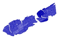
| URL: | http://pubs.usgs.gov/of/2006/1381/GIS/thumbnails/SeismicLines.jpg |
|---|---|
| Name: | Browse Graphic |
| URL Type: |
Browse Graphic
|
| File Resource Format: | JPEG |
| Description: |
JPEG image of seismic tracklines |
Child Items
Rubric scores updated every 15m
| Type | Title |
|---|---|
| Entity | SV_SeismicLines |