Great Lakes Restoration Initiative Great Lakes Mussel Watch(2009-2014)
Data Set (DS) | National Centers for Coastal Ocean Science (NCCOS)GUID: gov.noaa.nmfs.inport:38753 | Updated: May 30, 2023 | Published / External
Summary
Short Citation
National Centers for Coastal Ocean Science, 2025: Great Lakes Restoration Initiative Great Lakes Mussel Watch(2009-2014), https://www.fisheries.noaa.gov/inport/item/38753.
Full Citation Examples
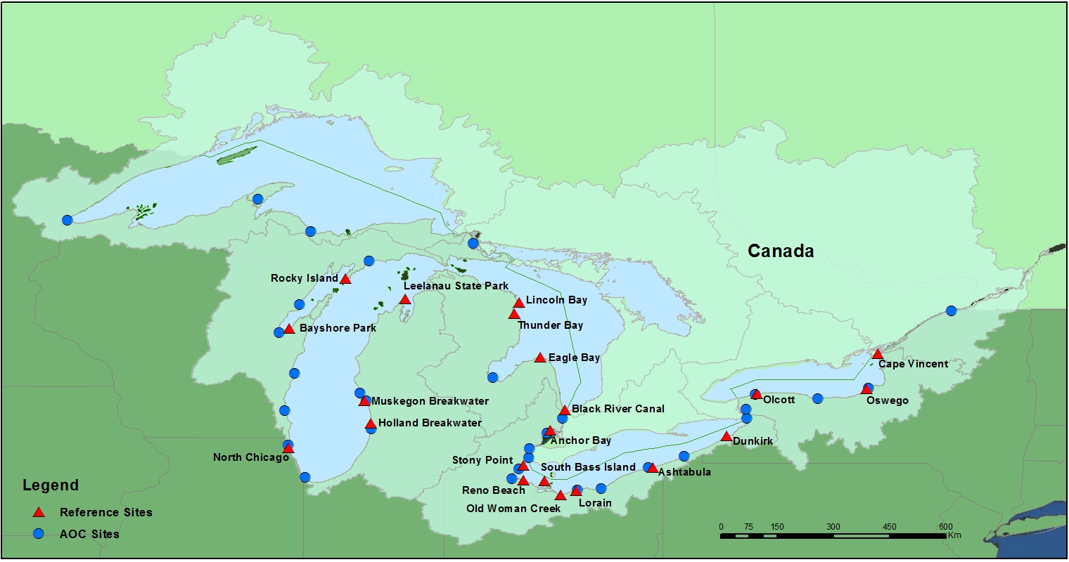
Following the inception of the Great Lakes Restoration Initiative (GLRI) to address the significant environmental issues plaguing the Great Lakes region, the National Centers for Coastal Ocean Science (NCCOS) Mussel Watch Program (MWP)expanded its regional monitoring activities in the Great Lakes in 2009 to include all U.S. Areas of Concern (AOCs). This enhanced effort falls under the "Toxic Substances and Areas of Concern" Focus Area outlined in the GLRI Action Plan (2010-2014).
PurposeThe overall objective of the expanded monitoring is to assess remediation effectiveness, and provide relevant biological data to support decision making for "Beneficial Use Impairment" (BUI) removal and subsequent delisting of AOCs. The stated objective is being addressed through a phased approach utilizing a suite of mussel and sediment indicators at newly established sites within AOCs, and by leveraging the long-term monitoring data at reference sites for meaningful interpretation of AOC status and recovery.
Distribution Information
No Distributions available.
Access Constraints:None
NOAA requests that all individuals who use NOAA data acknowledge the source of these data in any reports, papers, or presentations. If you publish these data, please include a statement similar to: Some or all of the data described in this article were produced by the NOAA's National Centers for Coastal Ocean Science
Controlled Theme Keywords
biota, environment, geoscientificInformation, health, inlandWaters
URLs
Child Items
No Child Items for this record.
URLs
URL 1
| URL: | https://coastalscience.noaa.gov/projects/detail?key=179 |
|---|---|
| URL Type: |
Online Resource
|
URL 2
| URL: | https://products.coastalscience.noaa.gov/collections/ltmonitoring/nsandt/default.aspx |
|---|---|
| URL Type: |
Online Resource
|
URL 3
| URL: | https://www.erma.unh.edu/greatlakes |
|---|---|
| URL Type: |
Online Resource
|
URL 4
| URL: | https://nccospublicstor.blob.core.windows.net/projects-attachments/179/NSandT_GLRI_browse_graphic.jpg |
|---|---|
| URL Type: |
Browse Graphic
|
| File Resource Format: | JPEG |
| Description: |
Map of sampling sites. Within each site there can be multiple sampling stations. |