



Humboldt Bay Benthic Habitats 2009 Aquatic Setting
Data Set (DS) | Office for Coastal Management (OCM)GUID: gov.noaa.nmfs.inport:47851 | Updated: May 30, 2023 | Published / External
Item Identification
| Title: | Humboldt Bay Benthic Habitats 2009 Aquatic Setting |
|---|---|
| Short Name: | ca_hb09-aquatic_Metadata |
| Status: | Completed |
| Publication Date: | 2016 |
| Abstract: |
Humboldt Bay is the largest estuary in California north of San Francisco Bay and represents a significant resource for the north coast region. Beginning in 2007 the Coastal Services Center began collaborating with the California SeaGrant program and other local partners to support an ecosystem-based management (EBM) project for Humboldt Bay. One element of this project was to develop subtidal habitat goals for the long-term management of the bay and provide a framework for conservation and management across the land-sea interface. An aerial imagery-based mapping effort was conducted between 2008 and 2010 which produced a shallow benthic habitat map classified using the Florida System for Classifying Habitats in Estuarine and Marine Environments (SCHEME) system. This effort resulted in a single polygon shapefile which was later converted to the Coastal and Marine Ecological Classification Standard (CMECS)classification and organized into separate feature layers for three CMECS components; geoform, substrate, and biotic. Aquatic setting layers (#1 and #2) were produced to further populate the CMECS data structure. Ancillary data was used to accomplish this process in 2015. Original contact information: Contact Org: NOAA Office for Coastal Management Phone: 843-740-1202 Email: coastal.info@noaa.gov |
| Purpose: |
The data was developed to support ecosystem based management in the Humboldt Bay region. The focus of the mapping was on shallow water benthic habitats with particular concern for eelgrass meadows. This aquatic setting layer was developed to further populate the CMECS structure and to serve as an example data set for other CMECS users. |
| Notes: |
10009 |
| Supplemental Information: |
The study area covers Arcata (North) Bay, Entrance Bay, South Bay and the Eel River Delta, Humboldt County, California. This file geodatabase contains five feature layers corresponding to the CMECS 2012 Aquatic Setting, Geoform, Substrate, and Biotic components. These layers were converted from an earlier version classified according to the System for Classifying Habitats in Estuarine and Marine Environments (SCHEME) using the CMECS Crosswalk Tool. Each feature layer has its own metadata record describing the attributes, and data development methods associated with it. |
Keywords
Theme Keywords
| Thesaurus | Keyword |
|---|---|
| Global Change Master Directory (GCMD) Science Keywords |
EARTH SCIENCE > BIOSPHERE > ECOSYSTEMS > MARINE ECOSYSTEMS > BENTHIC
|
| Global Change Master Directory (GCMD) Science Keywords |
EARTH SCIENCE > BIOSPHERE > ECOSYSTEMS > MARINE ECOSYSTEMS > COASTAL
|
| Global Change Master Directory (GCMD) Science Keywords |
EARTH SCIENCE > BIOSPHERE > ECOSYSTEMS > MARINE ECOSYSTEMS > ESTUARY
|
| ISO 19115 Topic Category |
environment
|
| UNCONTROLLED | |
| None | Aquatic Setting |
| None | Benthic |
| None | Biotic Component |
| None | California SeaGrant |
| None | CMECS |
| None | Coastal and Marine Ecological Classification Standard |
| None | Environmental Monitoring |
| None | Geoform Component |
| None | Habitat |
| None | NOAA |
| None | Substrate Component |
Spatial Keywords
| Thesaurus | Keyword |
|---|---|
| Global Change Master Directory (GCMD) Location Keywords |
CONTINENT > NORTH AMERICA > UNITED STATES OF AMERICA > CALIFORNIA
|
| UNCONTROLLED | |
| None | Arcata Bay |
| None | California |
| None | Eel River Delta |
| None | Entrance Bay |
| None | Humboldt Bay |
| None | South Bay |
| None | U.S. |
Physical Location
| Organization: | Office for Coastal Management |
|---|---|
| City: | Charleston |
| State/Province: | SC |
Data Set Information
| Data Set Scope Code: | Data Set |
|---|---|
| Maintenance Frequency: | As Needed |
| Data Presentation Form: | Map (digital) |
| Distribution Liability: |
NOAA provides no warranty, nor accepts any liability occurring from any incomplete, incorrect, or misleading data, or from any incorrect, incomplete, or misleading use of the data. It is the responsibility of the user to determine whether or not the data is suitable for the intended purpose. |
Support Roles
Data Steward
| Date Effective From: | 2016 |
|---|---|
| Date Effective To: | |
| Contact (Organization): | NOAA Office for Coastal Management (NOAA/OCM) |
| Address: |
2234 South Hobson Ave Charleston, SC 29405-2413 |
| Email Address: | coastal.info@noaa.gov |
| Phone: | (843) 740-1202 |
| URL: | https://coast.noaa.gov |
Distributor
| Date Effective From: | 2016 |
|---|---|
| Date Effective To: | |
| Contact (Organization): | NOAA Office for Coastal Management (NOAA/OCM) |
| Address: |
2234 South Hobson Ave Charleston, SC 29405-2413 |
| Email Address: | coastal.info@noaa.gov |
| Phone: | (843) 740-1202 |
| URL: | https://coast.noaa.gov |
Metadata Contact
| Date Effective From: | 2016 |
|---|---|
| Date Effective To: | |
| Contact (Organization): | NOAA Office for Coastal Management (NOAA/OCM) |
| Address: |
2234 South Hobson Ave Charleston, SC 29405-2413 |
| Email Address: | coastal.info@noaa.gov |
| Phone: | (843) 740-1202 |
| URL: | https://coast.noaa.gov |
Point of Contact
| Date Effective From: | 2016 |
|---|---|
| Date Effective To: | |
| Contact (Organization): | NOAA Office for Coastal Management (NOAA/OCM) |
| Address: |
2234 South Hobson Ave Charleston, SC 29405-2413 |
| Email Address: | coastal.info@noaa.gov |
| Phone: | (843) 740-1202 |
| URL: | https://coast.noaa.gov |
Extents
| Currentness Reference: | Ground Condition |
|---|
Extent Group 1
Extent Group 1 / Geographic Area 1
| W° Bound: | -124.278286 | |
|---|---|---|
| E° Bound: | -124.065296 | |
| N° Bound: | 40.868302 | |
| S° Bound: | 40.675231 |
Extent Group 1 / Time Frame 1
| Time Frame Type: | Discrete |
|---|---|
| Start: | 2016-03-31 |
Spatial Information
Spatial Representation
Representations Used
| Grid: | Yes |
|---|
Access Information
| Security Class: | Unclassified |
|---|---|
| Data Access Constraints: |
None |
| Data Use Constraints: |
None |
Distribution Information
Distribution 1
| Download URL: | ftp://ftp.coast.noaa.gov/pub/benthic/Benthic_Cover_Data/CA_HumboldtBay.zip |
|---|---|
| Distributor: | |
| File Name: | Bulk Download |
| Description: |
FTP download of data files. |
URLs
URL 1
| URL: | https://iocm.noaa.gov/cmecs |
|---|---|
| Name: | CMECS Home Page |
| URL Type: |
Online Resource
|
| Description: |
Information and resources on the CMECS standard and how to apply it |
URL 2
| URL: | https://www.cmecscatalog.org/ |
|---|---|
| Name: | CMECS Catalog |
| URL Type: |
Online Resource
|
| Description: |
Searchable online catalog of CMECS units, descriptions, and source references |
URL 3
| URL: | https://coast.noaa.gov/digitalcoast/ |
|---|---|
| Name: | NOAA's Office for Coastal Management (OCM) Digital Coast Data section |
| URL Type: |
Online Resource
|
| Description: |
The website provides not only coastal data, but also the tools, training, and information needed to make these data truly useful. Content comes from many sources, all of which are vetted by NOAA. |
URL 4
| URL: | https://www.coast.noaa.gov/ |
|---|---|
| Name: | NOAA's Office for Coastal Management (OCM) website |
| URL Type: |
Online Resource
|
| Description: |
Information on the NOAA Office for Coastal Management (OCM) |
URL 5
| URL: | https://coast.noaa.gov/data/Images/Collections/BenthicCover_thumbnail.jpg |
|---|---|
| Name: | Browse Graphic |
| URL Type: |
Browse Graphic
|
| File Resource Format: | JPEG |
| Description: |
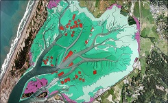
Sample of benthic cover data |
Activity Log
Activity Log 1
| Activity Date/Time: | 2017-03-30 |
|---|---|
| Description: |
Date that the source FGDC record was last modified. |
Activity Log 2
| Activity Date/Time: | 2017-11-14 |
|---|---|
| Description: |
Converted from FGDC Content Standard for Digital Geospatial Metadata (version FGDC-STD-001-1998) using 'fgdc_to_inport_xml.pl' script. Contact Tyler Christensen (NOS) for details. |
Activity Log 3
| Activity Date/Time: | 2018-02-08 |
|---|---|
| Description: |
Partial upload of Positional Accuracy fields only. |
Activity Log 4
| Activity Date/Time: | 2018-04-11 |
|---|---|
| Description: |
Partial upload to move data access FTP links to Distribution Info and remove broken URLs. |
Data Quality
| Accuracy: |
A thematic raster data set classified into three estuarine tidal depth zones was produced from a bathymetric digital elevation model (DEM) which itself is a merge between LIDAR based depths and those obtained through multi-beam acoustic data (hb_5mbth_fus). |
|---|---|
| Horizontal Positional Accuracy: |
The horizontal accuracy has not been independently verified. |
| Completeness Report: |
The spatial resolution of this data is 5 meters (1 pixel is 5m x 5m in size). |
| Conceptual Consistency: |
raster topology present. Every pixel has a label. |
Lineage
Sources
hb_5mbth_fus
| Contact Name: | California State-Monterey Bay and CICORE partnership |
|---|---|
| Publish Date: | 2005-07-29 |
| Extent Type: | Discrete |
| Extent Start Date/Time: | 2005-12-31 |
| Source Contribution: |
Depth classes | Type of Source Media: online |
wc_mllw_navd_m_utm_10_draftv2a.img
| Contact Name: | NOAA Office for Data Management (OCM) |
|---|---|
| Source Contribution: |
Difference in meters between NAVD88 and MLLW elevations | Type of Source Media: offline |
Process Steps
Process Step 1
| Description: |
The hb_5mbth_fus Grid, with z-values referenced to the NAVD88 vertical datum, was added to a NAVD88-MLLW conversion grid to create the aquatic setting raster. The conversion grid (wc_mllw_navd_m_utm_10_draftv2a.img) was produced by OCM staff using the VDATUM tool. Each (500m x 500m) cell of the conversion grid contains the difference between the NAVD88 and MLLW elevation for that cell. The resulting continuous raster was then classified into 3 CMECS tidal depth zones and converted to a thematic raster using ArcMap 10.3 tools. |
|---|---|
| Process Date/Time: | 2016-01-01 00:00:00 |

Catalog Details
| Catalog Item ID: | 47851 |
|---|---|
| GUID: | gov.noaa.nmfs.inport:47851 |
| Metadata Record Created By: | Anne Ball |
| Metadata Record Created: | 2017-11-14 12:57+0000 |
| Metadata Record Last Modified By: | SysAdmin InPortAdmin |
| Metadata Record Last Modified: | 2023-05-30 18:09+0000 |
| Metadata Record Published: | 2018-04-11 |
| Owner Org: | OCM |
| Metadata Publication Status: | Published Externally |
| Do Not Publish?: | N |
| Metadata Last Review Date: | 2018-04-11 |
| Metadata Review Frequency: | 1 Year |
| Metadata Next Review Date: | 2019-04-11 |