Sea Turtle Radio Telemetry Data
Data Set (DS) | Southeast Fisheries Science Center (SEFSC)GUID: gov.noaa.nmfs.inport:30418 | Updated: May 15, 2025 | Published / External
Summary
Short Citation
Southeast Fisheries Science Center, 2025: Sea Turtle Radio Telemetry Data, https://www.fisheries.noaa.gov/inport/item/30418.
Full Citation Examples
Radio transmitters attached to sea turtles captured in various fishing gear enabled us to track and measure surfacing time of each turtle. Determining location of each turtle required detection and direction (bearing) of radio signals simultaneously by two or more receivers in the area. From these bearings, the animal's location is determined via triangulation. Furthermore, because radio signals only transmit in the air, duration of detected signals can be used to determine length of time turtles were spending on the surface of the water.
PurposeRadio transmitters were attached to sea turtles to track movements and determine habitat preference, in addition to determining surfacing intervals.
Distribution Information
-
CSV - Comma Separated Values (Text)
ONLINE RESOURCE
NOAA and NCEI cannot provide any warranty as to the accuracy, reliability, or completeness of furnished data. Users assume responsibility to determine the usability of these data. The user is responsible for the results of any application of this data for other than its intended purpose
Distribution liability: NOAA and NCEI make no warranty, expressed or implied, regarding these data, nor does the fact of distribution constitute such a warranty. NOAA and NCEI cannot assume liability for any damages caused by any errors or omissions in these data. If appropriate, NCEI can only certify that data it distributes are an authentic copy of the records that were accepted for inclusion in the NCEI archives..
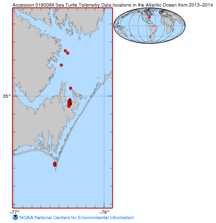
Cite as Mcneill, B. Joanne (2017). Sea turtle acoustic and radio telemetry data in the Atlantic Ocean from 2013-2014 (NCEI Accession 0160089). Version 2.2. NOAA National Centers for Environmental Information. Dataset. [access date]
Controlled Theme Keywords
BIOLOGICAL CLASSIFICATION, REPTILES
URLs
-
Homepage of NCEI Archive Accession 0160089
Child Items
| Type | Title |
|---|---|
| Entity | Radio Telemetry Column Definitions |
| Entity | Sea_turtle_radio_telemetary_data.csv |
URLs
URL 1
| URL: | https://www.ncei.noaa.gov/archive/accession/0160089/2.2/about/0160089_map.jpg |
|---|---|
| Name: | Map File |
| URL Type: |
Browse Graphic
|
| File Resource Format: | .jpg |
| Description: |
Shows where telemetry readings were taken |
URL 2
| URL: | https://accession.nodc.noaa.gov/0160089 |
|---|---|
| Name: | NCEI Archive Accession 0160089 |
| URL Type: |
Online Resource
|
| File Resource Format: | html |
| Description: |
Homepage of NCEI Archive Accession 0160089 |
Child Items
Rubric scores updated every 15m
| Type | Title |
|---|---|
| Entity | Radio Telemetry Column Definitions |
| Entity | Sea_turtle_radio_telemetary_data.csv |