National Coral Reef Monitoring Program: Assessment of fish communities in the Florida Reef Tract from 2018-06-05 to 2018-12-17 (NCEI Accession 0208321)
Data Set (DS) | Southeast Fisheries Science Center (SEFSC)GUID: gov.noaa.nmfs.inport:37041 | Updated: April 1, 2025 | Published / External
Summary
Short Citation
Southeast Fisheries Science Center, 2025: National Coral Reef Monitoring Program: Assessment of fish communities in the Florida Reef Tract from 2018-06-05 to 2018-12-17 (NCEI Accession 0208321), https://www.fisheries.noaa.gov/inport/item/37041.
Full Citation Examples
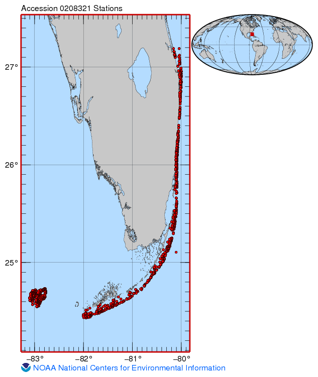
The stationary point count method (7.5m radius cylinder) is used to conduct fish surveys in Florida as part of the National Coral Reef Monitoring Program (NCRMP). This method collects and reports information on species composition, density, size structure, abundance and derived metrics (e.g., species richness, diversity). Data provided in this data set are from three (3) distinct regions along the Florida reef tract; 1) Dry Tortugas, 2) Florida Keys from Key West north to Miami and 3) Miami north to Martin County. Data are collected using a 2-stage, stratified random survey design. Lead agencies involved include the National Oceanic and Atmospheric Administration's Southeast Fisheries Science Center (NOAA Fisheries) and National Centers for Coastal Ocean Science (NCCOS)
PurposeThe National Coral Reef Monitoring Program (NCRMP) details a long-term approach to provide an ecosystem perspective via monitoring climate, fish, benthic, and socioeconomic variables in a consistent and integrated manner. The NCRMP is intended to coordinate various Coral Reef Conservation Coral Reef Program (CRCP) biological, physical, and human dimensions activities into a cohesive NOAA-wide effort. Through the implementation of the NCRMP, NOAA will be able to clearly and concisely communicate results of national-scale monitoring to national, state, and territorial policy makers, resource managers, and the public on a periodic basis.
Distribution Information
Controlled Theme Keywords
BENTHIC, BIOLOGICAL CLASSIFICATION, CORAL REEFS, DOC/NOAA/NESDIS/NCEI, DOC/NOAA/NMFS/SEFSC, DOC/NOAA/NOS/NMS, DOI/NPS, FISH, U-MIAMI/RSMAS
URLs
-
ERDDAP > tabledap > Data Access Form
Dataset Title: CRCP_Reef_Fish_Surveys_Florida
Institution: Coral Reef Conservation Program (Dataset ID: CRCP_Reef_Fish_Surveys_Florida)
I
Child Items
URLs
URL 1
| URL: | https://www.ncei.noaa.gov/erddap/tabledap/CRCP_Reef_Fish_Surveys_Florida.html |
|---|---|
| Name: | ERDDAP Data Access Form - CRCP_Reef_Fish_Surveys_Florida |
| URL Type: |
Online Resource
|
| Description: |
ERDDAP > tabledap > Data Access Form Dataset Title: CRCP_Reef_Fish_Surveys_Florida Institution: Coral Reef Conservation Program (Dataset ID: CRCP_Reef_Fish_Surveys_Florida) I |
URL 2
| URL: | https://www.ncei.noaa.gov/archive/accession/0208321/1.1/about/0208321_map.jpg |
|---|---|
| Name: | Sampling Points NCEI Accession 0208321 |
| URL Type: |
Browse Graphic
|
| File Resource Format: | JPG |
Child Items
Rubric scores updated every 15m