National Coral Reef Monitoring Program: Assessment of coral reef fish communities in the Florida Reef Tract
Data Set (DS) | Southeast Fisheries Science Center (SEFSC)GUID: gov.noaa.nmfs.inport:69159 | Updated: August 11, 2023 | Published / External
Summary

Short Citation
Southeast Fisheries Science Center, 2024: National Coral Reef Monitoring Program: Assessment of coral reef fish communities in the Florida Reef Tract, https://www.fisheries.noaa.gov/inport/item/69159.
Full Citation Examples
DOI: 10.7289/v52n50ks
AbstractCoral reef fish survey data provided in this collection are from three (3) distinct regions along the Florida reef tract; 1) Dry Tortugas, 2) Florida Keys from Key West north to Miami and 3) Miami north to Martin County. These data are collected using a 2-stage, stratified random survey design. The stationary point count method (7.5m radius cylinder) is used to conduct fish surveys in Florida as part of the ongoing National Coral Reef Monitoring Program (NCRMP). This method collects and reports information on species composition, density, size structure, abundance and derived metrics (e.g., species richness, diversity). Lead agencies involved include the National Oceanic and Atmospheric Administration's Southeast Fisheries Science Center (NOAA Fisheries) and National Centers for Coastal Ocean Science (NCCOS).
Distribution Information
-
127.988 MB
Controlled Theme Keywords
BENTHIC, BIOLOGICAL CLASSIFICATION, CORAL REEFS, DOC/NOAA/NESDIS/NCEI, DOC/NOAA/NMFS/SEFSC, DOC/NOAA/NOS/NMS, DOI/NPS, FISH, U-MIAMI/RSMAS
Child Items
URLs
URL 1
| URL: | https://doi.org/10.7289/v52n50ks |
|---|---|
| Name: | Landing Page |
| URL Type: |
Online Resource
|
URL 2
| URL: | https://www.ncei.noaa.gov/erddap/tabledap/CRCP_Reef_Fish_Surveys_Florida.html |
|---|---|
| Name: | CRCP Florida Reef Fish Survey ERDDAP Page |
| URL Type: |
Online Resource
|
URL 3
| URL: | https://www.ncei.noaa.gov/metadata/granule/geoportal/?from=0&size=10&esdsl=%7B%22query%22%3A%7B%22bool%22%3A%7B%22must%22%3A%5B%7B%22query_string%22%3A%7B%22analyze_wildcard%22%3Atrue%2C%22query%22%3A%22fileid%3ANCRMP-Fish-Florida.*%22%7D%7D%5D%7D%7D%7D#searchPanel |
|---|---|
| Name: | NCEI Granule Geoportal |
| URL Type: |
Online Resource
|
| Description: |
RVC Data From NCEI Granule Geoportal |
URL 4
| URL: | https://www.ncei.noaa.gov/archive/accession/0169400/2.2/about/0169400_map.jpg |
|---|---|
| Name: | Sampling Points NCEI Accession 0169400 |
| URL Type: |
Browse Graphic
|
| File Resource Format: | jpg |
URL 5
| URL: | https://www.ncei.noaa.gov/archive/accession/0208321/1.1/about/0208321_map.jpg |
|---|---|
| Name: | Sampling Points NCEI Accession 0208321 |
| URL Type: |
Browse Graphic
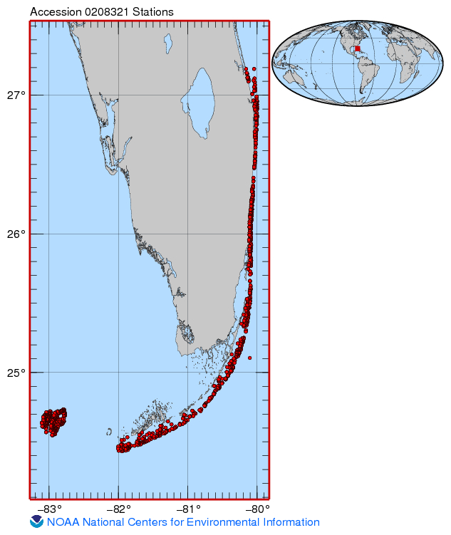
|
URL 6
| URL: | https://www.ncei.noaa.gov/archive/accession/0156445/3.3/about/0156445_map.jpg |
|---|---|
| Name: | Sampling Points NCEI Accession 0156445 |
| URL Type: |
Browse Graphic
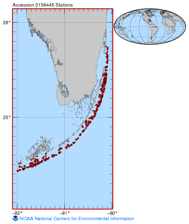
|
URL 7
| URL: | https://www.ncei.noaa.gov/archive/accession/0253454/1.1/about/0253454_map.jpg |
|---|---|
| Name: | Sampling Map For Accession 0253454 |
| URL Type: |
Browse Graphic
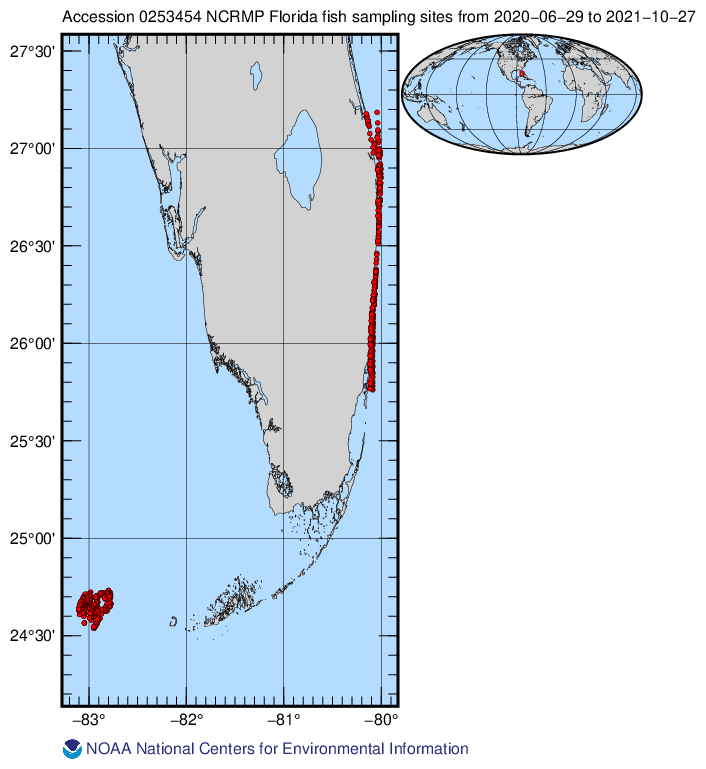
|
Child Items
Rubric scores updated every 15m