National Coral Reef Monitoring Program: Assessment of coral reef fish communities in Puerto Rico from 2014-05-19 to 2014-12-03 and from 2016-06-07 to 2017-09-15 (NCEI Accession...
Data Set (DS) | Southeast Fisheries Science Center (SEFSC)GUID: gov.noaa.nmfs.inport:70448 | Updated: May 15, 2025 | Published / External
Summary
Short Citation
Southeast Fisheries Science Center, 2025: National Coral Reef Monitoring Program: Assessment of coral reef fish communities in Puerto Rico from 2014-05-19 to 2014-12-03 and from 2016-06-07 to 2017-09-15 (NCEI Accession 0224477), https://www.fisheries.noaa.gov/inport/item/70448.
Full Citation Examples
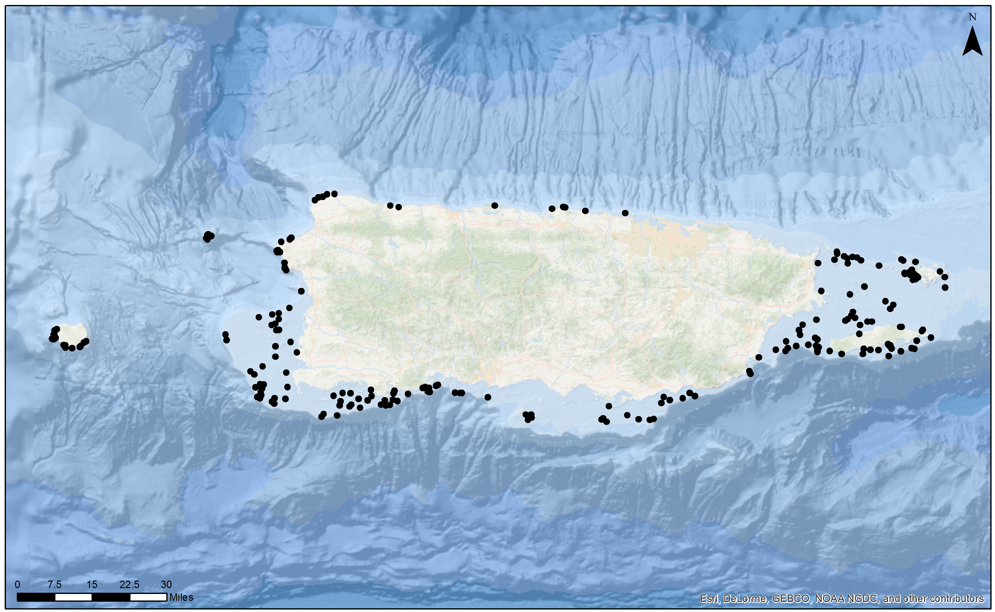
The National Coral Reef Monitoring Program (NCRMP) assessed coral reef communities in in Puerto Rico using the 25m Fish Transect method and stationary point count (Reef Visual Census, RVC) method (7.5m radius cylinder). These methods collects and reports information on species composition, density, size structure, abundance and derived metrics (e.g., species richness, diversity). Data are collected using a random survey design in hardbottom and coral reef habitats less than 30m in depth. All datasets contain data fields on general station information (e.g., survey strata, depth, rugosity). Each of these data tables contain additional survey-specific data fields. For complete information and descriptions of attributes and data fields for all data tables, refer to the data dictionaries. Three datasets are provided under the stationary point count fish protocols and are distributed as one compiled package: (1) Analysis Ready dataset, (2) Boatlog/Station dataset, and (3) raw QAQC'd sample data file. The methodology used for this survey can be found in the point count fish protocols. All three datasets contain data fields on general station information (survey strata, depth, rugosity). Each of these data tables contain additional survey-specific data fields. For complete information and descriptions of attributes and data fields for all data tables, refer to the data dictionaries.
Distribution Information
-
~ (470.052 MB)
None
Controlled Theme Keywords
BENTHIC, BIOLOGICAL CLASSIFICATION, CORAL REEF, CORAL REEFS, DOC/NOAA/NESDIS/NCEI, DOC/NOAA/NMFS/SEFSC, DOC/NOAA/NOS/NCCOS, FISH
Child Items
URLs
URL 1
| URL: | https://www.ncei.noaa.gov/archive/accession/0224477 |
|---|---|
| Name: | NCEI 0224477 Landing Page |
| URL Type: |
Online Resource
|
URL 2
| URL: | https://www.ncei.noaa.gov/archive/accession/0224477/1.1/data/0-data/NCRMP_PR2014-2016_Fish_Updated_Submission/NCRMP_PR2014_Fish_BrowseGraphic.jpg |
|---|---|
| Name: | 2014 Browse Graphic File |
| URL Type: |
Browse Graphic
|
URL 3
| URL: | https://www.ncei.noaa.gov/archive/accession/0224477/1.1/data/0-data/NCRMP_PR2014-2016_Fish_Updated_Submission/NCRMP_PR2016_Fish_BrowseGraphic.jpg |
|---|---|
| Name: | 2016 Browse Graphic File |
| URL Type: |
Browse Graphic

|
Child Items
Rubric scores updated every 15m