Abundance and behavior of parrotfishes (Labridae, Scarinae) in the upper Florida Keys (NCEI accession 0127525)
Data Set (DS) | Southeast Fisheries Science Center (SEFSC)GUID: gov.noaa.nmfs.inport:24177 | Updated: May 15, 2025 | Published / External
Summary
Short Citation
Southeast Fisheries Science Center, 2025: Abundance and behavior of parrotfishes (Labridae, Scarinae) in the upper Florida Keys (NCEI accession 0127525), https://www.fisheries.noaa.gov/inport/item/24177.
Full Citation Examples
To better understand the functional roles of parrotfishes on Caribbean reefs we documented abundance, habitat preferences, and diets of nine species of parrotfishes (Scarus coelestinus, Scarus coeruleus, Scarus guacamaia, Scarus taeniopterus, Scarus vetula, Sparisoma aurofrenatum, Sparisoma chrysopterum, Sparisoma rubripinne, Sparisoma viride) on three high-relief spur-and-groove reefs (Molasses, Carysfort, and Elbow) offshore of Key Largo in the Florida Keys National Marine Sanctuary. On each reef, we conducted fish surveys, behavioral observations, and benthic surveys in three habitat types: high-relief spur and groove (depth 2 - 6 m), low-relief carbonate platform/hardbottom (depth 4 - 12 m), and carbonate boulder/rubble fields (depth 4 - 9 m).In addition, fish surveys were also conducted on a fourth high-relief spur-and-groove reef (French). We estimated parrotfish abundance in each of the three habitat types in order to assess the relative abundance and biomass of different species and to quantify differences in habitat selection. To estimate parrotfish density, we conducted 20 to 30 minute timed swims while towing a GPS receiver on a float on the surface to calculate the amount of area sampled. During a swim the observer would swim parallel with the habitat type being sampled and count and estimate the size to the nearest cm of all parrotfishes > 15 cm in length that were encountered in a 5 m wide swath. To quantify parrotfish behavior, approximately six individuals of each species were observed at each site for 20 min each. Foraging behavior was recorded by a SCUBA diver while towing a GPS receiver (Garmin GPS 72) attached to a surface float, which obtained position fixes of the focal fish at 15 s intervals. Fish were followed from a close distance (~ 2 m when possible), and food items were identified to the lowest taxonomic level possible, with macroalgae and coral usually identified to genus or species. Many bites involved scraping or excavating substrate colonized by a multi-species assemblage of filamentous "turf" algae and crustose coralline algae (CCA). Thus, multiple species of filamentous algae, endolithic algae, and CCA could be harvested in a single bite, and it was impossible to determine the specific species of algae targeted. We also recorded the type of substrate targeted during each foraging bout, categorizing each substrate as one of the following: (1) dead coral, (2) coral pavement, (3) boulder, (4) rubble, or (5) ledge. Dead coral included both convex and concave surfaces on the vertical and horizontal planes of three dimensional coral skeletons (primarily dead Acropora palmata) that were attached to reef substrate. Coral pavement was carbonate reef with little topographic complexity (i.e., flat limestone pavement). Boulder was large remnants of dead mounding corals not clearly attached to the bottom and often partially buried in sand. Coral rubble consisted of small dead coral fragments (generally < 10 cm in any dimension) that could be moved with minimal force. Ledges consisted entirely of the undercut sides of large spurs in the high-relief spur and groove habitat. In order to quantify the relative abundance of different food types, we estimated the percent cover of algae, coral, and other sessile invertebrates on each of the five substrates commonly targeted by parrotfishes (dead coral, coral pavement, boulder, rubble, or ledge) in 0.5 m x 0.5 m photoquadrats. We photographed a total of 8 haphazardly selected quadrats dispersed throughout the study site for each substrate type at each of the three sites (N = 24 quadrats per substrate type, N = 120 quadrats total). Each photoquadrat was divided into sixteen 12 cm x 12 cm sections which were individually photographed, and percent cover was estimated from 9 stratified random points per section (N = 144 point per quadrat).
Distribution Information
-
2.196 MB
Homepage Download of NCEI Accession 127525
None
Dataset credit required.
Cite as: Adam, Thomas C; Kelley, Megan; Ruttenberg, Benjamin I; Burkepile, Deron E (2015). Abundance and behavior of parrotfishes (Labridae, Scarinae) in the upper Florida Keys from 2013-06-19 to 2013-07-30 (NODC Accession 0127525). National Centers for Environmental Information, NOAA. Dataset. [access date]
Controlled Theme Keywords
BENTHIC, biota, CORAL REEFS, Scarus coelestinus, Scarus coeruleus, Scarus guacamaia, Scarus taeniopterus, Scarus vetula, Sparisoma aurofrenatum, Sparisoma chrysopterum, Sparisoma rubripinne, Sparisoma viride
Child Items
| Type | Title |
|---|---|
| Document | 0127525_latlon.txt |
| Document | 0127525_map.jpg |
| Document | 24177xml.xml |
| Entity | Data_dictionary.csv |
| Document | EYR2MY-ISO-19155-2.xml |
| Document | EYR2MY-confirmation_email.txt |
| Document | Herbivory and the resilience of Caribbean coral reefs: knowledge gaps and implications for management |
| Document | Managing herbivores for their impacts on Caribbean coral reef ecosystems: A summary report for managers and practitioners |
| Document | NODC-readme.txt |
| Entity | PF_length_weight_parameters.csv |
| Document | Site Lat Lon.txt |
| Entity | habitat_sampled.csv |
| Document | metadata.txt |
| Entity | pf_counts.csv |
| Entity | pf_feedings.csv |
| Entity | pf_summary.csv |
| Entity | point_contacts.csv |
Keywords
Theme Keywords
| Thesaurus | Keyword |
|---|---|
| Global Change Master Directory (GCMD) Science Keywords |
EARTH SCIENCE > BIOSPHERE > ECOSYSTEMS > MARINE ECOSYSTEMS > BENTHIC
|
| Global Change Master Directory (GCMD) Science Keywords |
EARTH SCIENCE > SOLID EARTH > GEOMORPHIC LANDFORMS/PROCESSES > COASTAL LANDFORMS > CORAL REEFS
|
| ISO 19115 Topic Category |
biota
|
| World Register of Marine Species (WoRMS) |
Scarus coelestinus
|
| World Register of Marine Species (WoRMS) |
Scarus coeruleus
|
| World Register of Marine Species (WoRMS) |
Scarus guacamaia
|
| World Register of Marine Species (WoRMS) |
Scarus taeniopterus
|
| World Register of Marine Species (WoRMS) |
Scarus vetula
|
| World Register of Marine Species (WoRMS) |
Sparisoma aurofrenatum
|
| World Register of Marine Species (WoRMS) |
Sparisoma chrysopterum
|
| World Register of Marine Species (WoRMS) |
Sparisoma rubripinne
|
| World Register of Marine Species (WoRMS) |
Sparisoma viride
|
| UNCONTROLLED | |
| CoRIS Discovery Thesaurus | Numeric Data Sets > Biology |
| CoRIS Theme Thesaurus | EARTH SCIENCE > Biosphere > Ecological Dynamics > Dominance > Keystone Species |
| CoRIS Theme Thesaurus | EARTH SCIENCE > Biosphere > Ecological Dynamics > Herbivory |
| CoRIS Theme Thesaurus | EARTH SCIENCE > Biosphere > Ecological Dynamics > Predation > Coral Predation |
| CoRIS Theme Thesaurus | EARTH SCIENCE > Biosphere > Vegetation > Algae |
| CoRIS Theme Thesaurus | EARTH SCIENCE > Biosphere > Vegetation > Algae > Algal Cover |
| CoRIS Theme Thesaurus | EARTH SCIENCE > Biosphere > Vegetation > Algae > Calcareous Macroalgae |
| CoRIS Theme Thesaurus | EARTH SCIENCE > Biosphere > Vegetation > Algae > Coralline Algae |
| CoRIS Theme Thesaurus | EARTH SCIENCE > Biosphere > Vegetation > Algae > Crustose Coralline Algae |
| CoRIS Theme Thesaurus | EARTH SCIENCE > Biosphere > Vegetation > Algae > Encrusting Macroalgae |
| CoRIS Theme Thesaurus | EARTH SCIENCE > Biosphere > Vegetation > Algae > Fleshy Macroalgae |
| CoRIS Theme Thesaurus | EARTH SCIENCE > Biosphere > Vegetation > Algae > Turf Algae |
| CoRIS Theme Thesaurus | EARTH SCIENCE > Oceans > Marine Biology > Fish |
| CoRIS Theme Thesaurus | EARTH SCIENCE > Oceans > Marine Biology > Fish > Fish Assemblages |
| CoRIS Theme Thesaurus | EARTH SCIENCE > Oceans > Marine Biology > Fish > Fish Behavior |
| CoRIS Theme Thesaurus | EARTH SCIENCE > Oceans > Marine Biology > Fish > Fishing |
| CRCP Project | 182 |
| CRCP Project | The Importance of Parrotfish (fam. Scaridae) on the Maintenance and Recovery of Coral-Dominated Reefs |
| NCEI ACCESSION NUMBER | 0127525 |
| NCEI ACCESSION NUMBER | 127525 |
| NODC COLLECTING INSTITUTION NAMES | University of California - Santa Barbara |
| NODC COLLECTING INSTITUTION NAMES | US DOC; NOAA; NMFS; Southeast Fisheries Science Center |
| NODC PROJECT NAMES | Coral Reef Conservation Program (CRCP) |
| NODC PROJECT NAMES | Coral Reef Information System (CoRIS) |
| NODC PROJECT NAMES | CORAL REEF STUDIES |
| NODC SUBMITTING INSTITUTION NAMES | University of California - Santa Barbara |
| WMO_CategoryCode | Oceanography |
Spatial Keywords
| Thesaurus | Keyword |
|---|---|
| Global Change Master Directory (GCMD) Location Keywords |
OCEAN > ATLANTIC OCEAN > NORTH ATLANTIC OCEAN
|
| Global Change Master Directory (GCMD) Location Keywords |
OCEAN > ATLANTIC OCEAN > NORTH ATLANTIC OCEAN > GULF OF AMERICA
|
| UNCONTROLLED | |
| CoRIS Place Thesaurus | COUNTRY/TERRITORY > United States of America > Florida > Monroe County > Carysfort Reef (25N080W0013) |
| CoRIS Place Thesaurus | COUNTRY/TERRITORY > United States of America > Florida > Monroe County > Elbow Reef (25N080W0020) |
| CoRIS Place Thesaurus | COUNTRY/TERRITORY > United States of America > Florida > Monroe County > French Reef (25N080W0022) |
| CoRIS Place Thesaurus | COUNTRY/TERRITORY > United States of America > Florida > Monroe County > Key Largo (25N080W0010) |
| CoRIS Place Thesaurus | COUNTRY/TERRITORY > United States of America > Florida > Monroe County > Molasses Reef (25N080W0003) |
| CoRIS Place Thesaurus | OCEAN BASIN > Atlantic Ocean > North Atlantic Ocean > Florida Reef Tract > Upper Florida Keys > Carysfort Reef (25N080W0013) |
| CoRIS Place Thesaurus | OCEAN BASIN > Atlantic Ocean > North Atlantic Ocean > Florida Reef Tract > Upper Florida Keys > Elbow Reef (25N080W0020) |
| CoRIS Place Thesaurus | OCEAN BASIN > Atlantic Ocean > North Atlantic Ocean > Florida Reef Tract > Upper Florida Keys > French Reef (25N080W0022) |
| CoRIS Place Thesaurus | OCEAN BASIN > Atlantic Ocean > North Atlantic Ocean > Florida Reef Tract > Upper Florida Keys > Key Largo (25N080W0010) |
| CoRIS Place Thesaurus | OCEAN BASIN > Atlantic Ocean > North Atlantic Ocean > Florida Reef Tract > Upper Florida Keys > Molasses Reef (25N080W0003) |
| NODC SEA AREA NAMES | Florida Keys National Marine Sanctuary |
| None | Gulf of Mexico |
Instrument Keywords
| Thesaurus | Keyword |
|---|---|
| Global Change Master Directory (GCMD) Instrument Keywords |
CAMERA > CAMERA
|
| Global Change Master Directory (GCMD) Instrument Keywords |
GPS RECEIVERS > GPS RECEIVERS
|
| Global Change Master Directory (GCMD) Instrument Keywords |
VISUAL OBSERVATIONS > VISUAL OBSERVATIONS
|
| UNCONTROLLED | |
| NODC INSTRUMENT TYPES | camera |
| NODC INSTRUMENT TYPES | swimmer/diver |
| NODC INSTRUMENT TYPES | visual observation |
URLs
URL 1
| URL: | https://dx.doi.org/10.3354/meps11170 |
|---|---|
| Name: | Mar Ecol Prog Ser 520:1-20 |
| URL Type: |
Online Resource
|
| Description: |
Journal article derived in part from this data set. Adam TC, Burkepile DE, Ruttenberg BI, Paddack MJ (2015) Herbivory and the resilience of Caribbean coral reefs: knowledge gaps and implications for management. Mar Ecol Prog Ser 520:1-20 |
URL 2
| URL: | https://www.ncei.noaa.gov/archive/accession/0127525 |
|---|---|
| Name: | Home Page for NCEI Accession 0127525 |
| URL Type: |
Online Resource
|
| Description: |
Abundance and behavior of parrotfishes (Labridae, Scarinae) in the upper Florida Keys from 2013-06-19 to 2013-07-30 (NCEI Accession 0127525) |
URL 3
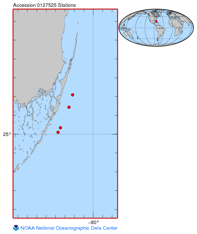
| URL: | https://www.ncei.noaa.gov/archive/accession/0127525/1.1/about/0127525_map.jpg |
|---|---|
| Name: | Data Set Sampling Locations |
| URL Type: |
Browse Graphic
|
| File Resource Format: | jpg |
| Description: |
Sampling locations For Data Set Abundance and behavior of parrotfishes (Labridae, Scarinae) in the upper Florida Keys from 2013-06-19 to 2013-07-30 (NCEI Accession 0127525) |
Child Items
Rubric scores updated every 15m
| Type | Title |
|---|---|
| Document | 0127525_latlon.txt |
| Document | 0127525_map.jpg |
| Document | 24177xml.xml |
| Entity | Data_dictionary.csv |
| Document | EYR2MY-ISO-19155-2.xml |
| Document | EYR2MY-confirmation_email.txt |
| Document | Herbivory and the resilience of Caribbean coral reefs: knowledge gaps and implications for management |
| Document | Managing herbivores for their impacts on Caribbean coral reef ecosystems: A summary report for managers and practitioners |
| Document | NODC-readme.txt |
| Entity | PF_length_weight_parameters.csv |
| Document | Site Lat Lon.txt |
| Entity | habitat_sampled.csv |
| Document | metadata.txt |
| Entity | pf_counts.csv |
| Entity | pf_feedings.csv |
| Entity | pf_summary.csv |
| Entity | point_contacts.csv |