CRCP-Comparative status of extant Acropora cervicornis NCEI Accession 0127933
Data Set (DS) | Southeast Fisheries Science Center (SEFSC)GUID: gov.noaa.nmfs.inport:24307 | Updated: April 1, 2025 | Published / External
Summary
Short Citation
Southeast Fisheries Science Center, 2025: CRCP-Comparative status of extant Acropora cervicornis NCEI Accession 0127933, https://www.fisheries.noaa.gov/inport/item/24307.
Full Citation Examples
This project was funded for two years by CRCP (FY13-14) and built upon one year of pilot work conducted in FY12 funded by NMFS-SEFSC and SERO as an NRC postdoctoral research fellowship (Huntington). The goals of the project were to characterize natural, robust Acropora cervicornis populations in different regions, including various aspects of A. cervicornis condition, function (growth and tissue condition), and resident fish assemblages. To this end, we conducted surveys at sites in four regions (i.e., Dry Tortugas, Southeast Florida, Belize, USVI) designed to span the range of natural A. cervicornis density present each region. In addition, we conducted similar surveys within restored populations of at two sites in Puerto Rico with high density restored populations. Lastly, we undertook three hypothesis-driven studies in the Dry Tortugas region only, to investigate the potential for positive feedbacks between the sheltering reef fish community and high density stands of A. cervicornis. A macroagal bioassay was used to determine the relative bioavailability of nutrients in the water surrounding high density versus low density stands of A. cervicornis. Wild tissue collections of A. cervicornis occurred at these same sites to compare nutrient concentration and zooxanthellae density within colonies.
Distribution Information
-
4.512 MB
download of all files in gzip format
None
Controlled Theme Keywords
Acropora cervicornis, CORAL REEF, CORAL REEFS, DOC/NOAA/NESDIS/NCEI, DOC/NOAA/NESDIS/NODC, DOC/NOAA/NMFS/SEFSC, MACROALGAE (SEAWEEDS)
Child Items
Keywords
Theme Keywords
| Thesaurus | Keyword |
|---|---|
| Global Change Master Directory (GCMD) Data Center Keywords |
DOC/NOAA/NESDIS/NCEI > National Centers for Environmental Information, NESDIS, NOAA, U.S. Department of Commerce
|
| Global Change Master Directory (GCMD) Data Center Keywords |
DOC/NOAA/NESDIS/NODC > National Oceanographic Data Center, NESDIS, NOAA, U.S. Department of Commerce
|
| Global Change Master Directory (GCMD) Data Center Keywords |
DOC/NOAA/NMFS/SEFSC > Southeast Fisheries Science Center, National Marine Fisheries Service, NOAA, U.S. Department of Commerce
|
| Global Change Master Directory (GCMD) Science Keywords |
EARTH SCIENCE > BIOLOGICAL CLASSIFICATION > PLANTS > MACROALGAE (SEAWEEDS)
|
| Global Change Master Directory (GCMD) Science Keywords |
EARTH SCIENCE > BIOSPHERE > ECOSYSTEMS > MARINE ECOSYSTEMS > REEF > CORAL REEF
|
| Global Change Master Directory (GCMD) Science Keywords |
EARTH SCIENCE > LAND SURFACE > GEOMORPHIC LANDFORMS/PROCESSES > COASTAL LANDFORMS > CORAL REEFS
|
| World Register of Marine Species (WoRMS) |
Acropora cervicornis
|
| UNCONTROLLED | |
| CoRIS Discovery Thesaurus | Numeric Data Sets > Biology |
| CoRIS Theme Thesaurus | EARTH SCIENCE > Oceans > Marine Biology > Fish > Fish Census |
| CoRIS Theme Thesaurus | EARTH SCIENCE > Biosphere > Zoology > Corals |
| CoRIS Theme Thesaurus | EARTH SCIENCE > Biosphere > Zoology > Corals > Coral Growth |
| CoRIS Theme Thesaurus | EARTH SCIENCE > Biosphere > Zoology > Corals > Coral Nutrition |
| CoRIS Theme Thesaurus | EARTH SCIENCE > Biosphere > Zoology > Corals > Reef Monitoring and Assessment > Benthos Analysis > Transect monitoring |
| CRCP Project | 819 |
| CRCP Project | Determining patterns of staghorn coral recovery to establish targets for Caribbean reef restoration |
| NCEI ACCESSION NUMBER | 0127933 |
| NCEI ACCESSION NUMBER | 127933 |
| NODC COLLECTING INSTITUTION NAMES | US DOC; NOAA; NMFS; Southeast Fisheries Science Center; Miami, FL Laboratory |
| NODC DATA TYPES | CORAL - COLONY SIZE |
| NODC DATA TYPES | CORAL |
| NODC DATA TYPES | FISH - CORAL REEF |
| NODC DATA TYPES | FISH CENSUS |
| NODC DATA TYPES | MACROALGAE |
| NODC OBSERVATION TYPES | in situ |
| NODC OBSERVATION TYPES | benthic |
| NODC OBSERVATION TYPES | biological |
| NODC OBSERVATION TYPES | survey - biological |
| NODC OBSERVATION TYPES | survey - coral reef |
| NODC OBSERVATION TYPES | survey - swimmer/diver |
| NODC OBSERVATION TYPES | visual observation |
| NODC PROJECT NAMES | CORAL REEF STUDIES |
| NODC PROJECT NAMES | Coral Reef Conservation Program (CRCP) |
| NODC SUBMITTING INSTITUTION NAMES | US DOC; NOAA; NMFS; Southeast Fisheries Science Center; Miami, FL Laboratory |
Temporal Keywords
| Thesaurus | Keyword |
|---|---|
| UNCONTROLLED | |
| None | 2012-2014 |
Spatial Keywords
| Thesaurus | Keyword |
|---|---|
| Global Change Master Directory (GCMD) Location Keywords |
OCEAN > ATLANTIC OCEAN > NORTH ATLANTIC OCEAN
|
| Global Change Master Directory (GCMD) Location Keywords |
OCEAN > ATLANTIC OCEAN > NORTH ATLANTIC OCEAN > CARIBBEAN SEA
|
| Global Change Master Directory (GCMD) Location Keywords |
OCEAN > ATLANTIC OCEAN > NORTH ATLANTIC OCEAN > GULF OF AMERICA
|
| UNCONTROLLED | |
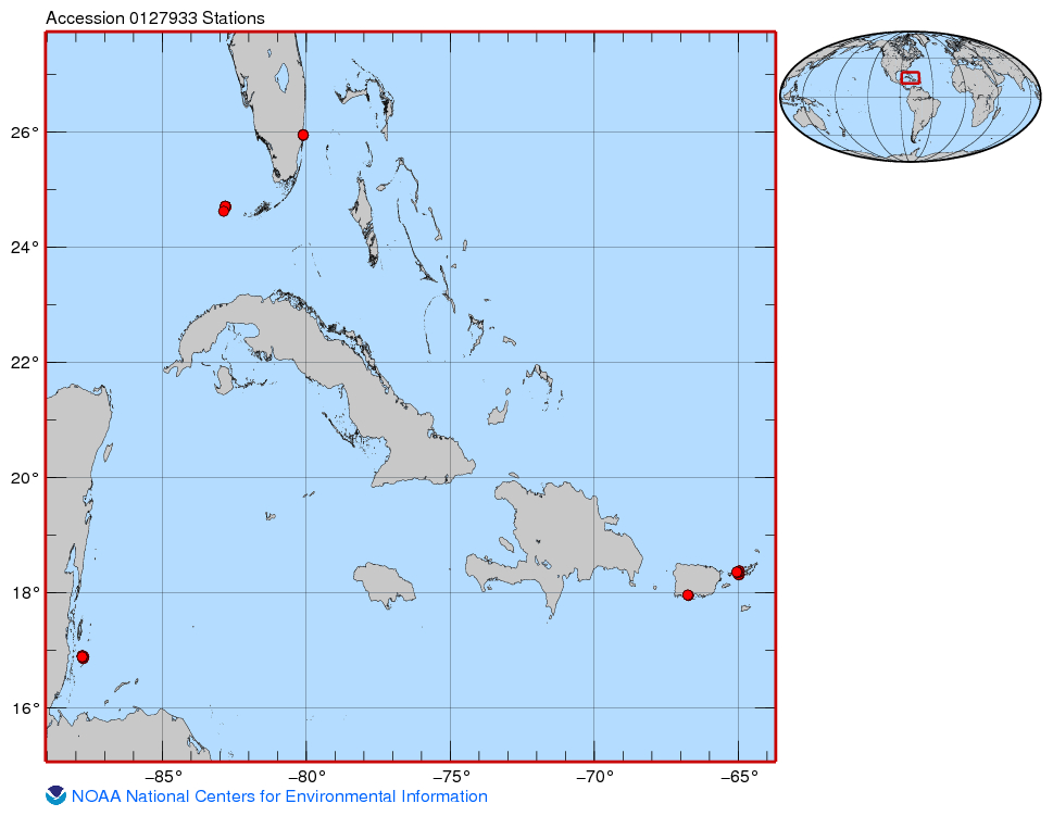
| CoRIS Place Thesaurus | COUNTRY/TERRITORY > Belize > Belize > Glovers Reef (16N087W0001) |
| CoRIS Place Thesaurus | COUNTRY/TERRITORY > United States of America > Florida > Dade County > Miami (25N080W0018) |
| CoRIS Place Thesaurus | COUNTRY/TERRITORY > United States of America > Florida > Monroe County > Dry Tortugas > Pulaski Shoal (24N082W0003) |
| CoRIS Place Thesaurus | COUNTRY/TERRITORY > United States of America > Puerto Rico > Ponce (17N066W0010) |
| CoRIS Place Thesaurus | COUNTRY/TERRITORY > United States of America > U. S. Virgin Islands > St. Thomas > St. Thomas (18N064W0033) |
| CoRIS Place Thesaurus | OCEAN BASIN > Atlantic Ocean > Caribbean Sea /North Atlantic Ocean > Puerto Rico > Ponce (17N066W0010) |
| CoRIS Place Thesaurus | OCEAN BASIN > Atlantic Ocean > Caribbean Sea > Belizean Barrier Reef > Glovers Reef (16N087W0001) |
| CoRIS Place Thesaurus | OCEAN BASIN > Atlantic Ocean > Caribbean Sea > Virgin Islands > Leeward Islands > St. Thomas (18N064W0033) |
| CoRIS Place Thesaurus | OCEAN BASIN > Atlantic Ocean > North Atlantic Ocean > Florida Reef Tract > Dry Tortugas > Pulaski Shoal (24N082W0003) |
| CoRIS Place Thesaurus | OCEAN BASIN > Atlantic Ocean > North Atlantic Ocean > Florida Reef Tract > Miami (25N080W0018) |
Instrument Keywords
| Thesaurus | Keyword |
|---|---|
| Global Change Master Directory (GCMD) Instrument Keywords |
VISUAL OBSERVATIONS > VISUAL OBSERVATIONS
|
| UNCONTROLLED | |
| NODC INSTRUMENT TYPES | scale |
| NODC INSTRUMENT TYPES | swimmer/diver |
| NODC INSTRUMENT TYPES | visual analysis |
| NODC INSTRUMENT TYPES | visual observation |
URLs
URL 1
| URL: | https://www.ncei.noaa.gov/archive/accession/0127933 |
|---|---|
| Name: | Landing Pages Accession 127933 |
| URL Type: |
Online Resource
|
| File Resource Format: | html |
| Description: |
Miller, Margaret; Huntington, Brittany (2015). Coral, fish and other data to inform staghorn coral recovery in the Caribbean Sea from 2012-04-05 to 2014-07-28 (NCEI Accession 0127933). |
URL 2
| URL: | https://www.ncei.noaa.gov/archive/accession/0127933/1.1/about/0127933_map.jpg |
|---|---|
| Name: | Sampling Map For Accession 127933 |
| URL Type: |
Browse Graphic
|
| File Resource Format: | JPG |
Child Items
Rubric scores updated every 15m