Fish survey data from Uva Island reef, Panama
Data Set (DS) | Southeast Fisheries Science Center (SEFSC)GUID: gov.noaa.nmfs.inport:24251 | Updated: October 3, 2024 | Published / External
Summary
Short Citation
Southeast Fisheries Science Center, 2025: Fish survey data from Uva Island reef, Panama, https://www.fisheries.noaa.gov/inport/item/24251.
Full Citation Examples
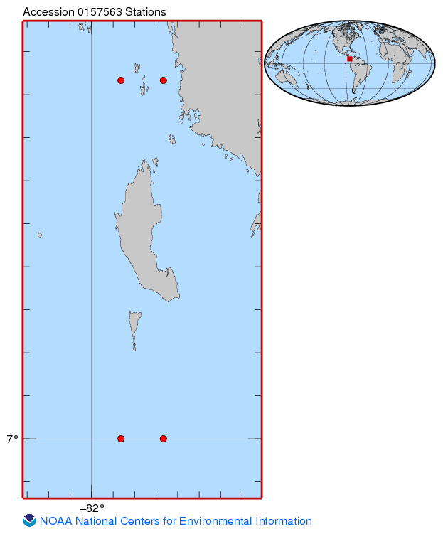
This project examines an eastern Pacific fish assemblage associated with a 2.5 hectare coral reef located within the boundaries of Coiba National Park, Panama. From 1980 to 2010, consistent, quantitative coral reef and fish survey monitoring methods have been applied at Uva Island reef, which lies in area that has received virtually no fishing pressure or watershed development over the past 80 years. Data stored in Excel files.
PurposeTo examine for climate effects on a relatively undisturbed reef fish assemblage.
Distribution Information
-
NCEI Download Landing Page for this data set.
The file is the current tar file containing all files in the archive.
This may change if archived files are updated.
None
Please cite appropriately
Controlled Theme Keywords
biota, DOC/NOAA/NESDIS/NCEI, DOC/NOAA/NESDIS/NODC, DOC/NOAA/NMFS/SEFSC, environment, FISH, oceans
URLs
-
CRCP Project#: 20513-2010 Evaluating climate effects on a coral reef fish community: analysis of a 30-year ecological monitoring effort. Unpublished report, submitted to the Coral Reef Conservation Program, May 11, 2011.
-
Fish survey data from Uva Island reef, Panama collected between 1980 and 2010 (NCEI Accession 0157563)
Child Items
| Type | Title |
|---|---|
| Document | 0157563_lonlat.txt |
| Document | 0157563_map.jpg |
| Document | 2017 NOAA Data Management Plan |
| Document | K23AJB-confirmation_email.txt |
| Document | K23AJB-report.txt |
| Document | Long-term patterns of diversity and abundance in an eastern Pacific reef fish assemblage : reef fish response to coral recovery |
| Entity | Metadata_Table.csv |
| Document | NCEI Journal File |
| Entity | UVA_fish_2010_Study.csv |
URLs
URL 1
| URL: | https://www.ncei.noaa.gov/data/oceans/coris/library/NOAA/CRCP/project/20513/20513_FR_Serafy_05_2011-1.pdf |
|---|---|
| Name: | Long-term patterns of diversity and abundance in an eastern Pacific reef fish assemblage : reef fish response to coral recovery : final report |
| URL Type: |
Online Resource
|
| File Resource Format: | |
| Description: |
CRCP Project#: 20513-2010 Evaluating climate effects on a coral reef fish community: analysis of a 30-year ecological monitoring effort. Unpublished report, submitted to the Coral Reef Conservation Program, May 11, 2011. |
URL 2
| URL: | https://www.ncei.noaa.gov/archive/accession/0157563 |
|---|---|
| Name: | Landing Page For NCEI Accession 0157563 |
| URL Type: |
Online Resource
|
| Description: |
Fish survey data from Uva Island reef, Panama collected between 1980 and 2010 (NCEI Accession 0157563) |
URL 3
| URL: | https://www.ncei.noaa.gov/archive/accession/0157563/1.1/about/0157563_map.jpg |
|---|---|
| Name: | Sampling Map For Accession 0157563 |
| URL Type: |
Browse Graphic
|
Child Items
Rubric scores updated every 15m
| Type | Title |
|---|---|
| Document | 0157563_lonlat.txt |
| Document | 0157563_map.jpg |
| Document | 2017 NOAA Data Management Plan |
| Document | K23AJB-confirmation_email.txt |
| Document | K23AJB-report.txt |
| Document | Long-term patterns of diversity and abundance in an eastern Pacific reef fish assemblage : reef fish response to coral recovery |
| Entity | Metadata_Table.csv |
| Document | NCEI Journal File |
| Entity | UVA_fish_2010_Study.csv |