Amendment 15 to the 2006 Consolidated HMS Fishery Management Plan: Spatial Fisheries Management and Electronic Monitoring Cost Allocation
Summary
NOAA Fisheries explored management options for two broad components of the longline fisheries:
- Modification, data collection, and assessment of four commercial longline spatial management areas.
- Administration and funding of the highly migratory species pelagic longline electronic monitoring program.
Spatial Management
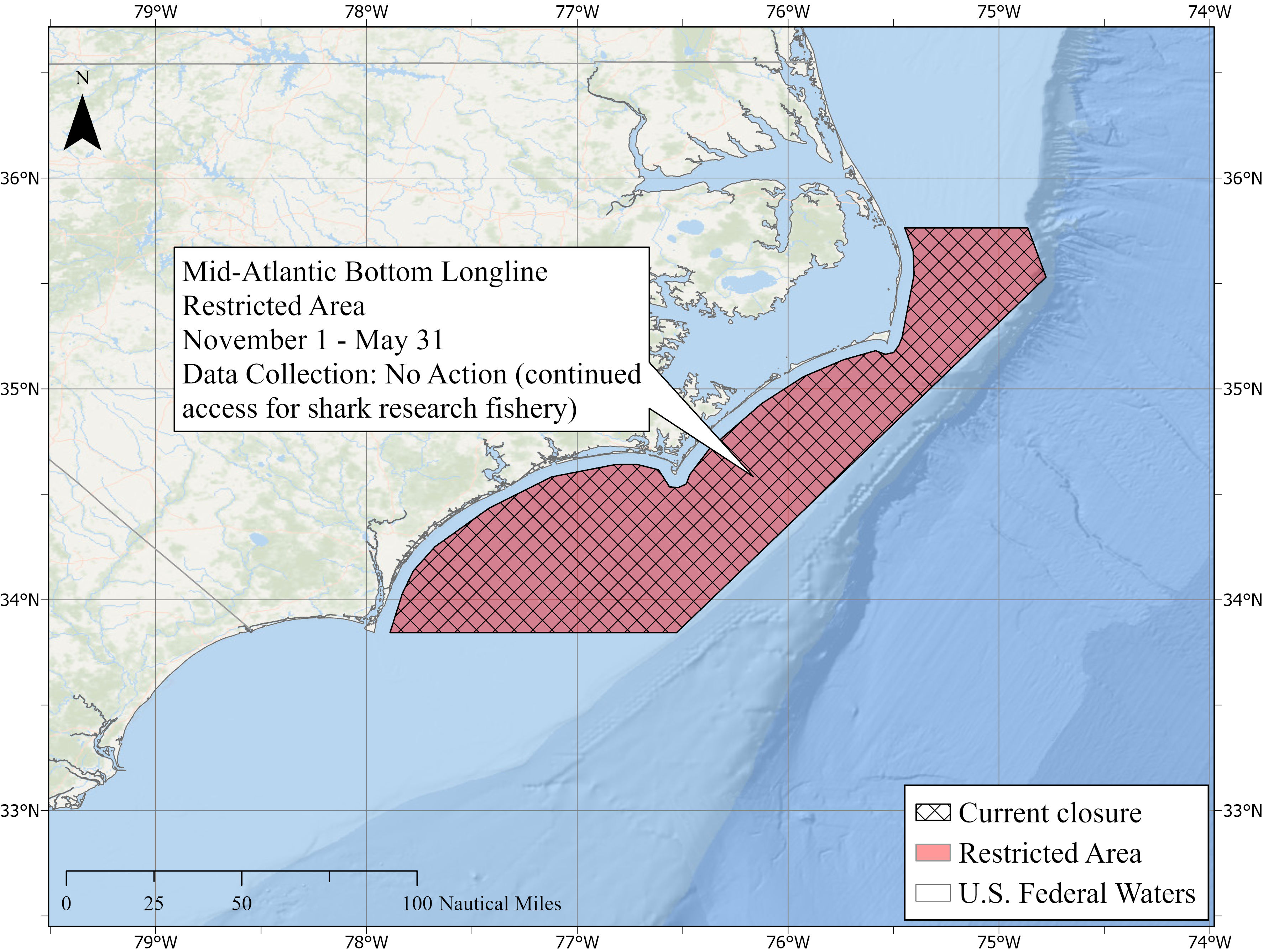
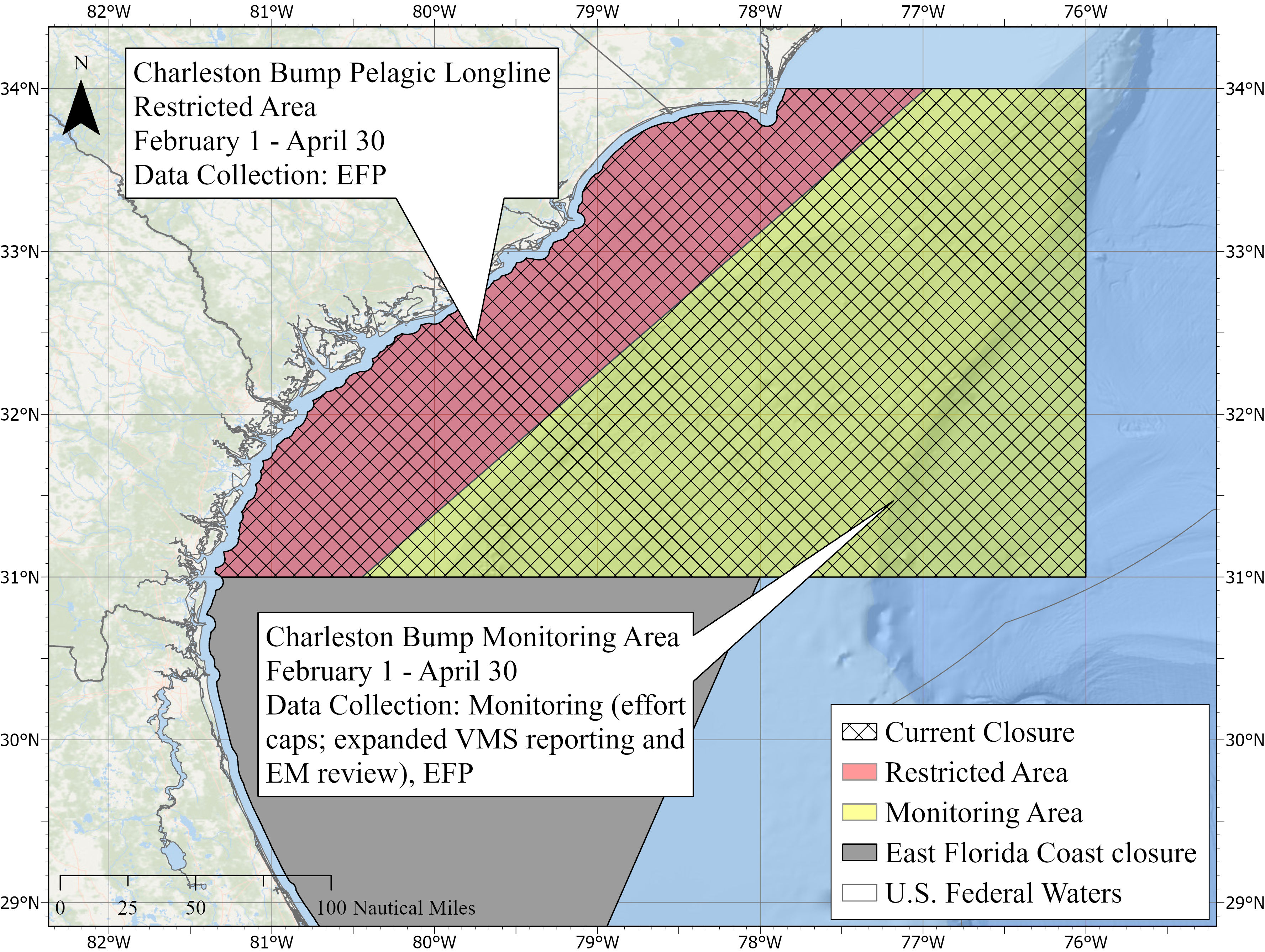
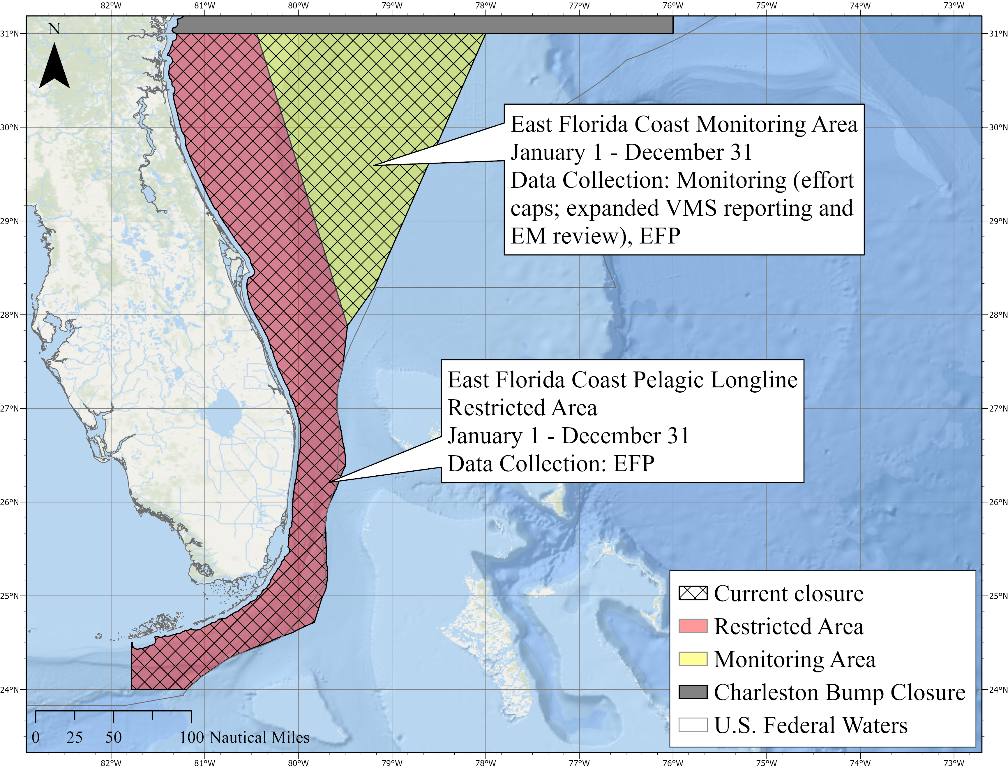
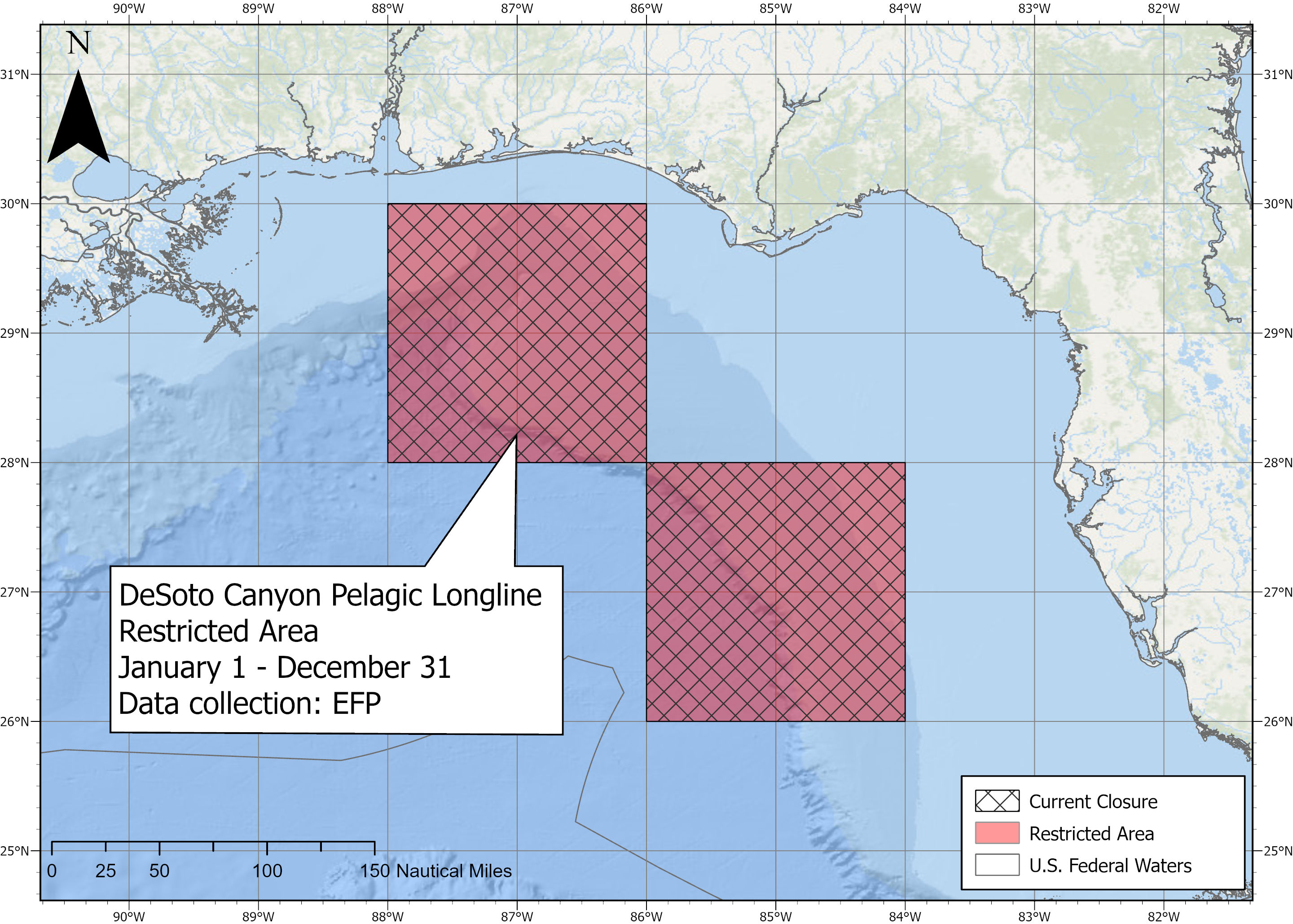
Amendment 15 modifies the boundaries and/or temporal extents of four spatial management areas that restrict commercial longline fishing (Mid-Atlantic Shark, Charleston Bump, East Florida Coast, and DeSoto Canyon closed areas). These modifications will more efficiently protect bycatch species and would allow for data collection to support analyses on the areas’ effectiveness. These new boundaries include the creation of monitoring areas within offshore portions of Charleston Bump and East Florida Coast.
Management Area | Modifications to Management Areas |
| Mid-Atlantic Bottom Longline Spatial Management Area | Area redesignated as the “Mid-Atlantic Bottom Longline Restricted Area.” Restricted area in effect from Nov. 1 – May 31. |
| Charleston Bump Pelagic Longline Spatial Management Area | Spatial Management Area divided into two zones. The inshore portion is designated as the “Charleston Bump Pelagic Longline Restricted Area.” The offshore portion is designated as the “Charleston Bump Monitoring Area.” Restricted and Monitoring Areas in effect from Feb. 1 – Apr. 30. |
| East Florida Coast Pelagic Longline Spatial Management Area | Spatial Management Area divided into two zones. The inshore portion is designated as the “East Florida Coast Pelagic Longline Restricted Area.” The offshore portion is designated as the “East Florida Coast Monitoring Area.” Restricted and Monitoring Areas remain in effect year-round. |
| DeSoto Canyon Pelagic Longline Spatial Management Area | Area redesignated as the “DeSoto Canyon Pelagic Longline Restricted Area.” Restricted area remains in effect year-round. |
Monitoring areas are special fishing access areas that aid data collection to assess the efficacy of Charleston Bump and East Florida Coast Monitoring Areas in meeting conservation and management needs. Monitoring area fishing effort is limited via effort caps (Charleston Bump: 380 sets Feb. 1 - Apr. 30; East Florida Coast: 250 sets annually). Those choosing to fish within monitoring areas are subject to the following requirements:
- VMS-hail out requirements
- Bycatch species reporting via VMS
- Enhanced EM video review (50% of sets) on trips that fished in monitoring areas, paid for by vessel owners if they choose to fish in the monitoring areas.
As special access areas, monitoring areas can be closed early and/or not reopened if conditions warrant.
Pelagic Longline Electronic Monitoring Program
Based on public comment, NOAA Fisheries will take no action on fleet-wide Electronic Monitoring cost allocation for the pelagic longline fishery at this time. Many of the comments from the industry and EM vendors indicated that the proposed modification to the EM program warrants further consideration. However, NOAA Fisheries intends to initiate future rulemaking to consider modifications to the program. Some components of the EM cost allocation preferred alternative in the DEIS would apply in the monitoring areas described above.
Federal Register
Supporting Materials
- Final Environmental Impact Statement (PDF, 704 pages)
- Amendment 15 Maps and Shapefiles
- Draft Amendment 15 and Draft Environmental Impact Statement (DEIS)
- HMS Predictive Spatial Modeling (PRiSM)
- HMS PRiSM Methodology Publication
- Center of Independent Experts (CIE) Review of DEIS
- Scoping and Issues and Options Paper
- Scoping Meeting Presentation
- Amendment 15 Public Hearing Posters
- Draft Spatial Management Story Map
- Draft Electronic Monitoring Cost Allocation Infographic