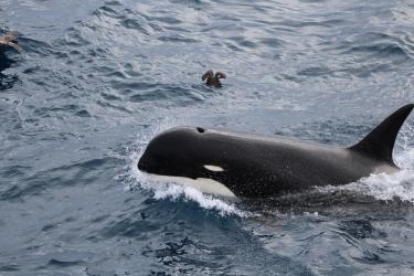
There are thousands of small islands that comprise Alaska’s Aleutian Island chain, but only a few dozen significant passes among those islands. These passes are important bottlenecks for water exchange among the North Pacific, Gulf of Alaska, and the Bering Sea. However, until now there has been limited detail on estimates of pass location, size, shape, length, and depth.
“Flow estimates have been based on rough pass size estimates from over 50 years ago,” said Mark Zimmermann, fisheries biologist from the Alaska Fisheries Science Center. “We have updated information for eastern, western and central passes along the Aleutian Island chain. This new information will help oceanographers and ecologists better quantify impacts of water flow on Alaska marine ecosystems and better understand environmental and ecological changes that are taking place.”
Size of Passes Differ from Historic and More Recent Estimates
Two new NOAA Fisheries’ studies provide more detail on the size and extent of the passes and the shoreline around the Aleutian Islands.
One study showed that all of the western-most Aleutian passes, from Kavalga to Semichi, are larger (18 to 71 percent) than previously reported. The last study was conducted for this area in the 1960s. This includes Amchitka Pass (+23 percent), the largest in the Aleutians.
The other study focused on the easternmost pass, False Pass, which posed a particular challenge for co-author Zimmermann. False Pass is unusual: it’s the only Aleutian pass that directly connects the shallow shelves of the western Gulf of Alaska and eastern Bering Sea. It is also the only pass with constricted southern and northern openings. We found this pass to have a single northern inlet to the Bering Sea—however, until recently it had two. This conflicts with current navigational charts, depicting two inlets to the Bering Sea now, compared to just one on the older charts (1926–1943).
“Our analysis of eastern pass sizes compared to the results of the 1960s study generated mixed results,” said Zimmermann. “In some cases, our pass size estimates were larger while in other cases they were smaller than previous estimates.”
In 2005, NOAA scientists updated information on some of the eastern and central passes. When Zimmermann looked at the two eastern passes from that study, he found that they were actually larger than previously thought. He also found that five central Aleutian passes were smaller than reported. The earlier study did not examine western pass sizes. The new studies include much more detailed information about the seafloor and shoreline that was not available at the time of the earlier analyses. As a result, they will be a great new resource for oceanographers and ecologists studying marine systems.

Historic Maps Provide More Detail of Aleutian Passes
Zimmermann and co-author Megan Prescott used bathymetric maps of the Aleutians that they produced from historical hydrographic survey documents from the 1930s-40s called smooth sheets. Originally available only as archived paper documents, the smooth sheets were scanned into digital form and the depth soundings were digitized into text files.
Prescott, a partner on both projects, added depth and other data collected from single and multi-beam sonar (acoustic) surveys conducted by NOAA over the past several decades. She also digitized information from the inshore areas from the smooth sheets. She added necessary details about geographic features, such as shorelines, rocks, islets, and rocky reefs in these areas that allowed full, new shore-to-shore pass size estimates.
“These geographic features sometimes have depths associated with them that are often missed or digitalized incorrectly. Also, some areas of the Aleutians have never been charted, and we did our best to fill in those gaps with available data sets,” said Prescott.

Key Geographic Features Play Role in Northward Water Flow
There are three major bathymetric features that influence the northward water flow from the North Pacific to the Arctic:
- Aleutian Island passes
- Canyons along the Bering Sea slope
- Shallow waters of Bering Strait
In 2018, Zimmermann and Prescott published a map and defined the canyon thalwegs of the eastern Bering Sea slope. Thalwegs are the lines of lowest elevation within an underwater valley. Under international law, a thalweg is the middle of the primary navigable channel of a waterway that defines the boundary line between states. These remote and infrequently studied canyons are among the largest canyons in the world, providing important conduits for deep-water flow onto the Bering Sea shelf.
In this current project, the scientists updated a draft Aleutian bathymetry map they produced in 2013. Cumulatively, the new version represents about 8,000 hours of mapping work, providing more complete information on pass locations and pass size estimates. This information can be used to recalculate pass flow estimates.
Next, Zimmermann hopes to conduct a detailed bathymetric map of the Bering Strait.
“The Aleutian passes are important, but small and rarely studied oceanographic features that impact the ecosystem of the far larger Bering Sea, ultimately influencing the Arctic and contributing to global ocean circulation,” said Zimmermann. “This is the first project in many years to critically re-examine seafloor influence of transport through the Aleutian passes.”