Lobster/Jonah Crab Minimum Traps Per Trawl: Maine Zone A
This map shows the new minimum traps per trawl requirements for Maine Zone A put in place by the 2021 amendments to the Atlantic Large Whale Take Reduction Plan.
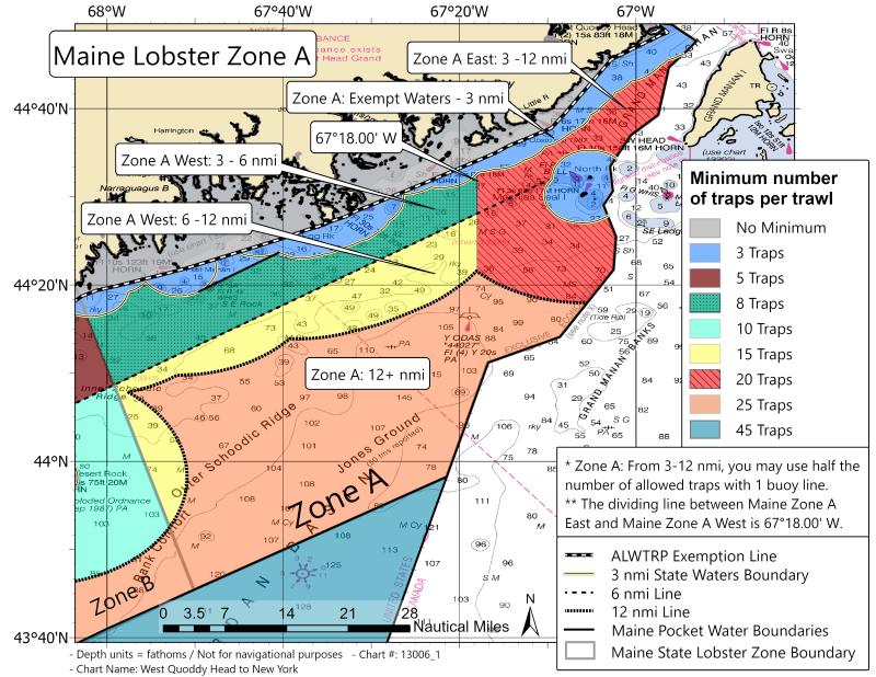
This map shows the new minimum traps per trawl requirements for Maine Zone A, effective May 1, 2022.
Zone A Description from Maine DMR Chapter 25.94
Eastern Line - International Boundary Line Canada and U.S. (Maine) extending to and following the Exclusive Economic Zone boundary to the point where it intersects with the Eastern boundary of lobster Zone B.
Western Line - The Southern tip of Schoodic Point at 44° 19.900’ N and 068° 03.609’ W and running due South 180° Magnetic to 43° 45.427’ N and 067° 50.122’ W, and then continuing South 180° magnetic to the Exclusive Economic Zone boundary.