Lobster/Jonah Crab Minimum Traps Per Trawl: Maine Zone G
This map shows the new minimum traps per trawl requirements for Maine Zone G put in place by the 2021 amendments to the Atlantic Large Whale Take Reduction Plan.
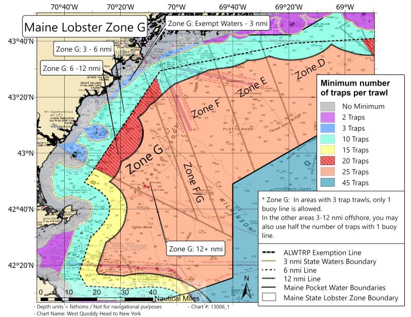
This map shows the new minimum traps per trawl requirements for Maine Zone G, effective May 1, 2022.
Zone G Description from Maine DMR Chapter 25.94
Zone G Eastern Line - Beginning at 43° 41.550’ N, 070° 14.650’ W, (a point on Presumpscott River Bridge that intersects with Loran line 13280), thence proceed SSE 159° Magnetic to 43° 32.875’ N, 070° 05.920’ W (a position where Loran line 13280 intersects with the 3-mile limit as identified on National Oceanic and Atmospheric Administration nautical charts), then South 180° Magnetic to 42° 22.424’ N, 069° 40.0’ W, thence due South 180° Magnetic to the Exclusive Economic Zone. Western Line - Seaward extension of the Maine - NH border to 43°02'42"N 70°42'06"W to 42°58'55"N 70°37'39"W to 42°58'45"N 70°36'43"W.