NOAA’s and Partners’ Largest Wetland Restoration Project is Complete; Monitoring Stage Begins
The Upper Barataria Marsh Creation Project, one of NOAA’s and its partners’ largest restoration projects to date, is now complete and monitoring activities are set to begin. The 1,200-acre project restores land lost from the Deepwater Horizon oil spill, supports healthier fisheries in Louisiana, and takes a step toward making the public whole. This project also supports NOAA’s goals and priorities for climate resilience. The project was approved by the Deepwater Horizon Louisiana Trustee Implementation Group to restore habitats impacted by the 2010 oil spill.
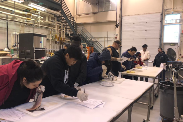
Now that the work to build the marsh is complete, monitoring activities have begun. Monitoring is a critical step in restoration, as it ensures the project provides long-term benefits. Additionally, monitoring helps with the development of beneficial adaptive management strategies for this project as well as future restoration efforts.
For example, by monitoring shrimp, crab, and fish species and examining “fish-friendly” project design features, the collaborating partners will be able to determine if the newly created marsh features are working as intended. Soil, plant communities, and water quality will also be assessed to understand how the marsh changes over time. Should data indicate that the project is not performing as expected, corrective actions will be implemented. Corrective actions could include establishing desirable marsh plant species, removing invasive species, and/or constructing additional tidal connections.
Monitoring partners include:
- NOAA
- The Water Institute
- Louisiana Coastal Protection and Restoration Authority (CPRA)
- The Louisiana Department of Wildlife and Fisheries (LDWF), and
- The U.S. Geological Survey (USGS).
The lessons NOAA and its partners learn from the Upper Barataria will help build even better, more successful large-scale restoration projects. This massive $181 million, two-phased restoration project benefits wildlife, fisheries, and people by providing habitat, storm protection, recreational opportunities, and a strong economic base for many Gulf related industries. It is one of NOAA’s largest habitat restoration efforts to date and builds upon previous efforts to restore wetland habitats in Louisiana.
Key Project Benefits

Coastal wetlands also provide a range of ecological functions and services including the following:
Habitat: Increasing the quality and quantity of marsh increases the amount of available habitat, which provides food, shelter, and nursery grounds for many animals including fish, shrimp, shellfish, sea turtles, birds, and mammals.
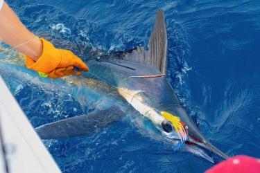
Fisheries: Healthy marshes are highly productive habitats and provide a greater diversity of foraging, breeding, spawning, and cover habitat for a variety of fish and shellfish species.
Wildlife: Marshes provide important habitats for the feeding, nesting, and roosting needs of birds. Marshes are also habitat for mammals, reptiles, and amphibians that rely on wetlands for part of their life cycle.
Coastal Resilience: Marshes help mitigate storm risk and provide protection to nearby infrastructure and coastal communities, increasing coastal resilience.
Economy: In addition to construction-related jobs, economic benefits of marshes include supporting the tourism and recreation industries, supporting recreationally and commercially important fisheries, and improving shoreline integrity for storm protection.
History and Importance of Louisiana’s Wetlands

Wetlands are a pivotal part of the natural system, providing tremendous benefits for coastal ecosystems and communities. They provide us with clean water, habitat for commercial and recreational fisheries, and countless opportunities for recreation, from hunting and fishing to hiking to observing wildlife. Additionally, wetlands provide Louisiana with its first line of defense during storms by reducing the detrimental effects of wind, waves, and flooding.
However, Louisiana has lost 1,800 square miles of land since 1932—and continues to lose approximately one football field of land every one to two hours. In the lifetime of a child born today, approximately 800,000 acres of Louisiana wetlands will be lost, moving the coastline inland by 33 miles in some areas. This will impact wildlife habitat and fisheries.
The Mississippi River delta naturally compacts and subsides over time, but historically the river would replenish the delta with new sediment. Levees meant to protect areas from flooding contained the river, but inadvertently cut off the supply of new sediment to surrounding marsh areas. As the land subsides and sea level rises, the open water of the Gulf of America (formerly Gulf of Mexico) moves closer and closer to the communities of southern Louisiana. This problem requires solutions on a grand scale.
Pumping sediment from the river to the marsh will replace some of the sediment starved from the estuary when it was separated from the river by levees. The newly created marsh areas will not only protect communities from storms and flooding but will also provide a home for many of the animals that are so important to the Louisiana economy. Species like white shrimp, blue crabs, and redfish need these protected habitats to survive.
Habitat Restoration After the Deepwater Horizon Oil Spill
On April 20, 2010, an explosion on the Deepwater Horizon Macondo oil well drilling platform started the largest marine oil spill in U.S. history. For 87 days after the explosion, the well blasted oil and natural gas continuously and uncontrollably into the northern Gulf. In all, an estimated 134 million gallons of oil was released, fouling the coasts of Florida, Alabama, Mississippi, Louisiana, and Texas.
After the spill, state and federal agencies undertook an intense scientific study of the impacts of the spill. They used this assessment to develop a science-based, comprehensive restoration plan for the Gulf. NOAA led development of the comprehensive restoration plan, along with the five Gulf States and three additional federal partners that comprise the Deepwater Horizon Trustee Council, a joint federal and state body now overseeing restoration in the Gulf of America.
Since 2018, the Louisiana Trustee Implementation Group, a joint effort of the State of Louisiana and federal trustees, has prepared the Strategic Restoration Plan for the Barataria Basin and has undertaken one of the largest habitat restoration efforts: the Upper Barataria Marsh Creation project.
Construction Schedule

The project contractor, Weeks Marine, Inc., began construction in late 2021. To maximize cost effectiveness, the project will have one construction phase and take approximately 26 months to complete. There are four construction stages:
- Late 2021 – Assemble equipment at the project site and begin construction
- January to early May 2021 – Construct earthen dike to contain dredged material
- Early May to early December 2022 – Dredge sediment from the Mississippi River and pump to contained areas for marsh creation
- January to May 2023 – Remove equipment from the project site
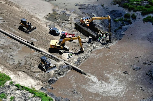
The project provided more than 140 construction-related jobs, further enhancing habitat restoration’s economic benefits in the region. The construction process filled target areas with approximately 8.4 million cubic yards of sediment dredged from the Mississippi River and pumped through a pipeline over 13 miles. That’s almost enough sediment to fill two Superdome stadiums!
The Barataria Basin has lost more than 276,000 acres of land since the 1930s. Wetlands in the basin were the most heavily impacted by the Deepwater Horizon oil spill, which accelerated a severe land loss trend threatening Louisiana’s estuaries. Monitoring of the creation site will take place to ensure anticipated outcomes are achieved. The Upper Barataria Marsh Creation Project is a key component of NOAA’s larger effort to build more resilient coasts and communities in Louisiana. The project will help lessen the impact of future storms and supports diverse species of fish and wildlife.
Construction activities included the following:
- sediment for creating the marsh was pumped over 13 miles from the Mississippi River borrow dredging area to the marsh creation area
- dredging was accomplished using a hydraulic cutter suction dredge
- using high-powered pumps, the sediment was transported through a pipeline connected to the dredge
- containment structures, in the form of earthen dikes, were filled with approximately 8.4 million cubic yards of sediment
Explore the Project

How Restoration Happens
Overhead Aerials
Dredging for Restoration
A special dredge on the Mississippi River carves sediment from a "take" area on the river bottom, then pumps it to the Upper Barataria marsh creation area 13 miles away.
13-Mile Pipeline
A 13-mile pipeline transports millions of gallons of sediment from the Mississippi River to rebuild eroded marshlands in coastal Louisiana.
Marsh Creation in Action
Building marshlands in coastal Louisiana involves dredging and pumping sediment from the Mississippi River, then carefully shaping it to function like a natural marsh.
Good Mud
At the "outfall," sediment pumped from the Mississippi River sprays from the end of a 13-mile pipe, and becomes the foundation of new Louisiana marshland.
The Future of the Marsh - Upper Barataria Marsh Creation
How do we know if the Upper Barataria marsh creation project is working as intended? Monitoring. This long-term work helps us develop and adapt management strategies for this restoration project, and apply those lessons to similar future projects.
Why We Are Restoring Habitat Here
What the Restoration Process Looks Like
Below, see some recent photos of the project site from November 2022. All photos are courtesy Patrick M. Quigley, www.gulfcoastairphoto.com. More aerial photos of the Upper Barataria Marsh Creation project are available, too.


Please reference the aerial photos of the Upper Barataria Marsh Creation project to witness the monthly transformation of the Upper Barataria project over the course of the construction schedule. All aerial photos are courtesy of Patrick M. Quigley, www.gulfcoastairphoto.com.
Featured News
Project Contact
Donna Rogers, Project Manager: Donna.Rogers@noaa.gov
Additional Links
For more information on the Upper Barataria marsh creation project, please visit the Louisiana Restoration Area section of the Deepwater Horizon Trustee Council website.
Information about other projects in Louisiana can be found through the interactive Gulf Spill Restoration Projects map.