Refine Results
Topic
Species Category
Region

Research Activity Results

3189 results match your filter criteria.

New Study Finds Incidents of Fishery Observer Harassment in Alaska Maritime Workplace Is Underreported

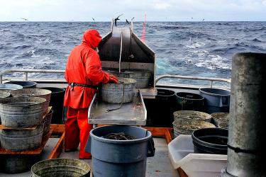
Scientists and law enforcement officers team up to lay a foundation for strengthening NOAA Fisheries efforts to improve observer safety on commercial fishing vessels and in seafood processing plants.
January 29, 2025 - Feature Story ,
DayInTheLife1.jpg

Predicting Sawfish Habitat in a Changing Environment

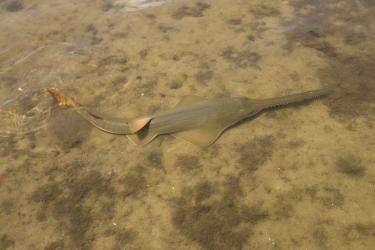
NOAA Fisheries and partners published research that identifies key habitat features of juvenile endangered smalltooth sawfish and predicts where else they could be.
January 22, 2025 - Feature Story ,
A small, flattened, elongated ray-like fish with a long tootled snout rests in the water on a muddy bottom A juvenile smalltooth sawfish. Credit: Olivier Born (Permit #22078)

Second Edition of “Field Guide to Seaweeds of Alaska” Released

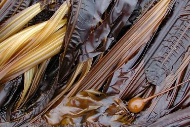
Scientists release the second edition of “Field Guide to Seaweeds of Alaska” with new taxonomic information, species descriptions, and photographic identification.
January 22, 2025 - Feature Story ,
View of brown seaweed. A plethora of seaweeds in the Alaskan intertidal. Credit: NOAA Fisheries/Mandy Lindeberg.

2024 Field Fresh Blog Photo Gallery

2024 in photos: Our observers, interns, and scientists share field experiences through their blog photos.
January 14, 2025 - Photo Gallery ,
A dolphin leaping out of the water.

Geostationary Extended Observations (GeoXO)

NOAA’s next-generation weather satellites are getting an upgrade with the newest satellite in the series, GeoXO.

Satellite Applications

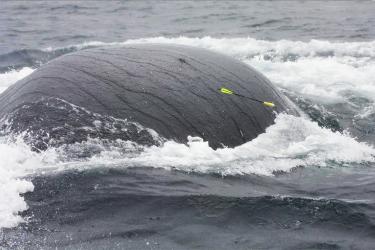
How does NOAA Fisheries use satellites? From coral reef management to monitoring illegal fishing activity, learn about the many ways that satellites contribute to effective marine resource management.

Satellite Data

NOAA scientists use a variety of satellite data streams to inform fisheries management.

Boredom is the Root of All Evil … Unless You’re a Glider

Autonomous Gliders in the Antarctic

We just deployed two gliders and hope for an encore of last year’s near-flawless deployment.
January 10, 2025 - Survey ,
A yellow autonomous underwater glider floats on the ocean surface. Several chunks of ice float behind and next to the glider. The water is dark grey and the sky is cloudy. An autonomous underwater glider floats at the surface, ready to begin its mission. Credit: NOAA Fisheries / Anthony Cossio

Satellite Oceanography

Cutting-edge satellite technology provides NOAA Fisheries scientists and managers with the most accurate data so they can make informed decisions about the management of our marine resources.