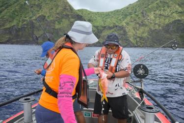
The National Fish Habitat Partnership is a science-based, state-led initiative to protect, restore, and enhance aquatic ecosystems across the United States. NOAA has played a key role in this unique partnership since its establishment. The initiative consists of a network of 20 Fish Habitat Partnerships, which focus on aquatic conservation at regional and local levels. Collectively, the partnerships have completed more than 1,000 projects in 50 states.
Each year, the National Fish Habitat Partnership hosts the Waters to Watch campaign. This campaign raises the visibility of some of the Fish Habitat Partnerships’ best on-the-ground projects. This year, five of the ten Waters to Watch projects are in coastal, estuarine, and marine habitats, where NOAA works.
Community-Based Restoration on Oʻahu, Hawaiʻi
Sponsoring Partnership: Hawaiʻi Fish Habitat Partnership
The Lower Heʻeia watershed on the island of Oʻahu once supported abundant fisheries, but habitat degradation has caused them to decline. In response, dedicated partners have been working to restore aquatic habitat. They are removing invasive vegetation, re-establishing native riparian vegetation, and addressing barriers to fish migration. Partners will also restore hydrology in adjacent waterways that are important for traditional Hawaiian agricultural practices. The work is community based, with significant input from native Hawaiians guiding the approach and desired outcomes.

The Lower Heʻeia Watershed is part of the Heʻeia National Estuarine Research Reserve. The reserve includes wetlands adjacent to Heʻeia stream and coral reefs extending into nearby Kāne‘ohe Bay. It is one of a national network of coastal sites designated to protect and study estuarine systems and one of the first to incorporate Indigenous resource management.
Project Partners
- Hawaiʻi DLNR–Division of State Parks
- Heʻeia National Estuarine Research Reserve
- Hui O Koʻolaupoko
- Kakoʻo ʻOiwi
- The Nature Conservancy–Hawaiʻi Marine Program
Improving Fish Passage in Southeast Alaska
Sponsoring Partnership: Southeast Alaska Fish Habitat Partnership
The salmon fisheries around Annette Islands Reserve, home to the Metlakatla Indian Community, are some of the most valuable in southeast Alaska. However, barriers pose a threat to these fish stocks by delaying these fish during their spawning migrations. On Graveyard Creek, within the reserve, partners are redesigning and replacing two aging culverts that restrict fish passage for key species:
- Coastal cutthroat trout
- Dolly Varden char
- Coho salmon
- Pink salmon
Larger, redesigned culverts will not only enhance fish passage, but also increase resilience to future high water events. In recent years, increased precipitation due to climate change has caused higher stream flows in the creek. This puts the existing culverts at risk of failure when the creek floods. Flooding and failed culverts can damage surrounding habitat, placing fish stocks further at risk.

The Annette Islands Reserve community relies on local fish stocks to support both their robust commercial fishing industry and subsistence harvest. The Metlakatla Indian Community Department of Fish and Wildlife also operates one of the largest tribally managed fisheries in the United States. The community is leading this project along with the Southeast Alaska Watershed Coalition and the U.S. Fish and Wildlife Service.
When the culvert redesign plans are complete, partners will remove and replace the culverts using additional Bipartisan Infrastructure Law funding, specifically designated to enhance fish passage. Restoring passage at these sites will reopen 1.4 miles of upstream habitat for resident and migratory fish to spawn, overwinter, and access feeding grounds. It will also help to create cooler conditions in the stream, providing areas of refuge for temperature sensitive fish such as salmon.
Project Partners
- Metlakatla Indian Community (lead)
- Southeast Alaska Watershed Coalition
- U.S. Fish and Wildlife Service
Reconnecting Floodplains in Oregon
Sponsoring Partnership: Pacific Lamprey Conservation Initiative
Once widespread and abundant throughout West Coast rivers and streams, Pacific lamprey populations have declined significantly in the region. In addition to dams and other barriers to upstream fish passage, stream and floodplain degradation are top contributors to these losses. Along Finn Rock Reach, a tributary of Oregon’s McKenzie River, large gravel pits and access roads have caused deep channels to form in the stream. This restricts fish from accessing valuable rearing habitats. Deep channels cause rapid and highly variable streamflow, while Pacific lamprey need slower and more consistent flows.

Partners at the Finn Rock Reach Restoration Project are working to restore valuable spawning and rearing habitats for Pacific lamprey along the reach. McKenzie River Trust is leading the project with other tribal, local, state, federal, non-profit, and academic partners. These efforts will also benefit other native fish species such as Chinook salmon and rainbow trout. Like the Pacific lamprey, these species are culturally important to Indigenous people in the region.
Partners will reconnect the Finn Rock Reach floodplain to the McKenzie River and restore 85 acres of habitat along the reach. To create the right conditions, partners will redistribute sediment and place large woody debris across the floodplain. Then, they will complete the restoration by planting native vegetation, which helps to stabilize the area and enhances the quality of the habitat.
Project Partners
- Confederated Tribes of Siletz Indians
- Eugene Water and Electric Board
- Oregon Department of Fish and Wildlife
- McKenzie Watershed Council
- McKenzie River Trust
- The Nature Conservancy
- University of Oregon Geography Department
- U.S. Bureau of Land Management
- U.S. Forest Service
Improving Seasonal River Flow in Northern California
Sponsoring Partnership: California Fish Passage Forum
In the Klamath River watershed, both natural and human-made barriers pose a challenge for fish passage. Dams and roads cut across streams, while upland disturbances such as wildfires, road failures, and mining have increased the amount of sediment running off into these tributaries. Sediment deposition in the watershed has created areas too shallow for fish to navigate or cut off above-ground streamflow altogether. Seasonal reductions in streamflow can further impede fish passage around these barriers.

Longtime partners, the Salmon River Restoration Council and the Mid Klamath Watershed Council, are removing or modifying sediment barriers by hand at more than 30 tributaries in the watershed. This will improve fish passage for species like Chinook salmon and steelhead trout, which are often cut off from habitats crucial to their survival during times of low streamflow. The work is temporary and not intended to remain after the annual floods that occur in the basin each winter. However, this effort will be cost-effective and provide immediate benefits to important species.
Salmon River Restoration Council and Mid Klamath Watershed staff will engage the local community in the project through education and volunteer opportunities. Students from nearby schools will assist with the fish passage improvement work while learning about fish identification and ecology. Partners will install informational signs at popular swimming holes and river access points to highlight the work, educating the public on fish passage and watershed health.
Project Partners
- California Fish Habitat Partnership
- Mid Klamath Watershed Council
- National Fish and Wildlife Foundation
- Salmon River Restoration Council
- U.S. Forest Service
Restoring River Flow for Chinook Salmon
Sponsoring Partnership: California Fish Passage Forum
Along the San Joaquin River, dams and other water diversions have greatly reduced or completely cut off populations of spring-run Chinook Salmon. A lawsuit regarding their effects on spring-run Chinook salmon resulted in a settlement in 2006. The San Joaquin River Restoration Program was formed as a result of this settlement. Since then, the program has been working to reverse trends along this 150 mile stretch of the river, including all areas between its confluence with the Merced River and the Friant Dam. One of the main goals of the program is to create and maintain a self-sustaining, naturally reproducing Chinook salmon fishery. Several restoration projects have been developed and implemented in support of this goal.
This project is focused on creating fish passage at the Eastside Bypass Control Structure, which—while important for flood control—creates a partial barrier to fish. Partners will install a 380 foot-long rock ramp downstream of the structure to improve flow conditions and simulate a natural river channel environment. They will also modify the structure to improve fish passage. None of this will affect its ability to provide flood control.
This work will also increase access to additional spawning and rearing habitat for white sturgeon, a popular recreational fisheries species, in addition to Chinook salmon.
Project Partners
- California Department of Fish and Wildlife
- California Department of Water Resources
- Lower San Joaquin Levee District
- River Partners
- The Bay Institute
- U.S. Bureau of Reclamation
- U.S. Fish and Wildlife Service