About 40 percent of the coastal wetlands in the contiguous United States are in Louisiana, but hundreds of thousands of acres of vital habitat have been washed away by natural and man-made disasters.
Storms, erosion, and increased sea levels, combined with construction of hard levees, digging canals, and oil spills have contributed to nearly 1,900 square miles of coastal land loss since the 1930’s. Continued losses increase impacts of events like these and decrease the ability of habitats like barrier islands and marshes to buffer the mainland from storms and associated flooding, one of their many benefits to fish, plants, and people.

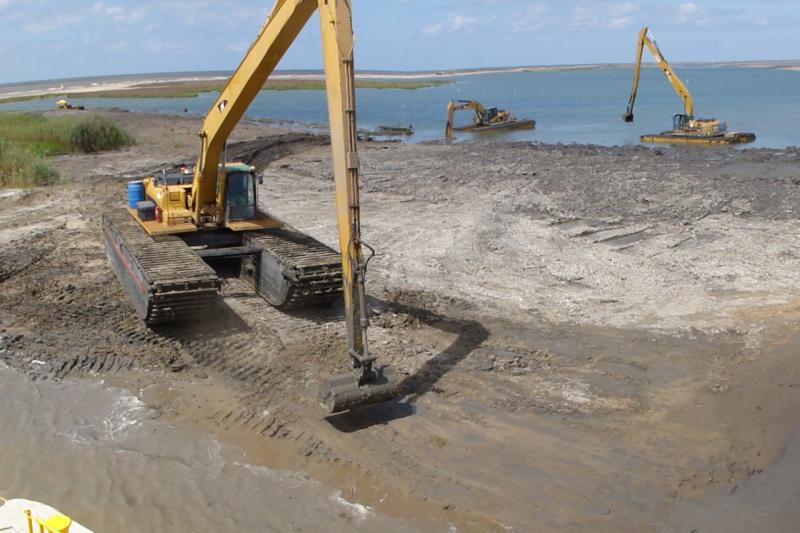
Dredged sediment pumped to restore a barrier island in Barataria Bay.
To help slow the loss of land and increase resilience, NOAA, the State of Louisiana, and other federal and state partners have been working to develop natural infrastructure projects that restore habitat and protect communities along the Louisiana coast.
We’re restoring barrier islands and creating marsh habitat in the Barataria Basin, helping build up first lines of defense from storms and flooding in the New Orleans area. Under the Coastal Wetlands Planning, Protection and Restoration Act program and more recently, the Deepwater Horizon restoration program, NOAA has built or enhanced almost 3,000 acres of barrier islands and marsh in the area.

Heavy equipment moves sediment around restored areas of a barrier island.
A 35-mile chain of barrier islands skirts the southern edge of the Barataria Basin along the Gulf of Mexico, helping protect the habitat of dozens of commercially-important fish species. Restoration of the islands requires dredging sediment from nearby areas and pumping it to the island to help rebuild the land. After sediment is pumped to the island, it is shaped into dune and marsh habitat, which eventually is planted with native vegetation.
Further north, restored marsh provides the next level of defense. These wetlands provide a different type of habitat for fish, shellfish and other species, help filter water to make it cleaner and are a part of the thriving tourism economy. Marsh creation (PDF, 2 pg) also involves dredging of sediment, but it’s placed in different areas and shaped differently to encourage vegetation growth and connection to other wetlands.

Inspecting newly planted vegetation on dunes on a restored barrier island in Barataria Bay.
Work to restore resiliency in the Barataria Basin will continue, with more large-scale projects being planned for the near future, to create and restore thousands more acres; improving protection for Louisiana’s people and property, and one of America’s richest fisheries.

An aerial view of a restored barrier island in Barataria Bay.
Our natural infrastructure work doesn’t stop in Louisiana. It extends along all of the U.S. coasts and the Great Lakes. Shorelines with strong natural coastal habitats experience less damage from severe storms and marshes dissipate wave energy, improving coastal resilience. Coastal habitats are unique ecosystems for fish, plants and animals, help improve water quality and improve local economies, all while protecting communities.