At an unmanned aerial system (UAS) workshop held on December 11, 2019, NOAA demonstrated how it uses UAS technology in coral-related marine applications. The workshop brought together various agencies and NGOs who conduct geographical surveys for a technology show-and-tell. The gathering may lead to new collaborative projects between NOAA and partners.
“Everybody was super excited about our demonstration,” said Robert O’Conner, fishery information specialist with the NOAA Fisheries Pacific Islands Regional Office. “The workshop was a really nice way to build collaboration between groups,” added Dr. Matthew Parry, a fishery biologist with the NOAA Restoration Center and the Damage Assessment, Remediation and Restoration Program.
The workshop was organized by the Hawai‘i Geographic Information Coordinating Council, a nonprofit that brings together members of Hawai‘i's geospatial community. Members include, among others:
- NOAA
- U.S. Geological Survey
- U.S. Forest Service
- University of Hawai‘i
- Hawai‘i Statewide GIS Program
- Women in Technology
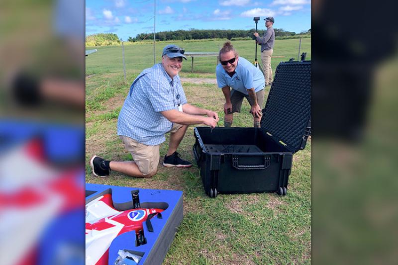
The event was held at the Kawainui R/C Air Model Field in Kailua, O‘ahu. There were UAS demonstrations from NOAA, the environmental consulting agency Dudek, and the surveying company Frontier Precision.
For the NOAA demonstration, O’Conner and Parry flew a FireFLY 6 UAS and discussed its capabilities. Some of the main benefits of this system, the pair explained, include its:
- Relatively low cost
- Payload flexibility, allowing it to carry various sensors and cameras
- Ability to take off and land vertically and fly horizontally
- Endurance (flight time)
O’Conner and Parry demonstrate landing a FireFLY 6 UAS. Note: This landing occurred at the He'eia Kea Small Boat Harbor, not at the Kawainui R/C Air Model Field.
These properties make the UAS perfect for mapping shallow-water habitats. Specifically, NOAA is using the drone to map vessel grounding scars and damage to coral reefs in Hawai‘i. We are also looking at the impact of the summer 2019 coral bleaching event.
“We’re also working with the state to monitor some of their actions,” Parry said. Kāne‘ohe Bay on the east side of O‘ahu contains numerous shallow patch reefs that are frequently injured by passing vessels. The Hawai‘i Department of Land and Natural Resources installed reef markers to alert boat operators where these patch reefs are. NOAA is now using the UAS to determine what effect these markers have had on the health of the reefs.
Various organizations at the workshop showed interest in using this system for their own applications. These include The Nature Conservancy, U.S. Fish and Wildlife Service, and the Hawai‘i Department of Business, Economic Development, and Tourism.
How other organizations use UAS technologies is similarly important to NOAA.
“It was a great opportunity to see where the industry and private and government entities are with UAS,” O’Conner said. “It’s good to make sure we’re on the same page and not reinventing the wheel.”


