In March, the Rainier Integrates Charting, Hydrography, and Reef Demographics (RICHARD) mission team, aboard NOAA Ship Rainier, set off to conduct research in the central Pacific. During this mission, scientists from different backgrounds measure water depths, map the seafloor, and gather information on coral reef habitats. The collected data will inform different regional efforts, including the Coral Reef Conservation Program’s National Coral Reef Monitoring Program’s long-term coral reef monitoring and Office for Coast Survey’s nautical chart updates. These efforts will further support NOAA Fisheries in their management of Magnuson-Stevens Act Essential Fish Habitat, Endangered Species Act, Marine National Monuments, as well as the American Sāmoa Government in their management of coastal resources. Scientists are halfway through their mission that will run through September.

One Fish, Two Fish, Small Fish, Big Fish
Scientists are busy identifying and counting reef fish of all sizes. This gives them a snapshot of what the entire reef fish population looks like. This information helps scientists and managers understand the condition of the reef fish population and how that relates to management needs. Sometimes it’s difficult to count large cloud-like swarms of small fish, but our highly trained scientists are up to the challenge and can count schools of fish quickly. So far, they have surveyed 79 sites around Tutuila, Baker, and Howland Islands. A mission highlight for scientists was spotting a giant grouper at Baker Island. These rare fish are much larger than most of the fish we see!

Temp Check!
The ocean and climate team measure ocean temperature and chemistry to determine how favorable conditions are for coral growth. Scientists use underwater temperature recorders to monitor marine heatwaves and collect seawater samples. Small plastic plates, called calcification accretion units, allow the team to measure how long-term trends in ocean acidification impact corals. Corals and other animals that contribute to reef growth settle and grow on the plates. When the team returns, they will measure growth and erosion. So far, the team has deployed 21 temperature recorders, collected 47 seawater chemistry samples, and installed 25 calcification accretion units. The data collected from these instruments will help scientists and managers understand climate change resilience and will help managers develop interventions to bolster coral reef resilience in the face of climate change.

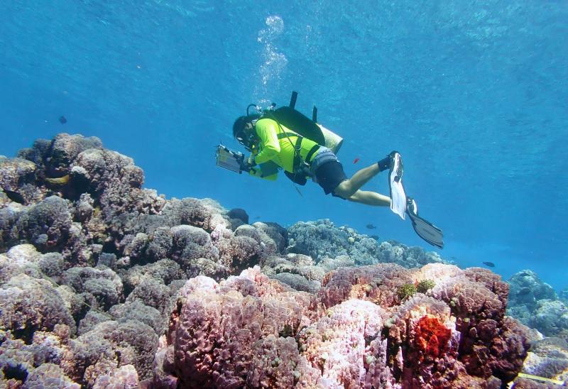
Modeling Corals
The team of benthic scientists study the corals and marine life on the seafloor. In April, the team visited the reefs of American Sāmoa to check on coral communities. They visited 150 sites around the islands of Swains, Taʻū, Ofu, Olosega, and Tutuila, and Rose Atoll. Scientists identified and assessed the health of existing coral colonies and counted the number of new coral babies. They were also on the lookout for the crown-of-thorns starfish. In large numbers, these predators can destroy entire reefs by feeding on coral tissue. Thankfully, the team only reported two crown-of-thorns starfish during the entire month.
Scientists took over 150,000 photos of the reef. These photos will be used to generate 3D models of the reef. Manu‘a Islands’ reefs continue to have the highest coral diversity in American Sāmoa and some of the highest numbers of baby corals in the region.

Mapping the Seafloor
Another team of scientists mapped shallow areas of the seafloor using two small boats while the Rainier collected data in the deeper areas. These mapping surveys include bathymetry (submarine topography) and backscatter (bottom type) data. Scientists combine them to create detailed 3D maps of the seafloor and its different habitats. These maps will update existing nautical charts and support marine resource management in the region.

The Work Continues
The team of scientists on this mission are grateful to conduct surveys in such a special place and are excited to share their findings with their local partners. They are still out at sea and will be carrying out their current mission through September. Be sure to follow along on the RICHARD story map as they post photos and updates of interesting facts and finds!


