The Bering Sea canyons occur along the continental slope.
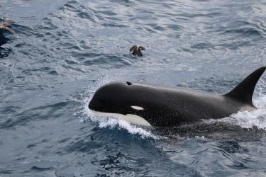
The waters of the eastern Bering Sea support large marine mammal and bird populations and some of the most profitable and sustainable commercial fisheries in the country.
In the eastern Bering Sea several hundred miles from shore, the seafloor descends into the abyss. Most of the continental slope makes a gradual descent, but in several places, canyons interrupt the regular topography. The seafloor of the slope is primarily composed of sand, mud, gravel or other course materials.
In recent years the advancement in technology has allowed us to peer deeper into the depths and study bottom-dwelling creatures like corals.
Because these species are vulnerable to fishing impacts, resource managers in Alaska were eager for scientists to use this technology to identify areas where corals were concentrated, particularly in relation to two eastern Bering Sea canyons -- Pribilof and Zhemchug.
Chris Rooper is a NOAA Fisheries Research Biologist with the Alaska Fisheries Science Center. He is one of the lead scientists on this journey to finding the answers.
Last summer Chris worked with a team of NOAA Fisheries scientists to conduct a research survey in the eastern Bering Sea. The team collected 225,000 (3-D) video images of the seafloor, the continental slope, and several underwater canyons at depths of around 300 feet to just over 2,600 feet. The study area spanned depths where a lot of the fishing activity takes place.
Questions & Answers
The following questions and answers provide more detailed background on why the survey was conducted, what was learned during the survey and how this new information is being used to inform fishery management decisions.
Q. What prompted interest in the canyons?
A. The North Pacific Fishery Management Council, the fishery management body that develops management measures for commercial and recreational fisheries in federal waters off Alaska, wanted to determine if coral concentrations in two canyons in the eastern Bering Sea, Pribilof and Zhemchug, warranted further protection from fishing activity. They asked scientists to collect information on coral presence inside and outside the canyons, information on the height and density of coral found, and the role of these coral as fish habitat. They also wanted scientists to document the presence, degree of fishing gear effects and the expected vulnerability of the canyons to anthropogenic activity (including fishing).
Q. What was NOAA Fisheries role in this?
A. We analyzed all existing data on the canyons and surrounding areas and input a subset of these data into scientific models. The models produced predictions of where coral was likely to occur, both inside and outside the canyons.
Q. What did you learn from the initial analyses?
A. Pribilof and Zhemchug canyons did not appear to be biologically unique compared to the rest of the eastern Bering Sea slope. Species distribution and abundance in these two canyons appeared similar to other canyons and adjacent slope areas in the eastern Bering Sea. However, the models of where coral habitat occurs predicted that most of the coral in the eastern Bering Sea was located in Pribilof Canyon and to the west of Pribilof Canyon along the slope. The initial analysis was reported out in 2013 and published in scientific article in 2015.
Q. What happened next?
A. More recently, the Council requested that we conduct a research survey on the water to ground truth the coral model and our initial analyses.
Q. When was the survey conducted?
A. We conducted the survey during the summer and fall of 2014.
Q. What did the survey entail?
A. It involved deploying underwater cameras from a research vessel in Pribilof and Zhemchug canyons and in areas around these canyons along the slope. We were trying to pinpoint areas of coral concentration, evaluate the role of coral as fish and crab habitat, and document fishing impacts. We put our cameras into the water at 250 randomly selected locations along the Bering Sea slope and canyons and collected 225,000 video images.
Q. What species did the survey focus on?
A. At the Council’s request, we focused our research on validating the coral model, which includes corals such as gorgonian and bamboo corals that predominately grow on hard, rocky bottoms. However, because we surveyed a variety of habitats inside and outside the canyons, the survey also provided us with an opportunity to collect information on other species such as sponges and sea whips. Sea whips are also a coral species, but one which grows on sandy bottoms.
Q. What information did you expect to derive from the collected photos?
A. We analyzed the collected images to see if coral, sponges and sea whips occurred in the areas we expected to see them, based on our model predictions. We also used the photos to gather information on the height and density, or amount of coral found in various areas, to determine if fish and other commercially important crab species were using these areas as habitat. We also were able to document the presence and degree of fishing gear effects in the sampled areas. All of this information will help managers better determine if there are key areas that warrant protective measures.
Q. What did you learn?
A. The results validate our previous modeling and analysis work, confirming that most coral habitat (for the species that predominantly grow on hard, rocky bottom) occurs inside Pribilof Canyon and along the Bering Sea slope to the west of Pribilof Canyon. In general, coral densities throughout our survey area were low even where they occurred. This is not surprising as the eastern Bering Sea seafloor contains little of the rocky habitat that is conducive to coral growth. Sea whip densities were highest in sandy portions of the slope and outer shelf throughout our survey area.
Q. Were there unique habitat features (e.g., bottom types) in the canyons as compared to areas outside the canyons?
A. Corals need rocky, hard bottoms to attach to and thrive. In most of the images, from both inside and outside the canyons, the observed seafloor consisted primarily of mud, sand, gravel, or coarse material—not conducive to the habitat requirements of this type of coral. Only about 2.8% of the habitat contained some type of rocky substrate (e.g., cobble, boulder, or exposed bedrock) and only 0.8% had rocky substrate as the primary habitat.
Q. Of the coral, sponges, and sea whips that you saw, what was most common?
A. We saw roughly 70,000 structure-forming invertebrates (animals without an internal skeleton made of bone). Of these, about 55% of them consisted of sponges (predominantly from two occasions when we put the camera in the water) and 40% were sea whips. Only 2% (< 1500 individuals) of the total invertebrates observed were corals.
Q. How big were the corals, sponges, and sea whips that you saw?
A. Corals: Densities and heights of corals were generally highest in Pribilof Canyon and to the west of Pribilof Canyon along the slope. Corals taller than several inches are uncommon in the Bering Sea, including those found in Zhemchug and Pribilof canyons.
Sponges: Densities and heights were highest surrounding Pribilof Canyon, north of Bering Canyon and in some locations in Zhemchug Canyon.
Sea whips: Densities and heights were highest on the outer shelf between Pribilof and Zhemchug Canyon and in an area to the south of Pribilof Canyon.
Q. Why is height and density important to know when studying corals?
A. We study height and density as a way to measure potential vulnerability to human-induced and natural disturbance.
Q. What did you learn about how species are using the coral as habitat?
A. We saw evidence that rockfish species, in particular, used sponge and to a lesser extent coral habitat. We also saw juvenile king crabs associated with sponges and corals. However, grenadiers and several crab species, like Tanner crabs, were seen in the greatest numbers on bare, sandy bottom rather than in close proximity to corals or sponges. These results were consistent with other laboratory and field studies in the North Pacific Ocean.
Q. Did you see evidence of fishing activity?
A. Direct evidence of fishing (mostly trawl tracks, but also some lost trawl nets, crab pots, and longline gear) occurred at 32 (12.8%) of the sample sites.
Q. Did you see any evidence of damaged coral, sponges, or sea whips?
A. The proportion of observed damage to coral was 2.9% and sponge was 0.3%. About 9% of individual sea whips observed were classified as either being somehow damaged, dead, or lying horizontal on the seafloor.
Q. Was this damage caused by fishing activity?
A. In most cases, it was difficult to determine if the damage was human-induced (e.g., fishing or other activity) or natural (e.g., brittle star predation, ocean currents). There were very few places where we actually saw both clear evidence of fishing activity (e.g., trawl tracks or fishing gear) and damaged coral, sponges or sea whips. This occurred in just 3.2% of our camera tows (8 of 250).
Q. So what can you conclude from this research? Would you recommend that areas of high coral, sponge, or sea whip density be protected?
A. We conducted this research at the request of the North Pacific Fishery Management Council. We expect to make a formal presentation to the Council in October 2015. The Council’s Scientific and Statistical Committee will conduct a peer-review of our report before the October meeting. We anticipate that various Council committees will consider the information we provided and determine if they need any further information from us. If any management actions or alternatives are developed, the Council is the authoritative body that will initiate that.


