Refine Results
Region
Multimedia Type
Topic
Species Category

Multimedia

Stream Temperature Monitoring and Modeling in the Pacific Northwest Photo Gallery

Images associated with stream temperature monitoring and modeling in the Pacific Northwest.
March 24, 2021 - Photo Gallery
A reach of the White River in the Wenatchee watershed that is used by salmon, and where we have data loggers installed to monitor hourly water and air temperatures.

Video Highlights Importance of Fishing in American Samoa

New video series features important contributions of recreational and non-commercial fishing in the Pacific Islands region.
March 23, 2021 - Video ,
American Samoa landscape background with a man fishing near rocks. Title of video center aligned.

2021 Aerial Surveys Monitoring Gray Seal Populations

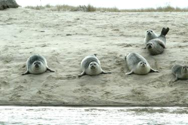
Counting gray seal pups in their nurseries is one way researchers are keeping tabs on this population as it reoccupies historic habitats off New England. Our 2021 gallery!
March 22, 2021 - Photo Gallery ,
Two NOAA pilots and two survey scientists dressed in orange jumpsuits stand in front of the NOAA Twin  otter airplane.

Sharing Seal Space by the Seashore: Introduction to the Greater Atlantic Marine Mammal Stranding Network

This story map shows seal strandings in the Greater Atlantic Region and highlights the organizations that provide emergency response and rehabilitation for stranded seals.
March 05, 2021 - Story Map ,
Harbor seals near the water on the beach in Chatham, Ma. Harbor seals in Chatham MA

The Atlantic Sea Scallop: A Fishery Success Story

This story map explores our partnership with fishermen and scientists to keep Atlantic sea scallops on our plates for a long time to come.
February 24, 2021 - Story Map ,
Sea scallops Atlantic sea scallops

Voices of the Fisheries: The Unique Lives and Work of Gloucester Fishermen

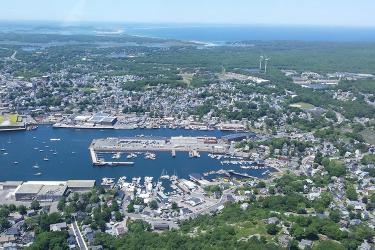
This story map provides a brief glimpse into the unique and sometimes difficult lives of members of the Gloucester, Massachusetts fishing community through their own voices.
February 19, 2021 - Story Map ,
Gloucester, Massachusetts as seen from the air. Harbor is center wind turbines to the right. Aerial view of Gloucester, Massachusetts

Newportal 2021 Contour Maps

These contour plots display the most recent oceanographic data collected off Newport, Oregon.
January 25, 2021 - Photo Gallery
Newportal contour maps 01/19/2021

Slick Nurseries Storymap Images

Slick Nurseries Storymap Images and Video
January 21, 2021 - Photo Gallery ,
Surface sunset damsel larval stages

Expanding Seafood Possibilities: Aquaculture Opportunity Areas

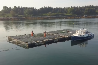
Watch and learn how we are expanding sustainable aquaculture opportunities in the United States to support healthy people, a healthy planet, and a healthy economy.
December 08, 2020 - Video ,
people walking on aquactulture cages in open water near coastline

Cold-Stunned Sea Turtles From Massachusetts Travel to Texas for Rehabilitation and Release

Follow the journey of the 120 cold-stunned sea turtles flown to Texas on December 7, 2020.
December 07, 2020 - Photo Gallery ,
Sea turtles being loaded onto an airplane