NOAA Fisheries and the Hawaiian Islands Humpback Whale National Marine Sanctuary are hosting a virtual information session for whale watch and marine wildlife tour operators in Hawai‘i.
Web mapping app that displays and queries spatial data in the West Coast Region for Endangered Species Act ranges, critical habitat designations, and Magnuson-Stevens Act essential fish habitat. Users can generate a printable spatial query report.
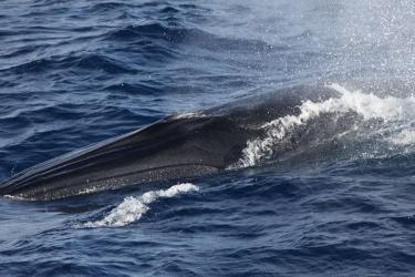
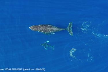
NOAA Fisheries records evidence of endangered Rice’s whales in the western Gulf of Mexico. These findings demonstrate their regular occurrence in waters offshore of Texas and the first evidence of Rice’s whales offshore of Mexico.
Sound plays an essential role for marine species, and the ocean is getting noisier. NOAA works to understand and reduce the impacts of human-produced noise on whales.