In January 2018, we approved the majority of the New England Fishery Management Council’s Omnibus Essential Fish Habitat Amendment. The final rule implementing the approved changes to year-round and seasonal closure areas has published and is now effective.
We approved the majority of the Council’s recommendations for changes to year-round closure areas. However, we disapproved the Council’s recommendations for eastern Georges Bank and Cox Ledge. As a result, the Closed Area II Closure Area and the Closed Area II Habitat Closure Area remain with the same footprint, restrictions, and exemptions. A thorough description of our rationale is provided in the final rule.
Among other changes, this rule implements the Council’s recommendation to remove the Closed Area I Closure Area and to implement a seasonal closure in the Closed Area I North Area from February 1 through April 15. Because this action became effective upon publication, Closed Area I North will remain closed through April 15, under the restrictions and exemptions listed on page 4 of this bulletin. In addition, a new seasonal closure will go into effect on April 15, 2018, and will remain closed to certain gears through April 30, 2018. This measure, known as the “Spring Massachusetts Bay Spawning Closure Area,” will close Block 125 for spawning protection. See the table on page 4 for details.
A description of the full suite of year-round groundfish and habitat closures, as well as the new seasonal closures is provided below. Tables with the coordinates for these areas are provided as an attachment. Other closures may apply to your vessel, depending on your permits, target species, and gear.
NOTE: The Closed Area I and the Nantucket Lightship Closure Areas remain closed to scallop vessels until allowed via a follow-on scallop action. The Council has proposed new access areas for those areas in Framework Adjustment 29. Approval and implementation of those recommendations is pending.
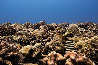
We also approved the Council’s recommendations for essential fish habitat designations, as well as Habitat Areas of Particular Concern designations. These designations do not have any implementing regulations. More information on these designations can be found here:

Omnibus Essential Fish Habitat Amendment; Year-Round and Seasonal Closure Areas
|
Area Name |
Measures |
|
Small Eastern Maine Habitat Management Area (HMA) |
Closed to mobile bottom-tending gear |
|
Fippennies Ledge HMA |
Closed to mobile bottom-tending gear |
|
Ammen Rock HMA |
Closed to all fishing, expect lobster traps |
|
Shrimp Trawl Exemption Area |
Closed to mobile bottom-tending gear, except shrimp trawls |
|
Stellwagen Dedicated Habitat Research Area1 |
Same restrictions as Cashes Ledge [Groundfish] Closure Area |
|
Great South Channel HMA |
Closed to mobile bottom-tending gear |
|
Great South Channel HMA, clam dredges exempted2 |
Closed to mobile bottom-tending gear, except hydraulic clam dredges for 1 year |
|
Cashes Ledge HMA |
Closed to mobile bottom-tending gear |
|
Jeffreys Bank HMA |
Closed to mobile bottom-tending gear |
|
Western Gulf of Maine [Groundfish] Closure Area |
Same as Cashes Ledge [Groundfish] Closure Area |
|
Georges Bank Dedicated Habitat Research Area1 |
Closed to mobile bottom-tending gear |
|
Cashes Ledge [Groundfish] Closure Area |
Closed to all fishing vessels, except:
|
|
Western Gulf of Maine Habitat Closure Area |
Closed to mobile bottom-tending gear |
|
Gulf of Maine/Georges Bank Roller Gear Restricted Area |
Trawls prohibited from using roller gear larger than 12 inches |
|
Closed Area II Habitat Closure Area |
Closed to mobile bottom-tending gear |
|
Closed Area II [Groundfish] Closure Area |
Closed to all fishing, except:
|
1 Dedicated Habitat Research Areas are designated for 3 years, after which the Regional Administrator will consult with the Council and the public on whether to maintain the designation.
2 Hydraulic clam dredges are exempted from the majority of the Great South Channel HMA for 1 year (i.e., until March 31, 2019), while the Council considers if a more discrete, longer-term exemption is appropriate and feasible.
New Seasonal Closures – These new seasonal closures are in addition to all other existing seasonal gear or area restriction currently in the regulations.
|
Area Name |
Season |
Measures |
|
Closed Area I North Seasonal Closure |
February 1–April 15 |
|
|
Closed Area II Seasonal Closure1
|
||
|
Winter Massachusetts Bay Spawning Protection Area |
November 1–January 31 |
Closed all vessels, except:
|
|
Spring Massachusetts Bay Spawning Protection Area |
April 15–April 30 |
Closed to all vessels, except:
|
1 The year-round Closed Area II Closure Area is still effective and the restrictions for that measure take precedence.
Groundfish Year-Round Closed Areas
Cashes Ledge Closure Area
|
Point |
N. lat. |
W. long. |
|
CL1 |
43°07′ N |
69°02′ W |
|
CL2 |
42°49.5′ N |
68°46′ W |
|
CL3 |
42°46.5′ N |
68°50.5′ W |
|
CL4 |
42°43.5′ N |
68°58.5′ W |
|
CL5 |
42°42.5′ N |
69°17.5′ W |
|
CL6 |
42°49.5′ N |
69°26′ W |
|
CL1 |
43°07′ N |
69°02′ W |
Western Gulf of Maine Closure Area
|
Point |
N. lat. |
W. long. |
|
WGM1 |
43° 15’ N |
70° 15’ W |
|
WGM2 |
42° 15’ N |
70° 15’ W |
|
WGM3 |
42° 15’ N |
70° 00’ W |
|
WGM4 |
43° 15’ N |
70° 15’ W |
|
WGM1 |
43° 15’ N |
70° 15’ W |
Closed Area II Closure Area
|
Point |
N. lat. |
W. long. |
Note |
|
CAII1 |
41°00′ |
67°20′ |
|
|
CAII2 |
41°00′ |
66°35.8′ |
|
|
CAII3 |
41°18.45’ |
(1) |
(2) |
|
CAII4 |
(3) |
67°20’ |
(2) |
|
CAII5 |
42°22′ |
67°20′ |
|
|
CAII1 |
41°00′ |
67°20′1 |
|
(1) The intersection of 41°18.45’ N. lat. and the U.S.-Canada Maritime Boundary, approximately 41°18.45’ N. lat. and 66°24.89’ W. long.
(2) From Point CAII3 to Point CAII4 along the U.S.-Canada Maritime Boundary
(3) The intersection of 67°20’ W. long. And the U.S.-Canada Maritime Boundary, approximately 42°22.06’ N. lat. and 67°20’ W. long.
New Seasonal Groundfish Closure Areas
Winter Massachusetts Bay Spawning Protection Area
|
Point |
N. Latitude |
W. Longitude |
|
WSPA1 |
42° 23.61’ |
70° 39.21’ |
|
WSPA2 |
42° 07.68’ |
70° 26.79’ |
Spring Massachusetts Bay Spawning Protection Area
|
Point |
N. Latitude |
W. Longitude |
Note |
|
SSPA1 |
42°30’ |
(1) |
|
|
SSPA2 |
42°30’ |
70°30’ |
|
|
SSPA3 |
42°00’ |
70°30’ |
|
|
SSPA4 |
42°00’ |
(2) |
(3) |
|
SSPA5 |
(4) |
71°00’ |
(3) |
|
SSPA6 |
(5) |
71°00’ |
(6) |
|
SSPA1 |
42°30’ |
(1) |
(6) |
(1) The intersection of 42°30’ N. lat. and the coastline at Marblehead, MA
(2) The intersection of 42°00’ N. lat. and the coastline at Kingston, MA
(3) From Point SSPA4 to Point SSPA5 following the coastline of Massachusetts
(4) The intersection of 71°00’ W. long and the coastline at Quincy, MA
(5) The intersection of 71°00’ W. long and the northernmost coastline at East Boston, Boston, MA
(6) From Point SSPA6 back to Point SSPA 1 following the coastline of Massachusetts
Closed Area I—North
|
Point |
N. lat. |
W. long. |
|
CIN1 |
41°30′ |
69°23′ |
|
CIN2 |
41°30′ |
68°30′ |
|
CIN3 |
41°26′ |
68°30′ |
|
CIN4 |
41°04′ |
69°01′ |
|
CIN1 |
41°30′ |
69°23′ |
Closed Area II Closure Area
|
Point |
N. lat. |
W. long. |
Note |
|
CAII1 |
41°00′ |
67°20′ |
|
|
CAII2 |
41°00′ |
66°35.8′ |
|
|
CAII3 |
41°18.45’ |
(1) |
(2) |
|
CAII4 |
(3) |
67°20’ |
(2) |
|
CAII5 |
42°22′ |
67°20′ |
|
|
CAII1 |
41°00′ |
67°20′1 |
|
(1) The intersection of 41°18.45’ N. lat. and the U.S.-Canada Maritime Boundary, approximately 41°18.45’ N. lat. and 66°24.89’ W. long.
(2) From Point CAII3 to Point CAII4 along the U.S.-Canada Maritime Boundary
(3) The intersection of 67°20’ W. long. And the U.S.-Canada Maritime Boundary, approximately 42°22.06’ N. lat. and 67°20’ W. long.
Habitat Management Areas
Eastern Maine HMA
|
Point |
N Latitude |
W Longitude |
|
EMH1* |
44°07.65’ N |
68°10.64’ W |
|
EMH2 |
44° 02.50’ N |
68° 06.10’ W |
|
EMH3 |
43° 51.00’ N |
68° 33.90’ W |
|
EMH4* |
43° 56.62’ N |
68° 38.12’ W |
|
* Points 1 and 4 are intended to fall along the outer limit of Maine state waters. |
Jeffreys Bank HMA
|
Point |
N Latitude |
W Longitude |
|
JBH1 |
43° 31’ N |
68° 37’ W |
|
JBH2 |
43° 20’ N |
68° 37’ W |
|
JBH3 |
43° 20’ N |
68° 55’ W |
|
JBH4 |
43° 31’ N |
68° 55’ W |
|
JBH1 |
43° 31’ N |
68° 37’ W |
Cashes Ledge HMA
|
Point |
N Latitude |
W Longitude |
|
CLH1 |
43° 01.0’ N |
69° 00.0’ W |
|
CLH2 |
43° 01.0’ N |
68° 52.0’ W |
|
CLH3 |
42° 45.0’ N |
68° 52.0’ W |
|
CLH4 |
42° 45.0’ N |
69° 00.0’ W |
|
CLH1 |
43° 01.0’ N |
69° 00.0’ W |
Fippennies Ledge HMA
|
Point |
N Latitude |
W Longitude |
|
FLH1 |
42° 50.0’ N |
69° 17.0’ W |
|
FLH2 |
42° 44.0’ N |
69° 14.0’ W |
|
FLH3 |
42° 44.0’ N |
69° 18.0’ W |
|
FLH4 |
42° 50.0’ N |
69° 21.0’ W |
|
FLH1 |
42° 50.0’ N |
69° 17.0’ W |
Ammen Rock HMA
|
Point |
N Latitude |
W Longitude |
|
ARH1 |
42° 55.5’ N |
68° 57.0’ W |
|
ARH2 |
42° 52.5’ N |
68° 55.0’ W |
|
ARH3 |
42° 52.5’ N |
68° 57.0’ W |
|
ARH4 |
42° 55.5’ N |
68° 59.0’ W |
|
ARH1 |
42° 55.5’ N |
68° 57.0’ W |
Western Gulf of Maine HMA
|
Point |
N Latitude |
W Longitude |
|
WGMH1 |
43° 15’ N |
70° 15’ W |
|
WGMH2 |
42° 15’ N |
70° 15’ W |
|
WGMH3 |
42° 15’ N |
70° 00’ W |
|
WGMH4 |
43° 15’ N |
70° 15’ W |
|
WGMH1 |
43° 15’ N |
70° 15’ W |
Western Gulf of Maine Shrimp Exemption Area
|
Point |
N Latitude |
W Longitude |
|
SEA1 |
43° 15’ N |
70° W |
|
SEA2 |
43° 13’ N |
70° W |
|
SEA3 |
43° 13’ N |
70° 05’ W |
|
SEA4 |
43° 09’ N |
70° 05’ W |
|
SEA5 |
43° 09’ N |
70° 08’ W |
|
SEA6 |
42° 55’ N |
70° 08’ W |
|
SEA7 |
42° 55’ N |
70° 15’ W |
|
SEA8 |
43° 15’ N |
70° 15’ W |
|
SEA1 |
43° 15’ N |
70° W |
Closed Area II Habitat Closure Area
|
Point |
N Latitude |
W Longitude |
Notes |
|
CIIH1 |
42° 10’ N |
67° 20’ W |
|
|
CIIH 2 |
42° 10’ N |
67° 9.38’ W |
(1)(2) |
|
CIIH 3 |
42° 00’ N |
67° 0.63’ W |
(2)(3) |
|
CIIH 4 |
42° 00’ N |
67° 10’ W |
|
|
CIIH 5 |
41° 50’ N |
67° 10’ W |
|
|
CIIH 6 |
41° 50’ N |
67° 20’ W |
|
|
CIIH1 |
42° 10’ N |
67° 20’ W |
|
(1) Point CIIH2 represents the intersection of 42°10’ N. lat. and the U.S.-Canada Maritime Boundary
(2) From Point CIIH2 to Point CIIH3 along the U.S.-Canada Maritime Boundary
(3) Point CIIH3 represents the intersection of 42°00’ N. lat. and the U.S.-Canada maritime Boundary
Great South Channel HMA
|
Point |
N Latitude |
W Longitude |
|
GSCH1 |
41° 30.3’ N |
69° 31.0’ W |
|
GSCH 2 |
41° 0.00’ N |
69° 18.5’ W |
|
GSCH 3 |
40° 51.7’ N |
69° 18.5’ W |
|
GSCH 4 |
40° 51.6’ N |
69° 48.9’ W |
|
GSCH 5 |
41° 30.2’ N |
69° 49.3’ W |
|
GSCH1 |
41° 30.3’ N |
69° 31.0’ W |
Great South Channel Mobile Bottom-Tending Gear Closure
The hydraulic clam dredge exemption does not apply in the area defined as the straight lines connecting the following points in the order stated:
|
Point |
N Latitude |
W Longitude |
|
GSC 1 |
41° 30.3’ N |
69° 31.0’ W |
|
MBTG 2 |
41° 21.0’ N |
69° 27.2’ W |
|
MBTG 3 |
41° 21.0’ N |
69° 43.0’ W |
|
MBTG 4 |
41° 30.0’ N |
69° 43.0’ W |
|
GSC 1 |
41° 30.3’ N |
69° 31.0’ W |
Dedicated Habitat Research Areas
Stellwagen DHRA
|
Point |
N Latitude |
W Longitude |
|
SDHRA1 |
42° 15.0’ N |
70° 00.0’ W |
|
SDHRA2 |
42° 15.0’ N |
70° 15.0’ W |
|
SDHRA3 |
42° 45.2’ N |
70° 15.0’ W |
|
SDHRA4 |
42° 46.0’ N |
70° 13.0’ W |
|
SDHRA5 |
42° 46.0’ N |
70° 00.0’ W |
|
SDHRA1 |
42° 15.0’ N |
70° 00.0’ W |
Georges Bank DHRA
|
Point |
Latitude |
Longitude |
|
GBDHRA1 |
40°54.95’ N. |
68°53.37’ W. |
|
GBDHRA2 |
40°58’ N. |
68°30’ W. |
|
GBDHRA3 |
40°45’ N. |
68°30’ W. |
|
GBDHRA4 |
40°45’ N. |
68°45’ W. |