Environmental satellites are a forecaster's best friend. Orbiting high above the planet, these "eyes in the sky" watch for extreme weather and climate conditions that threaten lives and property.
But meteorologists aren't the only ones who rely on these spacecraft. Marine biologists, fishery managers, and coastal habitat planners need satellites to track changes in ocean color and spikes in ocean temperature--important clues in understanding where marine animals live, spawn, and feed. In turn, that information can be used by scientists and managers to sustain marine resources for generations to come.
In photos, see how NOAA Fisheries will benefit from the new Joint Polar Satellite System (JPSS-1), which launched November 18, 2017.
Seeing Ocean Color

JPSS-1's Visible Infrared Imager Radiometer Suite (VIIRS) instrument will measure ocean color, which reveals important information about the marine ecosystem. Credit: NOAA Fisheries.
The ocean is blue, but to a fisheries scientist, different hues mean different things. Because the ocean absorbs sunlight, darker blue indicates deeper water. Lighter and electric blue colors indicate shallower seafloors and thriving coral reef systems. Flying on board JPSS-1 is the prolific VIIRS sensor, which produces stunning photos of the Earth's surface. This sensor is so precise it can detect shades of blues and greens that illustrate the distribution and abundance of chlorophyll and phytoplankton (the base of the marine food web), as well as browns and reds that can indicate outbreaks of algae or spilled oil.
Observing Sea Surface Temperature

JPSS-1 will also monitor sea surface temperature, which help fishery scientists and managers understand warming trends in our oceans. Credit: NOAA.
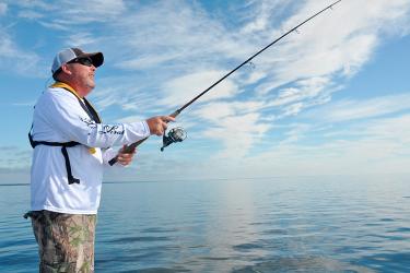
Fishing is big business in the United States, with fishermen landing 9.6 billion pounds of seafood valued at $5.3 billion in 2016. As our oceans have become warmer, some fish are moving northward or deeper to stay in cooler waters--particularly in high-latitude regions like Alaska and New England. Understanding sea surface temperature trends is key to helping fishery managers better plan for the future, and that is a service JPSS-1 will provide. State-of-the-art microwave and infrared radiometers on the spacecraft collect data that, when combined with data from buoys and NOAA vessels, provide timely and reliable readings of water temperature.
Tracking Tagged Animals

Scientists will be able to tap into data streams from JPSS-1 to understand the environmental conditions where tagged species live and travel. Credit: NOAA.
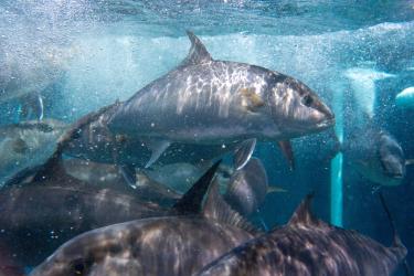
Fish and marine mammals are always on the go, and for centuries their movements were a mystery to scientists. Today, experts place tracking tags on sharks, whales, dolphins, tuna, turtles, and other animals to understand where these animals congregate and migrate. Understanding population patterns helps scientists and managers develop conservation measures to ensure the long-term protection of these animals. Along with other U.S. satellites, scientists will be able to tap into data streams from JPSS-1 to understand the environmental conditions where tagged species live and travel.
Measuring Ocean Productivity

The powerful VIIRS instrument on JPSS-1 also monitors for chlorophyll, which fuels the growth of phytoplankton-the base of the marine food web. Credit: NOAA.
On land, we know chlorophyll as a pigment that keeps grass green. On the ocean, it can be found in dense concentrations and fuels the growth of phytoplankton, a key food source for many creatures like whales, shrimp, and jellyfish. Using the powerful VIIRS instrument, JPSS-1 can make precise oceanographic measurements to measure chlorophyll. In turn, the measurements help scientists understand "hotspots" of where many species live and make predictions about the future productivity of valuable fisheries.