A 2020 study shows that two important indicators for understanding and predicting the effects of climate variability on eastern North Pacific marine ecosystems are less reliable than they were historically. This finding has important implications for fisheries and ecosystem management from Alaska to California.
Until recently, oceanographers and fishery biologists summarized and understood complex and
long-term relationships between regional fish stock productivity and ocean climate patterns using the Pacific Decadal Oscillation index (PDO) and the North Pacific Gyre Oscillation (NPGO).

The PDO accurately described the climate pattern north of 38 degrees N, and the NPGO described the pattern S of 38 degrees N. These two indices captured climate patterns that dominated North Pacific ecosystems for much of the 20th century.
“We were able use these indices to describe changes in collective environmental features including sea surface temperature, sea surface height, sea level pressure, salinity, chlorophyll-a, and ocean nutrients. They also helped us understand and predict changes in the productivity of species like plankton and fish that are sensitive to long-term weather patterns without having to understand specific relationships between individual species and their environment,” said Mike Litzow, NOAA fisheries oceanographer and study lead. “We could count on these indices as reliable tools to summarize this broad suite of climate-biology-relationships.”
But all of that changed beginning around 1988-89.
At that time, a shift in North Pacific climate changed the way that the atmosphere affected ocean conditions. In particular, the Aleutian Low, a semi-permanent low pressure system that is one of the main drivers of the PDO pattern, became less active.
Historically, the Aleutian Low had a major influence on ocean variables like temperature, wind mixing of the water column, and ocean currents that were related to the PDO. After 1988-89, these relationships grew weaker so that the PDO was no longer as good a predictor of overall ocean conditions. Similar changes in atmospheric drivers of the NPGO also occurred.
Of most relevance to fishery management is that, starting in the late 1980s, the relationship between these two major climate indicators and fish stock production weakened.
“In other words, the PDO and the NPGO were less effective tools for helping us understand and predict biological productivity in the ocean,” added NOAA Fisheries Mary Hunsicker, a coauthor on the study.
History of PDO and NPGO as Effective Tools for Influencing and Predicting Changes in Marine Ecosystems
Numerous studies have shown that PDO and NPGO patterns have had considerable influence on climate-sensitive natural resources in the Pacific and over parts of North America in the 20th Century prior to the late 1980s.
The years 1925, 1947, and 1977 were labeled regime shifts due to the large scale shift in the
structure of marine ecosystems as a result of a shift in the climate. In these years, a “warm” phase of the climate (indicated by a positive PDO) favored high production for Alaska fish stocks and low production for Washington, Oregon and California stocks. The “cool” phase of the climate had the opposite effect on Alaska and west coast stocks.
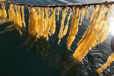
Scientists have linked PDO and NPGO fluctuations to changes in seabird populations, marine mammal abundance and distribution, plankton communities, and even the bloom time of lilac and honeysuckle bushes in spring in the western United States. The NPGO was shown to be particularly important for predicting salmon survival for West Coast salmon.
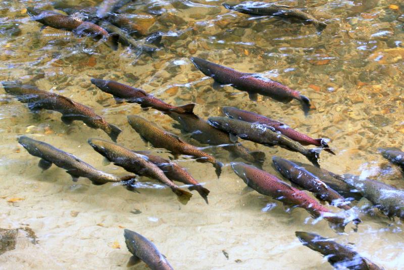
Predicting Salmon Productivity in Alaska Using the PDO
When the PDO was in a "warm" phase, like during 1925-1945 and from 1977 through at least the late 1980s, Alaska salmon production was high. However, in years when the PDO was in a cool regime, (like 1947-1976) Alaska salmon production was low.
“In the 20th Century we could reliably predict trends in salmon abundance because there was a clear link between interdecadal changes in North Pacific climate and salmon stocks,” said Hunsicker. “This was a simpler approach than understanding the complex ecosystem relationships affecting salmon production."
Just by looking at this one indicator scientists could predict whether salmon production was going to be high or low in a particular year or a series of years.
PDO Links to Pacific Groundfish Productivity and Ecosystem Transitions
The PDO pattern has also been shown to correlate to groundfish stock production. A strong one year jump in sablefish recruitment (number of young fish that survive to maturity) in the Northeast Pacific coincided with the 1976–77 regime shift. Pacific halibut recruitment also shifted similar to the interdecadal phases of the PDO. Like Alaska salmon, halibut flourish during warm phases of the PDO. Several flatfish species (arrowtooth flounder, Greenland turbot) have exhibited PDO-like recruitment histories.
According to Litzow, the PDO and NPGO also have been powerful tools for capturing climate shifts that have resulted in major reorganizations in biological communities over vast oceanic regions.
Perhaps the most notable among these occurred in the Gulf of Alaska. Prior to the mid-1970s, the Gulf of Alaska ecosystem was dominated by lower trophic level forage species including capelin, shrimp and sand lance. The ecosystem supported highly productive shrimp and crab fisheries.
A shift in climate coupled with high exploitation rates by international and domestic fleets lead to a decline in shrimp and crab abundance in the Gulf of Alaska. The ecological community structure changed. Higher trophic level groundfish including cod-like fish and flatfish, most notably walleye pollock and Pacific cod, became the dominant species in the Gulf of Alaska ecosystem. This was captured by the PDO.
The New Norm
For many years, the PDO and NPGO served as useful indices for not only understanding climate variability but also predicting fish productivity and distribution patterns. Scientists, resource managers, and fishermen used them to guide sustainable resource management and business planning.
“However, with continued warming of the world’s oceans, these tools are becoming less and less reliable for summarizing and understanding physical and biological relationships,” stressed Litzow.
From the Bering Sea to southern California, individual climate and biological variables are changing. Ocean temperatures are changing and so are wind patterns that drive ocean currents and ocean mixing. As a result, correlations between the PDO and NPGO indices and regional climate and biological variables that have previously been strong, are now weaker or have disappeared completely.
"Our challenge is to better understand the mechanisms linking physical properties of the North Pacific atmosphere-ocean system to important ecosystem variables, including but not limited to salmon abundances. With that kind of understanding, we would be that much better equipped to know what we need to monitor for the near term and for future projections,” said Nick Bond, Joint Institute for the Atmosphere and the Ocean, University of Washington.
The scientific team emphasized the need for new predictive tools to replace the PDO and NPGO indices to understand climate variability and important ecological responses as old patterns no longer hold true.