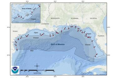
Map and GIS data representing Madison and Swanson sites and Steamboat Lumps, and the Edges fishery management closures to protect Gulf of America* (formerly Gulf of Mexico) reef fish.
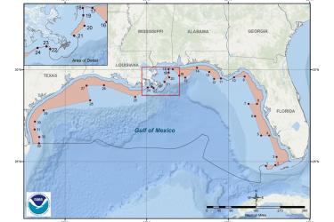
Map and GIS data representing the seasonal closure of the recreational sector for shallow-water grouper (SWG) to protect Gulf of America* (formerly Gulf of Mexico) reef fish.
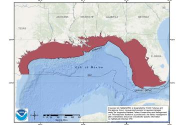
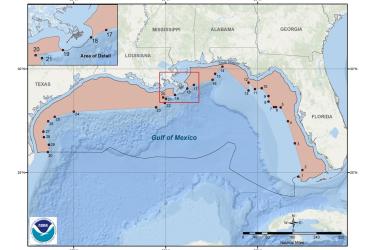
Map and GIS data representing the seasonal prohibitions applicable to bottom longline fishing for Gulf reef fish fishery management area in the Gulf of America* (formerly Gulf of Mexico).