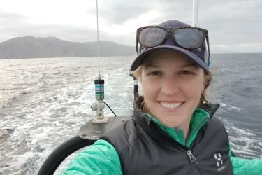
A scientific paper was recently published in NOAA’s Fishery Bulletin that provides abundance estimates of whales and dolphins in Hawaiian waters using data from a ship-based survey that took place in 2010. PIFSC scientist and lead author of the paper Amanda Bradford describes how these estimates were made and how they help us maintain healthy populations of whales and dolphins.
At least 25 species of cetaceans (whales and dolphins) can be found in the waters around the Hawaiian Islands. All marine mammals in the United States are protected by the Marine Mammal Protection Act (MMPA), which was passed in 1972. The MMPA covers a suite of conservation and management measures designed at making sure activities like military sonar, oil and gas development, commercial fisheries operations, and even scientific research do not cause marine mammal populations to fall below sustainable levels–in other words, to become too small to recover from losses of individual animals.
As part of these measures, the MMPA specifies that stock (or population) assessment reports be prepared for all known marine mammal populations in U.S. waters. For my colleagues and I in the PIFSC Protected Species Division, that means all known marine mammal populations across the vast U.S. Pacific Islands region–from the main to the Northwestern Hawaiian Islands, from American Samoa to the Mariana Islands. A stock assessment report synthesizes relevant information, like where the population is distributed and how much it is affected by humans, so that we can determine how the population is doing–its status, in other words. An important part of determining the status of a population is estimating its size, or how many individuals are in the population. If we do not know how many whales or dolphins there are, we will not know how to help keep their populations healthy and sustainable.
Since we are not able to go out and count all individuals one by one, we rely on sampling methods that allow us to use sighting rates of some animals in the population to help us estimate the total number of animals in the population. One of these methods, called line-transect sampling, involves surveying an area from some platform, in our case a ship, on established tracklines (or transects) and then using detection rates of cetacean sightings off those lines to estimate the density of cetaceans in the entire area that was surveyed. We can then multiply that density by the size of our whole study area to get an estimate of population size. This method is particularly well-suited for surveying large areas like the U.S. Hawaiian Islands Exclusive Economic Zone (EEZ), which is about 2.5 million square kilometers (that is, larger than the combined areas of the two largest U.S. states, Alaska and Texas).

A schematic of line-transect sampling showing a ship on a transect (black line) in part of a study area. When a cetacean sighting is made, we get a measure of its perpendicular distance from the trackline, labeled as x. These values of x from multiple sightings within a strip (yellow lines) show us that our ability to detect sightings generally decreases the farther they are from the trackline. However, we can quantify this detectability, which allows us to estimate the density of animals within the strip and ultimately the abundance of animals in the entire study area. Credit: NOAA Fisheries
When we conduct a line-transect survey for cetaceans, we use a 225-ft NOAA research vessel that is staffed with a dozen or more scientists—including a team of visual observers. This team consists of six observers who rotate through three positions searching for cetaceans 180° forward of the vessel from the ship’s flying bridge, which is about 15 meters above the sea surface. The three positions are a right- and left-side observer who search for cetaceans through 25-powered binoculars that we call “big eyes” and a center observer who collects data on a computer, while also searching with naked eye. When cetaceans are sighted within three nautical miles of the trackline, we stop our search effort so that various data can be collected, including the information that allows us to calculate the perpendicular distance to the sighting.

Visual observers search for cetaceans from the flying bridge of a NOAA research vessel. Credit: NOAA Fisheries/Ernesto Vázquez
The formal survey we carry out for the purpose of estimating cetacean abundance around the Hawaiian Islands is called the Hawaiian Islands Cetacean and Ecosystem Assessment Survey, or HICEAS. HICEAS is a line-transect survey of the entire Hawaiian Islands EEZ that takes place over four months during the summer and fall using two NOAA research vessels. The survey design of HICEAS is a series of parallel transects that form a grid that provides comprehensive coverage of the study area. The first HICEAS took place in 2002. During that survey, 23 species were encountered and abundance was estimated for 19 of them. Those estimates represented the first abundance estimates for most Hawaiian cetacean stocks. To make sure we are not missing important changes in population size, we consider abundance estimates to be expired after 8 years. Therefore, a second HICEAS was carried out in 2010.

A false killer whale sighted by the NOAA ship Oscar Elton Sette during HICEAS 2010. Credit: NOAA Fisheries/Corey Sheredy (Permit #14097)
Over 16,000 kilometers of line-transect effort was conducted during HICEAS 2010, which led to 198 cetacean sightings. Abundance was estimated for the 19 species seen while on line-transect effort, although 23 species were encountered overall during the survey. The resulting abundance estimates range from 133 to 72,528 individuals and are lowest for killer and baleen whales and highest for the smaller-sized dolphin species. Note that the recently-published paper presents all the HICEAS 2010 abundance estimates except those for false killer whales, which were reported in an earlier paper. Overall, cetacean density in the Hawaiian EEZ is low compared to other regions, reflecting the relatively low amounts of nutrients in our offshore waters. As a point of comparison, cetacean density has been estimated to be at least 3.5 times higher in the eastern tropical Pacific and 4.5 times higher in the California Current, both areas with relatively high nutrient production.

Locations of the 198 cetacean sightings (black dots) made during HICEAS 2010. The gray lines represent completed transects and the outer black line shows the extent of the Hawaiian Islands EEZ. Credit: NOAA Fisheries

Abundance estimates for 19 cetacean species in the Hawaiian Islands EEZ resulting from HICEAS 2010. The coefficient of variation (CV) is a measure of the precision of each estimate. Precise line-transect estimates will have CVs less than 0.3, but ours tend to be greater than 0.3 because sighting rates are low in our study area. We take the precision of an abundance estimate into account when we determine the status of a population. Credit: NOAA Fisheries
These abundance estimates are set to expire in 2018, so we are gearing up for another HICEAS, which will take place in the summer and fall of this year. HICEAS 2017 will be similar in design to the previous two surveys.

Rough-toothed dolphins were the most abundant species encountered in the Hawaiian Islands EEZ during HICEAS 2010. What species will be the most abundant during HICEAS 2017? Credit: NOAA Fisheries/Adam Ü (Permit #15240)
Thanks to the large number of hard-working scientists who contributed to HICEAS 2010, as well as to the officers and crew of the NOAA ships McArthur II and Oscar Elton Sette. HICEAS 2010 was a collaborative effort between the Southwest and Pacific Islands Fisheries Science Center. All work was carried out under research permit.