A saildrone is an unmanned surface vehicle (USV) designed for long-range ocean science missions by Saildrone, Inc. These environmentally-friendly ocean drones are powered exclusively by the wind (for propulsion) and solar (for the onboard instruments).
Early saildrone prototypes were designed with a narrow hull supported by two outriggers; the latest design consists of the single hull with a deeper, heavier keel. The carbon composite wing is effectively a sail, like on a sailboat, with a design more similar to a wing on an airplane. Wind passing over the wing produces thrust, and a small tab on the end of the tail attached to the wing controls the angle of attack. The rudder controls the direction of the hull, and the keel keeps the saildrone upright.
Saildrones are equipped with Global Positioning System (GPS) and an onboard computer, enabling the vehicles to navigate a series of prescribed waypoints, autonomously adjusting for wind direction and current. Each vehicle is supervised 24/7 by operators at Saildrone Mission Control in Alameda, CA.
The design of the saildrone evolved from Greenbird, the land-sailing vehicle in which Saildrone, Inc. founder and CEO Richard Jenkins set the land speed record for a wind-powered vehicle at 126 mph. However, Saildrone USVs aren't designed for speed, but rather stability and consistency, which is better for data collection. They typically sail at an average speed of 2 - 3 knots (think walking pace).
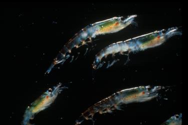
Each saildrone carries a payload of science-grade sensors to measure important meteorological and oceanographic variables in real time. The standard sensor suite includes instruments to measure wind speed and direction, barometric pressure, air and sea surface temperature, chlorophyll, salinity, and wave height and period. Enhanced package sensors include the echosounder, ADCP, the NOAA-developed pCO2 sensor suite, Remote Optical Watcher to detect surface hydrocarbons, and VEMCO acoustic receiver to follow tagged fish or crustaceans.
Saildrone USVs fit in a shipping container. They can be deployed from any oceanside dock and will return to the same dock upon mission completion. Routes can be altered on the fly via the online Saildrone Mission Portal.
To ensure safe operations at sea, each saildrone carries an Automated Identification System (AIS) transceiver, enabling it to see and be seen by nearby commercial traffic. The USVs are slow relative to other marine vehicles and are designed to be highly visible. They are equipped with a radar reflector, high visibility colors for daytime visibility, and a bright navigation light for nighttime awareness. Each vehicle carries sky, sea, and horizon cameras to provide domain awareness to operators at Saildrone Mission Control, as well as collect visual information about the mission operation area.
The seven saildrones operating collaboratively during the 2019 West Coast surveys make up the largest regional fleet to date. Four saildrones are duplicating transects performed by the NOAA Ship Bell M. Shimada as part of NWFSC's Summer Survey that targets Pacific Hake, and three saildrones are augmenting ship-based efforts during the SWFSC's Coastal Pelagic Species Survey being conducted by the NOAA Ship Reuben Lasker.
Saildrones have been deployed in the Arctic, Antarctic, Atlantic, North Sea, Tropical Pacific, and Gulf of Mexico on a variety of missions tracking fish and mammals, measuring pCO2, salinity, and ocean acidification, detecting and tracking oil seeps and spills, charting underwater bathymetry for safe navigation, and surveying the Arctic ice edge. In the Summer of 2019, there are more than 30 saildrones operating on concurrent missions around the world.
The primary objective of the Saildrone technology is to lower the cost of in-situ ocean data collection, which in turns enables monitoring of much larger areas in near real time. By collecting better inputs for scientists, Saildrone USVs are helping to improve the understanding of how our oceans drive critical systems affecting humanity--global weather, fish abundance, and ocean acidification.
Read more about the work Saildrone is doing at saildrone.com/updates.