Refine Results
Topic
Species Category
Region

Clams, Mussels, Oysters Results

220 results match your filter criteria.

Coral Reef Ecosystem Monitoring Report for American Samoa: 2002–2006

This report provides data and information on corals, reef fish, and ocean conditions around the islands and atolls of American Samoa collected during research missions in 2002, 2004, and 2006.
August 31, 2018 - Other Reports ,
756x936-American-Samoa-Monitoring-Report-Cover.jpg

Marine Aquaculture in NOAA Fisheries' Southeast Region

NOAA Fisheries takes a thorough approach to sustainable aquaculture that will create employment and business opportunities in coastal communities, provide safe, sustainable seafood, and complement the agency's comprehensive strategy for maintaining healthy and productive marine populations, species, and ecosystems and vibrant coastal communities.

Oyster Bar 101

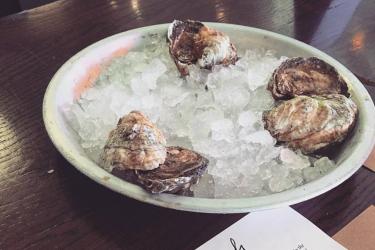
With oyster aquaculture production on the rise in many regions of the United States, more and more people are finding themselves at oyster bars. Also known as a raw bar, these establishments offer guests a variety of different types of oysters as well as the experience of eating in a more hands-on way. Whether you are looking to impress a date or just avoid spilling cocktail sauce on your shirt, here is some advice for oyster bar beginners.
August 03, 2018 - Feature Story ,
Raw oysters rest on a dish full of ice next to a Rappahannock Oyster Bar menu.

NOAA Announces Funding for Sixteen Coastal and Marine Habitat Restoration Projects

$8.2 million will leverage resources and establish lasting partnerships in support of productive and sustainable fisheries, healthy ecosystems, and resilient communities.
July 13, 2018 - Feature Story ,
Bloede Dam Project CRP 3x2.png

Gulf of Mexico Exempted Fishing Permits

The following are exempted fishing permits (EFP) that are currently applied for or have been issued for activities in the Gulf of Mexico.

Southeast Region Exempted Fishing Permits and Letters of Acknowledgement

Information on the authority of issuing exempted fishing permits and letters of acknowledgment for fishing or harvesting of federally managed fish in Gulf of Mexico, South Atlantic, and Caribbean federal waters for the purposes of research activity.

ShoreZone - Maps, Video, Images

Images, videos and maps of Alaska's coastline. The high resolution, attribute rich dataset is a useful tool for extrapolation of site data over broad spatial ranges for creating a variety of habitat models and oil spill response tools.
April 30, 2018 - Query Tool ,
shorezone-ak-coastline1217.png

ShoreZone Partners

Partners from state, federal, non-profit, and private organizations that work together on the ShoreZone mapping system to map the shoreline of Alaska, Oregon, Washington and British Columbia.

Restoring the Gulf of Mexico, Two Years after Historic Deepwater Horizon Settlement

In 2017 NOAA and the other Trustees continue to make significant progress toward restoring the Gulf of Mexico from Deepwater Horizon, which poured oil into the water and onto the coastline for almost three months in 2010.
April 24, 2018 - Feature Story ,

Alaska Bathymetry Map

Bathymetry data can be analyzed to provide important information (e.g., slope and roughness) for defining Essential Fish Habitat. This mapping tool contains bathymetry data compiled by the Alaska Fisheries Science Center's Groundfish Assessment Program from the Aleutian Islands, Cook Inlet, the Central Gulf of Alaska and Norton Sound in Alaska.
January 02, 2018 - Map ,