Refine Results
Topic
Species Category
Region

National Results

2705 results match your filter criteria.

NOAA's Teacher at Sea Program Celebrates 35 Years

A letter from Program Director Jennifer Hammond announcing the theme for NOAA Teacher at Sea Program's 35th Anniversary celebration.
view sunrise over a churning Gulf of Mexico - no other vessels in sight; the sky is mostly orange with small wispy clouds View of sunrise over the Gulf of Mexico captured by TAS '22 Jordan Findley aboard NOAA Ship Pisces.

2024 Regional Recreational Fishing Highlights

NOAA Fisheries' recreational fishing highlights and accomplishments by region.

2024 National Recreational Fishing Highlights

NOAA Fisheries' accomplishments and highlights in recreational fisheries and fishing.
January 17, 2025 - Feature Story ,
A bearded black man holds up a large, orange yelloweye rockfish using both hands and smiles for the camera. Three individuals stand behind him on a boat among fishing rods, buckets, caught fish, and other supplies.

How NOAA Satellites Monitor Ocean Health: Tracking Changes from Space

Satellites provide scientists important data they use to manage and protect fisheries and marine mammals.
January 16, 2025 - Podcast ,
A view from a satellite over Earth’s ocean and an aerial view of a blue whale A view from a satellite over Earth’s ocean and an aerial view of a blue whale.

Optics Technology: At the Heart of Marine Research

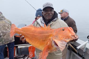
Videos and images from advanced underwater cameras are a critical component of collecting data. We use this information to make informed management decisions for marine species and habitat.
January 14, 2025 - Feature Story ,
Flower Garden Banks Reef Scene A Spanish hogfish (left) and yellowtail damselfish (right) peek out from a reef in the Gulf of America (formerly Gulf of Mexico). Credit: Emma Hickerson/NOAA

Technology Week: Launching into the Future with Advanced Technologies

Join us as we highlight the technologies our scientists use to fulfill our mission!
January 13, 2025 - Feature Story ,
Promotional graphic for Tech Week featuring various types of technology like airplanes, ships, and drones connected through digital network lines on a blue background.

Gliders: Collecting Data on Ocean Health

Autonomous vehicles, like gliders, are giving us critical new insights into what is going on in the deeper parts of the ocean.
January 13, 2025 - Video ,
Researchers in hard hats and vests use a pulley system to lower a glider into the water off the back of a research ship. Other researchers sit in a black raft floating in the water behind the boat. Deploying a glider off the side of a ship. Credit: NOAA Fisheries

Geostationary Extended Observations (GeoXO)

NOAA’s next-generation weather satellites are getting an upgrade with the newest satellite in the series, GeoXO.

Satellite Applications

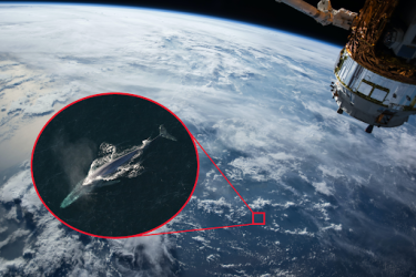
How does NOAA Fisheries use satellites? From coral reef management to monitoring illegal fishing activity, learn about the many ways that satellites contribute to effective marine resource management.