Unsupported Browser Detected

Internet Explorer lacks support for the features of this website. For the best experience, please use a modern browser such as Chrome, Firefox, or Edge.

2021 Fall Bottom Trawl Survey Completed in Northeast

December 06, 2021

This long-running, fishery-independent survey monitors abundance and distribution of fishery species on the Northwest Atlantic continental shelf from Cape Lookout, North Carolina to the Scotian Shelf.

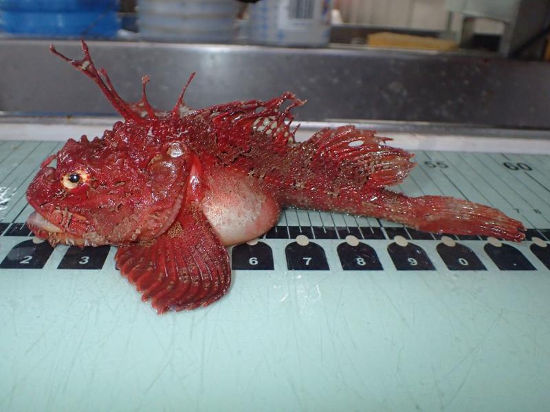
A color image taken at a fish sampling station on the NOAA Ship Henry Bigelow. The board is light-colored. The fish is on its belly, wing-like side fins fanned outward and its trademark spines sticking up along its backbone. A brilliantly red sea raven, Hemitripterus americanus. Sea ravens come in many shapes and colors, but this one is among the most striking. Credit: NOAA Fisheries

On November 15, Northeast Fisheries Science Center staff finished the 2021 fall bottom trawl survey aboard the NOAA Ship Henry B. Bigelow. Those aboard conducted resource survey tows and temperature and salinity sampling at 353 of 377 planned stations (94 percent completion). They sampled for plankton at 110 of 116 planned stations (95 percent completion.)

A chart showing the U.S. East Coast and adjacent ocean waters. A color overlay shows the survey strata and the percent of planned stations completed in each.
Northeast Fisheries Science Center 2021 fall bottom trawl survey stations completed. Credit: NOAA Fisheries

This year’s fall survey occurred in three legs, moving from south to north. The survey got underway as planned on September 11 and concluded on November 15.

Temperature and salinity profiles collected during the survey help link fish distribution to physical oceanographic conditions. Ichthyoplankton (larval fish and eggs) collected help with understanding spawning distributions and with estimating changes in fish abundance. Zooplankton (tiny animals and immature stages of some larger ones) collected tell researchers about the ocean food web. They are used to construct models that support ecosystem-based fisheries management.

 A chart showing the U.S. East Coast and adjacent ocean waters. A color overlay shows the survey strata and the percent of planned casts completed in each.
Northeast Fisheries Science Center 2021 fall bottom trawl conductivity, temperature, depth casts completed. Credit NOAA Fisheries

The NOAA Ship Henry B. Bigelow supports a variety of marine research. However, this multispecies bottom-trawl survey is the most important of its missions for monitoring the region’s fishery resources. It is the longest running of its kind in the world. Data collected are used to monitor the distribution and relative abundance of fish and invertebrate species on the continental shelf and upper slope of the Northwest Atlantic Ocean.
A chart showing the U.S. East Coast and adjacent ocean waters. A color overlay shows the survey strata and the percent of plankton tows completed in each.
Northeast Fisheries Science Center 2021 fall bottom trawl planned plankton tows completed. Credit: NOAA Fisheries

Last updated by Northeast Fisheries Science Center on December 06, 2021