In 2004, Alaska Fisheries Science Center biologists began attaching light sensors to Bering Sea survey bottom trawls to evaluate the effects of light on fish catchability. Fifteen years later, researchers looked at this unique dataset in a new light to reveal much more about the dynamic Bering Sea ecosystem.
NOAA Fisheries scientists collaborated with our partners to develop an automated process to translate these data into the first long time series of subsurface water clarity for the eastern Bering Sea.
“Until now, there was very little long term information on subsurface water clarity in the Bering Sea,” said Sean Rohan, the NOAA Fisheries Alaska Fisheries Science Center biologist who led the study. “Working with the annual surveys provided unprecedented spatial coverage and resolution over a span of 15 years.”
Their approach provides a tool that expands possibilities for research in other regions. Their findings reveal patterns and trends in water clarity over depth and time that enhance our understanding of recent and future changes in the Bering Sea.

Water Clarity Reflects And Influences Ecosystem Structure And Change
Measures of water clarity provide information about how deep light can penetrate into the water column. It profoundly influences the structure of marine ecosystems, from plankton to predators.
Through its effects on heat and light in the water column, clarity affects primary production: production of plankton, which forms the base of the food web. Those changes propagate through the food web to affect productivity of higher trophic levels like fish.
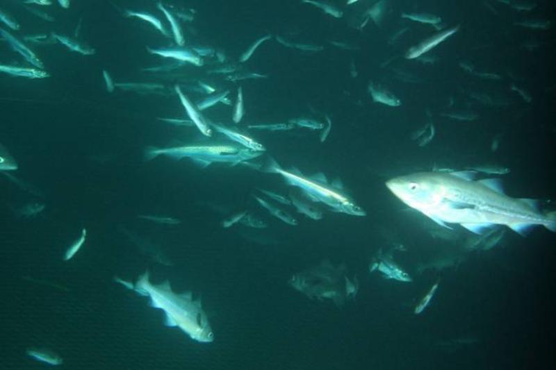
Through its effect on visibility, water clarity influences predator-prey dynamics. Vision is critical to the success of predators who hunt by sight, and the survival of prey that depend on vision to evade predators. Water clarity can tip the balance of competition between visual predators and those that use other senses to detect prey.
In the eastern Bering Sea, water clarity depends on:
- Amount and depth of plankton
- Organic matter and sediment from rivers
- Resuspension of seafloor sediment by currents and wind.
All of these factors can change over time with climate or other environmental change.

Monitoring Water Clarity Is Important—But Not Easy
Water clarity provides valuable information about commercially valuable fish and the ecosystem that supports them. But it can be difficult to monitor— especially in Alaska, where vast, remote seas and moody weather can make data collection a challenge.
Surface water clarity is widely recorded using satellite-based remote sensing. These measurements have shown changes in near-surface water clarity over decades. Previous studies provide insight into how these changes are related to changes in the ecosystem.

Frequent cloudy weather can make satellite coverage difficult to obtain in the Bering Sea. More importantly, surface clarity measured from satellites tells only part of the story. A lot of what goes on in the ocean happens beneath the surface.

Measuring subsurface light clarity has been particularly challenging.
“Nothing has been done before on this scale or this consistency. We had samples at about the same time every year from the same 376 stations, over the course of 15 years,” said Rohan.
Rohan says that the biggest challenge was coming up with a fully automated way to process the data. They needed to ensure that it is reproducible, consistent, and time-efficient in the long run. That also makes it an important tool beyond the Bering Sea.
“We are developing a method that opens doors to access subsurface clarity data in other Alaska regions where bottom trawl surveys are conducted,” said Rohan.
Bering Sea Clarity Varies Over Space, Depth, and Time
“We found a lot of variation in water clarity in the Bering Sea,” said Rohan. “This variability may be both a cause and consequence of changes in ecosystem structure.”

Cross-shelf profiles of subsurface clarity (Kd(z, λtag)) in relation to the mixed layer depth (MLD, solid black line); bottom layer depth (BLD, dashed black line); and depth of the 10% light level (Z10% , solid white line). Higher Kd(z, λtag) values (darker colors) indicate lower water clarity. Mixed layer depth (MLD) and bottom layer depth (BLD) show the density structure of surface and bottom layers based on temperature and salinity. Note the lower clarity water around the likely subsurface chlorophyll maximum near the bottom of the mixed layer, and near the seafloor.
The study also revealed a new discovery.
“Our most exciting finding was the nepheloid layer, a layer of turbid water near the bottom,” Rohan said. “Its extent and regular occurrence had not been previously documented.”
“We are not sure what it is. We suspect it is sediment resuspended by tidal action. That would mean ocean dynamics in the area are different than we thought,” said Rohan. “We hope to do further research to clarify what causes it, how it affects ecological processes, and why it is most prominent in the north.”
All of these findings underscore that the eastern Bering Sea is a complex, highly variable mosaic of optical habitat that is undergoing change. Across this mosaic there are likely differences in primary productivity, predator-prey interactions, and ecosystem structure.

Implications for Bering Sea Fish and Fisheries Management
Catchability
Catchability is a measure of how efficiently fish are caught in nets. Understanding catchability is essential to make accurate estimates of abundance and set sustainable fishing limits.
Water clarity affects visibility and therefore catchability. Most fish species are less likely to be herded into a bottom trawl net by peripheral gear (sweeps and doors) if they can’t see it approaching. Pollock are also less likely to be on the bottom when it's darker.
“The level of optical variability we observed is likely enough to cause variation in catchability of walleye pollock in surveys,” said Rohan.
The methods developed in the study provide a valuable tool to improve the accuracy and precision of abundance estimates for stock assessments. Light sensor tags are relatively inexpensive and cause minimal disruption to fishing operations. They could be deployed on commercial fishing gear to further explore the relationship between water clarity and catchability.
Fish Species Distribution and Composition
Changes in water clarity may affect the success of different fish species by influencing predator-prey interactions. Visual foragers can’t catch prey if they can’t see them. Spatial differences in water clarity could change the distribution of species in different areas. Declining water clarity over the years could favor nonvisual predators, such as jellyfish, over visual predators like walleye pollock.
“Our next steps are to examine variation in the visual predation environment for walleye pollock, and how much variation in water clarity leads to variation in catchability. In particular we want to look at how changes in water clarity combined with northward shifts in fish distribution affect catchability. Our data will help us predict how catchability may change if there is more fishing at high latitudes in the future,” said Rohan. “We are proactively thinking about how changes in fish distribution will affect what we see in surveys and what industry will see on the ground.”
Productivity
Variation in water clarity over the northern shelf is notable because primary production here typically continues throughout the summer by virtue of high surface clarity. Changes could affect productivity of fish in the region.
Further research could determine if variation in water clarity is caused by changes in nutrient availability, timing of productivity, or shifts in the balance between productivity and consumption.
Ecosystem Change
The ability to monitor subsurface clarity on a large scale over time provides a new tool to better understand how Alaska ecosystems are changing.
“This unique dataset is likely an index for benthic production and acidification in addition to its original purpose to look at fish catchability,” said Bob Foy, Alaska Fisheries Science Center director.
Moving Toward a Clearer Picture of Marine Ecosystems
“Monitoring subsurface water clarity in marine ecosystems remains an immense logistical challenge,” said Rohan. “In the future, emerging technologies such as autonomous underwater vehicles, biogeochemical Argo floats, and satellite-based high spectral resolution LiDAR may improve coverage. Until then, we have developed an approach that uses existing sampling platforms to greatly expand our ability to monitor subsurface water clarity.”
This research is a collaborative effort between NOAA Fisheries Alaska Fisheries Science Center (S. Rohan, S. Kotwicki, K. Kearney, E. Laman; L. Britt, K. Aydin; S. Zador); University of Washington School of Aquatic and Fishery Sciences (S. Rohan); University of Washington Joint Institute for the Study of the Atmosphere and Oceans (K. Kearney); U.S. Geological Survey, Western Ecological Research Center (J. Schulien); NOAA, Pacific Marine Environmental Laboratory (E. Cokelet); U.S. Geological Survey, Western Fisheries Research Center (D. Beauchamp). The research was funded in part by a NOAA Fisheries and the Environment Program grant.


