El Niño climate patterns contributed to the “warm blob” that began dominating the Gulf of Alaska in late 2013, and later gripped the West Coast of North America in what became the Northeast Pacific’s largest marine heatwave, according to a new study published in Nature Climate Change today.
While the warm blob started in the Gulf of Alaska in 2013, its persistence and evolution into a much larger pattern of ocean warming in 2014 and 2015 involved long-distance “teleconnections” between the North and tropical Pacific.
“The bottom line is that El Niño had a hand in this even though we’re talking about very long-distance influences,” said Nate Mantua, a research scientist at NOAA Fisheries’ Southwest Fisheries Science Center and a coauthor of the new study. “It’s been known for decades that El Niño causes changes in wind, weather, and ocean temperatures across the North Pacific through an ‘atmospheric bridge,’ where massive shifts in tropical rainfall influence storm tracks over the North Pacific and North America.”
The new research found that the known climate patterns linked the tropical and temperate latitudes of the North Pacific Ocean, helping to fuel the extreme marine heatwave.
Climate models suggest that the extreme atmospheric conditions that gave rise to the warm blob could become more pronounced as greenhouse gases accumulate in the atmosphere, the study found. The study was authored by Emanuele Di Lorenzo of the Georgia Institute of Technology and Mantua.
“Climate models predict that these kind of multi-year extremes become stronger in a warming climate,” Mantua said. “But while the models show that they should get stronger as the earth’s climate warms, it’s not clear to us yet if that is now detectable in nature.”
The heat wave emerged in the fall of 2013, when a ridge of high pressure dampened winds over the Gulf of Alaska, allowing a large section of the North Pacific to warm by up to 3 degrees C (about 5 degrees F) above average. It represented the highest temperature anomaly in the North Pacific in more than 100 years of records. The ridge came with weak winds in the subtropical Pacific near Hawaii, which is a known precursor of El Niño conditions that develop up to one year later.
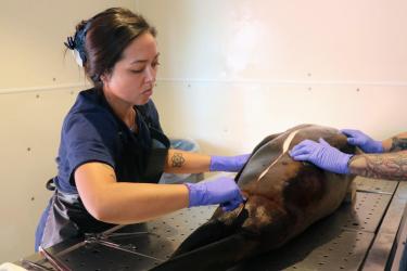
The warm patch spread to fill the northeast Pacific between Hawaii and the West Coast of North America by the fall of 2014, shaking up the marine food chain and leading to sightings of warm-water species far outside of their normal range. The conditions led to die-offs of seabirds, mass strandings for California sea lion pups, and likely contributed in 2015 to the largest-ever harmful algal bloom recorded on the West Coast, closing fisheries for clams and Dungeness crab.
“While the socio-economic consequences of this climate event need to be further evaluated, it is possible that the northeast Pacific warm anomaly of 2014-15 is the most ecologically and economically significant marine heatwave on record,” the researchers wrote.
A weak El Niño pattern that stalled out during the winter of 2014-15 contributed to the North Pacific’s heatwave, according to a combination of climate observations and model simulations. That was followed by a second and much stronger El Niño pattern that emerged the following winter, with an “atmospheric bridge” concentrating the extended warmth of the Northeast Pacific Ocean in an arc-pattern along the West Coast from Alaska to Mexico.


The latest observations in July 2016 show that ocean temperatures near the coast of Southern and Baja California, around Alaska and in a wide offshore band between Hawaii and Alaska remain about 3 degrees C warmer than average. In contrast, there are colder than normal surface temperatures along coast of Northern California and Southern Oregon, and in patches along the equator.
The latest seasonal forecasts from NOAA’s Climate Prediction Center show that the cool waters in the tropical Pacific are likely to expand and that a La Niña pattern is likely to develop during the Northern Hemisphere summer of 2016, with about a 75% chance of La Niña during the fall and winter of 2016-17.
La Niña would favor changes in wind, weather, and ocean currents that tend to cool the Northeast Pacific Ocean between Hawaii and North America. See NOAA’s latest advisory on the Climate Prediction Center's website.