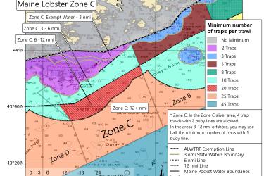
This map shows the new minimum traps per trawl requirements for Maine Zone C put in place by the 2021 amendments to the Atlantic Large Whale Take Reduction Plan.
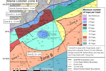
This map shows the new minimum traps per trawl requirements for Maine Zone B put in place by the 2021 amendments to the Atlantic Large Whale Take Reduction Plan.
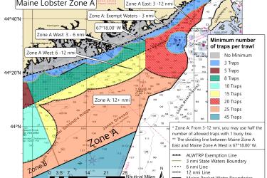
This map shows the new minimum traps per trawl requirements for Maine Zone A put in place by the 2021 amendments to the Atlantic Large Whale Take Reduction Plan.
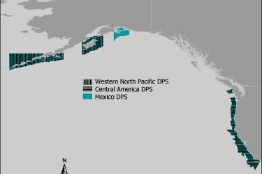
Maps and GIS data representing critical habitat for the Western North Pacific distinct population segment (DPS), the Central America DPS, and the Mexico DPS of humpback whales.
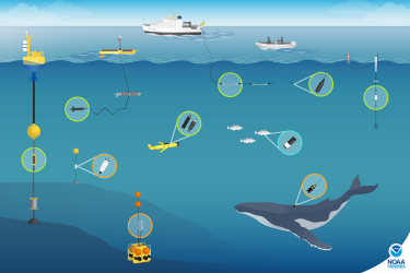
Distribution and Relative Abundance of Marine Mammals in the Eastern Chukchi Sea, Eastern and Western Beaufort Sea, and Amundsen Gulf, 2019 Annual Report
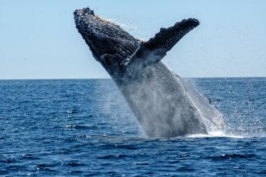
How Are Whales Responding to Fewer Tourists in the Waters Off Juneau, Alaska? A Summer Survey is Underway
Scientists hope to establish a baseline estimate of humpback whale abundance in waters around Juneau, AK and learn more about the impacts of human activities on the whales.
How Are Whales Responding to Fewer Tourists in the Waters Off Juneau, Alaska? A Summer Survey is Underway
Scientists hope to establish a baseline estimate of humpback whale abundance in waters around Juneau, AK and learn more about the impacts of human activities on the whales.