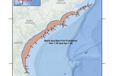
Map and GIS data representing the seasonal closure of the commercial black sea bass pot component of the snapper-grouper fishery for November 1-30 and April 1-30 in the South Atlantic Region.
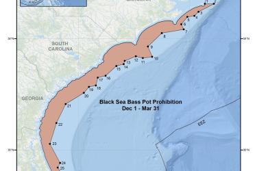
Map and GIS data representing the seasonal closure of the commercial black sea bass pot component of the snapper-grouper fishery from December 1 through March 31 in the South Atlantic Region.