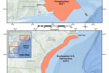
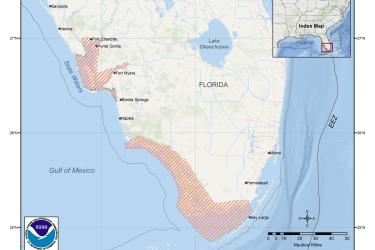
Map and GIS data representing critical habitat for the conservation of endangered North Atlantic right whale in the Greater Atlantic and Southeast Regions.
The Pacific Islands Benthic Habitat Mapping Center provides online access to benthic habitat maps and data for coral reef ecosystems throughout the U.S. Pacific Islands, including the U.S. territories.
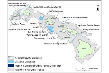
Map and GIS data representing critical habitat for the main Hawaiian Islands insular false killer whales in waters from 45 meters to 3,200 meters (49 to 3,500 yards) in depth surrounding the main Hawaiian Islands (from Ni‘ihau to Hawai‘i Island).
The NOAA Fisheries Distribution Mapping and Analysis Portal (DisMAP) provides easy access to information to track and understand the distributions of marine species in the U.S. Marine Ecosystems.
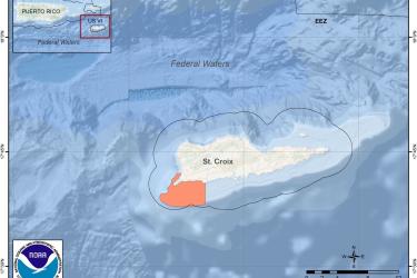
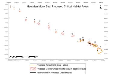
Critical habitat is habitat needed to support recovery of listed species. When a species is listed under the Endangered Species Act, NOAA Fisheries is required to determine whether there are areas that meet the definition of critical habitat.