NOAA Fisheries


Featured News
 Shucked eastern oysters at Row 34 in Boston, Massachusetts. Credit: NOAA Fisheries/Brianna Shaughnessy
Feature Story
The World is Your Oyster: A Beginners Guide to Ordering, Shucking, and Eating Oysters
Alaska
New England/Mid-Atlantic
Pacific Islands
Southeast
West Coast
National
 Image caption: Close up of a lanternfish. Credit: DEEPEND/Danté Fenolio
Feature Story
Decade of Data Shows Rapid Decline in Pelagic Fish and Invertebrates in Deep Gulf
Southeast
 A snow-Tanner hybrid crab collected during the 2026 eastern Bering Sea bottom trawl survey. Hybrid crab exhibit intermediate morphological traits—such as a curved mouth—relative to snow and Tanner crab parent species. Credit: NOAA Fisheries / Leah Zacher
 Documentation of depredation of an Atlantic sharpnose shark by a sandbar shark caught on the same hook during longline sampling. Credit: NOAA Fisheries
 A crane deposits stone on the bottom of Hooper Strait Oyster Sanctuary to build a new oyster reef. Credit: Molly Feltner/NOAA
Feature Story
NOAA-Funded Project to Build 70 Acres of Chesapeake Bay Oyster Reef Habitat
New England/Mid-Atlantic
 Restored oyster reefs are monitored to ensure the oysters that grow there are thriving. Photo: Oyster Recovery Partnership.
Notices & Rules
Fisheries
Fisheries
Protected Resources
Fisheries
Fisheries
Upcoming Events
Bulletins
Open Funding Opportunities
Find a Species


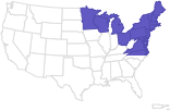
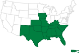
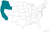
Explore By Region


Explore by Topic
- Aquaculture
- Bycatch
- Careers & More
- Chesapeake Bay
- Climate Change
- Commercial Fishing
- Consultations
- Ecosystems
- Endangered Species Conservation
- Enforcement
- Fishery Observers
- Habitat Conservation
- International Affairs
- Laws & Policies
- Marine Life in Distress
- Marine Life Viewing Guidelines
- Marine Mammal Protection
- Offshore Wind Energy
- Partners
- Population Assessments
- Recreational Fishing
- Recreational Fishing Data
- Resources for Fishing
- Seafood Commerce and Trade
- Socioeconomics
- Sustainable Fisheries
- Sustainable Seafood
- Teacher at Sea Program
Multimedia
 A scientist prepares to photograph a reef at Swains Island during the 2023 National Coral Reef Monitoring Program survey in American Samoa. Credit: NOAA Fisheries (Permit #NMSAS-2023-002)
 GulfCorps crews clear vegetation to restore habitat in Florida. Credit: John Stanmeyer/The Nature Conservancy.