The Mariana Trench, Pacific Islands Heritage, and Rose Atoll Marine National Monuments were established ten years ago. These spectacular and remote marine ecosystems continue to inspire us to explore, learn, and share more about the diverse species and habitats that flourish in the Pacific Ocean.
NOAA Fisheries’ Pacific Islands region, NOAA's Office of National Marine Sanctuaries, the U.S. Fish and Wildlife Service, the governments of the Commonwealth of the Northern Mariana Islands (CNMI) and American Samoa, and our many partners have been busy since these Monuments were designated on January 6, 2009.
These are just a few of the many projects and activities implemented in the past decade to help us protect and learn about the marine ecosystems in these marine national monuments. We hope you will follow along during the next 10 years as we continue our research and stewardship activities.
Learn more about the Marine National Monuments in the Pacific
Highlights & Accomplishments
NOAA Ship Okeanos Explorer: Campaign to Address Pacific Monument Science, Technology, and Ocean NEeds

The NOAA ship Okeanos Explorer conducted a 3-year exploration expedition to the Monuments and marine protected areas in the archipelagos of Hawaiʻi, the Marianas, Pacific Remote Islands, American Samoa, and Phoenix Islands. The project mapped more than 100,000 square kilometers of seafloor, collected hundreds of terabytes of data, and observed or discovered new seamounts and hundreds of new species—an invaluable accomplishment that will assist in characterizing these ecosystems.
Partnership Agreement for Managing Submerged Lands


A team of scientists and partners with the Resource Assessment Management Program of the NOAA Pacific Islands Fisheries Science Center have been monitoring the condition and trends of species and their habitats in the Mariana Trench, Pacific Islands Heritage, and Rose Atoll Marine National Monuments since 2000.
Pacific Islands Heritage Marine National Monument a
“Hope Spot”


Palmyra Atoll National Wildlife Refuge in the Pacific Islands Heritage Marine National Monument has been named a “Hope Spot” by Mission Blue. Mission Blue is a non-profit coalition dedicated to creating a global network of marine protected areas that give the world’s oceans respite from human impacts. Thanks to ongoing management—like the eradication of invasive rats and removal of shipwrecks that were damaging the coral reef—the atoll continues to thrive. The Palmyra Atoll is now available for 3-D viewing at Google Street View Oceans Portal and the 360-degree video on YouTube. Virtual filming was made possible through a NOAA grant awarded to Underwater Earth and support from the U.S Fish and Wildlife Service and The Nature Conservancy.
Rose Atoll Marine National Monument Education Materials


Local leaders in American Samoa, scientists, and partners visited Rose Atoll Marine National Monument and Rose Atoll National Wildlife Refuge to develop education materials based on the cultural tradition and oral history of the local communities. They produced a documentary and a bilingual brochure with lesson plans on coral reef ecosystems and geology, climate change, and water quality monitoring.
Mariana Trench Archipelago Science and Exploration Plan Workshops


In April 2015, 80 educators in the CNMI and Guam—responsible for teaching nearly 6,800 students in the public school systems—underwent an 8-hour professional development course and curriculum. They learned how to teach “Why Do We Explore the Mariana Trench Marine National Monument” for grades 5–12. The course was presented by the NOAA Fisheries Marine National Monuments Program and Office of Ocean Exploration and Research. Fifty educators in Pago Pago, American Samoa, underwent the same training in August 2016. Why Do We Explore? volume 1 and How Do We Explore? volume 2 from the NOAA Ship Okeanos Explorer Education Materials Collection are used to teach ocean exploration. They provide standards-based, hands-on activities and online resources that guide classroom teaching about ocean exploration, climate change, ocean energy, ocean health, human health, and technological innovations.
VIDEO: "Our Deepest Waters: Exploring Marine National Monuments in Remote Reaches of the Pacific

NOAA Fisheries awarded a grant to Open Boat Films, LLC. to develop the film Our Deepest Waters: Exploring the Remote Reaches of the Pacific Marine National Monuments. The film shows the research and management activities conducted in the monuments, as well as the unique natural marine resources in these remote areas. We also awarded a grant to Open Boat Films to produce a sing-along music video, The Marvelous Music Report, which won national and international awards at film festivals.
NOAA Fisheries awarded a grant to create lesson plans for educators. These plans help instructors teach marine biology and conservation using the four Pacific Marine National Monuments ecosystems as the study areas.
Maug’s Caldera: A Natural Laboratory Documentary


NOAA and the U.S. Fish and Wildlife Service also funded a documentary produced by Open Boat Films LLC and partnering scientists called Maug’s Caldera: A Natural Laboratory, which was broadcast on Changing Seas TV. The film captures the scientists conducting research in the natural hydrothermal vent conditions at Maug cauldron to learn how organisms survive and adapt.
DEEPSEA CHALLENGE Expedition: Mariana Trench


James Cameron (producer of Titanic and Avatar) conducted the DEEPSEA CHALLENGE Expedition, as he dove into the Mariana Trench to reach the deepest point on Earth. Learn more about the Mariana Trench expedition and see the trailer for a film about the dive. National Geographic, NOAA, U.S. Fish and Wildlife Service, University of Hawaiʻi, University of Guam, and partners supported the expedition.
Marine National Monument Reports
The NOAA Fisheries Marine National Monument Program funded the production of numerous reports to be used in developing monument management plans:
- Climate Change Vulnerability Analysis
- Marine Invasive Species Vector Analysis
- Traditional Fishing Patterns in the Marianas Trench Marine National Monument
- Kiribati Fisheries Vessel Assessment
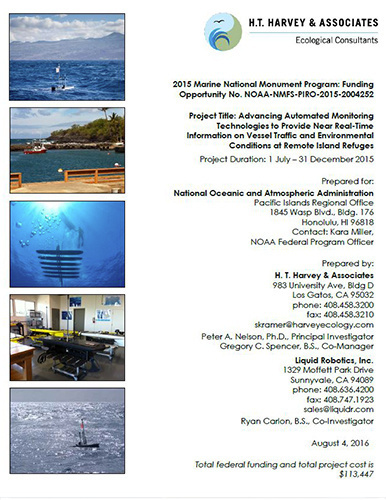
- Advancing Automated Monitoring Technologies to Provide Near Real-Time Information on Vessel Traffic and Environmental Conditions at Remote Island Monuments
- Pelagic Fish and Seabird Inter-relationships in the Central Tropical Pacific: Methods and Approaches to Study and Manage
- Examination of Pelagic Marine Protected Area Management
- A Brief History of Human Activities in the U.S. Pacific Remote Islands

NOAA, U.S. Fish and Wildlife Service, and CNMI government staff drafted the Mariana Trench Marine National Monument draft management plan and are implementing management activities, with the public review forthcoming.
Additionally, preparation for the Pacific Remote Islands Marine National Monuments* draft management plan will begin in 2019. We will start with the establishment and meeting of a “community group” which will contribute ideas on new and emerging issues to the agencies, supporting the proper stewardship of the monument resources.
*January 2, 2025 the White House announced the renaming of the Pacific Remote Islands Marine National Monument to the Pacific Islands Heritage Marine National Monument.