Unsupported Browser Detected

Internet Explorer lacks support for the features of this website. For the best experience, please use a modern browser such as Chrome, Firefox, or Edge.

2022 Fall Bottom Trawl Survey Completed in Northeast

December 02, 2022

This long-running, fishery-independent survey monitors abundance and distribution of fishery species on the Northwest Atlantic continental shelf from Cape Lookout, North Carolina, to the Scotian Shelf.

A woman scientist stands inside a research vessel wearing a yellow raincoat, blue rubber gloves and wears a face mask. She is holding a very small Atlantic wolffish. Scientist Angelia Miller holding a young Atlantic wolffish. Credit: NOAA Fisheries/Christine Kircun

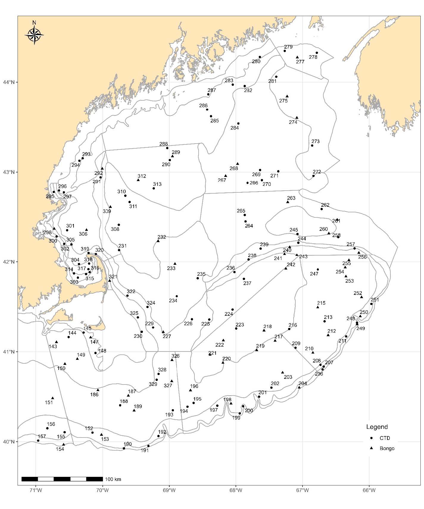
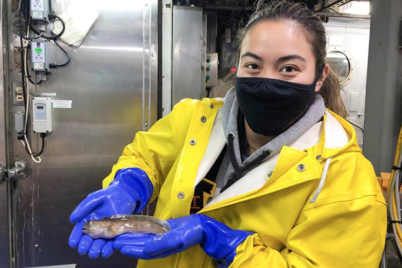
On November 16, Northeast Fisheries Science Center staff finished the 2022 fall bottom trawl survey aboard the NOAA Ship Henry B. Bigelow. Those aboard conducted resource survey tows and temperature and salinity sampling at 308 of 377 planned stations (82 percent completion). They sampled for plankton at 95 of 116 planned stations (82 percent completion).

This year’s fall survey occurred in three legs, moving from south to north. The survey got underway on September 10 and concluded on November 15. Multiple cases of COVID-19 resulted in the loss of 14 sea days during the first two legs of the survey.

The Henry B. Bigelow supports a variety of marine research. However, this multispecies bottom-trawl survey is the most important of its missions for monitoring the region’s fishery resources.

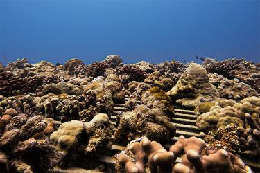
Temperature and salinity profiles collected during the survey help link fish distribution to physical oceanographic conditions. Ichthyoplankton (larval fish and eggs) collected help with understanding spawning distributions and with estimating changes in fish abundance. Zooplankton (tiny animals and immature stages of some larger ones) collected tell researchers about the ocean food web. They are used to construct models that support ecosystem-based fisheries management.

This long-running survey monitors fishery stock abundance and distribution on the Northwest Atlantic continental shelf from Cape Lookout, North Carolina, to the Scotian Shelf. Data collected include fish age, length, weight, sex, maturity and food habits information. These are critical inputs to regional fish stock assessments helping to inform fishery management decisions by the New England and Mid-Atlantic Fishery Management Councils as well as Atlantic States Marine Fisheries Commission.

A chart showing the U.S. East Coast and adjacent ocean waters. A dot marks the location of each of the 377 planned stations on the Northwest Atlantic shelf.
Northeast Fisheries Science Center 2022 fall bottom trawl survey planned stations in the Mid-Atlantic. Credit: NOAA Fisheries
A chart showing the U.S. East Coast and adjacent ocean waters. A dot marks the location of each of the 377 planned stations on the Northwest Atlantic shelf.
Northeast Fisheries Science Center 2022 fall bottom trawl survey planned stations in the Gulf of Maine. Credit: NOAA Fisheries
A chart showing the U.S. East Coast and adjacent ocean waters. A color overlay shows the survey strata and the percent of planned stations completed in each.
Northeast Fisheries Science Center 2022 fall bottom trawl survey trawl and CDT stations completed. Credit: NOAA Fisheries
A chart showing the U.S. East Coast and adjacent ocean waters. A color overlay shows the survey strata and the percent of planned stations completed in each.
Northeast Fisheries Science Center 2022 fall bottom trawl survey plankton stations completed. Credit: NOAA Fisheries

Last updated by Northeast Fisheries Science Center on February 21, 2023