Refine Results
Topic
Species Category
Region

Marine Ecology and Stock Assessment Program Results

91 results match your filter criteria.

Shortraker Rockfish Research in Alaska

Shortraker rockfish (Sebastes borealis) ranges from southeastern Kamchatka, north into the Bering Sea, through the Aleutian Islands and Gulf of Alaska, and south to southern California. The center of abundance appears to be Alaskan waters.
Orange fish at the bottom of the seafloor swimming

Economic Status Reports For The Gulf Of Alaska And Bering Sea/Aleutian Islands

The Groundfish Economic Status (SAFE) Reports summarizes available economic data about the federal groundfish fisheries in the Gulf of Alaska and the Bering Sea/Aleutian Islands.
Bottom Trawl Survey_KShotwell- Retouched.jpg

Alaska Sablefish Fisheries and Assessment

We use information collected during the Alaska Fisheries Science Center's annual longline survey on the continental slope of the eastern Bering Sea, Aleutian Islands, and the Gulf of Alaska to estimate the size of the sablefish population in Alaska.
Man wearing orange coat on a boat holding a large fish

Pacific Ocean Perch Stock Status in Alaska

We develop computer models and input a variety of data collected during research surveys in Alaska to determine the condition of Pacific Ocean Perch stocks.

Alaska Sablefish Tagging Program

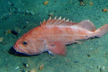
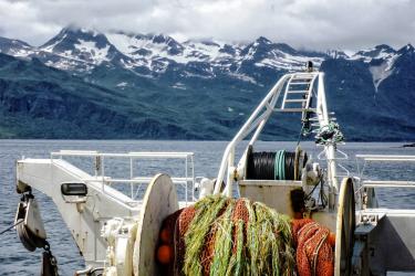
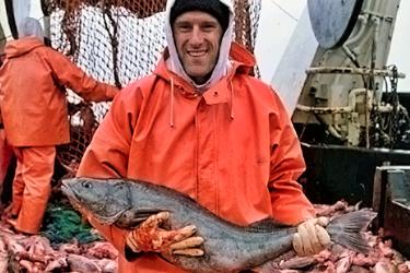
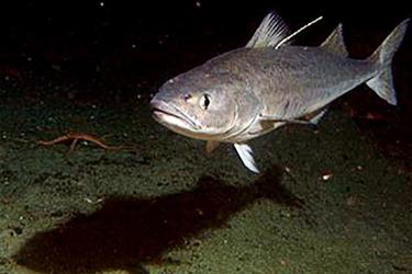
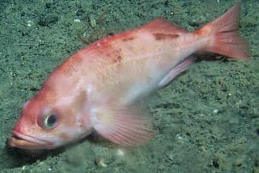
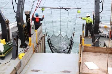
NOAA Fisheries has been tagging and releasing sablefish in Alaska waters since 1972. In that time, approximately 360,000 tags have been released and over 34,000 have been recovered. Tagging effort in Alaska has been centered in three main areas: 1) adult sablefish in offshore waters of the Gulf of Alaska, Bering Sea, and the Aleutian Islands; 2) adult sablefish in the inside waters of Chatham and Clarence Straits; and 3) juvenile sablefish in southeast Alaska.
Large fish swimming near the ocean floor

Pacific Ocean Perch Research in Alaska

Alaska Fisheries Science Center conducts a variety of research on Pacific ocean perch, which seem to be most abundant in the Gulf of Alaska and Aleutian Islands.
Orange fish swimming at bottom of ocean

Alaska Longline Survey Data Map

The Alaska Fisheries Science Center (AFSC) conducts annual longline surveys to estimate the relative abundance of major groundfish species on the continental slope of the eastern Bering Sea, Aleutian Islands, and the Gulf of Alaska. The survey is primarily designed to assess sablefish and indices of abundance have been computed since 1979. Catch data from other species are also available. From 1979 to 1994, the AFSC conducted cooperative annual longline surveys with Japan, and then independently from 1987 to present.
September 14, 2018 - Map ,

Alaska Longline Sablefish Survey Metadata

Data is available from annual bottom longline surveys conducted cooperatively by Japan (1979–1994) and the U.S. National Marine Fisheries Service, Alaska Fisheries Science Center (1988 to present).
September 14, 2018 - Data Set ,

Alaska Fisheries Science Center's Auke Bay Laboratories Data Sets

Many data sets have been collected by Auke Bay Laboratories over the years. For our purposes, a data set is defined as a collection of data records organized around a common attribute. A data set is created by converting raw data into records. Raw data are collected by the trained observer, and then converted into processed data by one or more actions. A record is a collection of processed data organized around some common attribute, such as date of collection, locality of collection, individual animal and so forth. A data set is a collection of those records.

Arctic Ecosystem Research in Alaska

We investigate how changing Arctic conditions affect Arctic fish feeding, growth, and survival.
benthic trawl in Chukchi.jpg