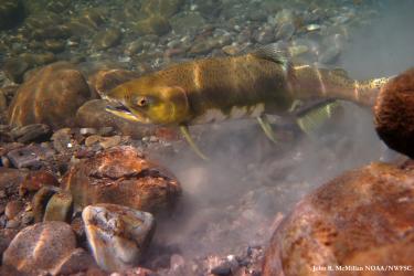
NOAA Fisheries scientists have developed a new experimental dynamic ocean management tool called TOTAL – Temperature Observations To Avoid Loggerheads - to reduce accidental catches of protected loggerhead turtles in fishing nets.
A new model based on daily oceanographic data and the movements of tagged whales has opened the potential for stakeholders to see where in the ocean endangered blue whales are most likely to be so that ships can avoid hitting them.
Scientists describe new “upwelling indices,” which represent a breakthrough in understanding the biological engine that drives the West Coast marine ecosystem.
Learn more about EcoCast—a dynamic ocean management tool that aims to minimize fisheries bycatch and maximize fisheries target catch in near real time.
New computer-generated daily maps will help fishermen locate the most productive fishing spots in near real-time while warning them where they face the greatest risk of entangling sea turtles, marine mammals, and other protected species.
Scientists have long used satellite tags to track blue whales along the West Coast, learning how the largest animals on the planet find enough small krill to feed on to support their enormous size.