It was fun to re-familiarize myself with the ship, the 146-foot R/V Hugh R. Sharp operated by the University of Delaware. It was also a chance to re-familiarize myself with the type of data collection that occurs for this survey.
In recent years, I have sailed on the bottom-trawl surveys aboard the NOAA Ship Henry B. Bigelow. Those surveys use a trawl net for sampling animals. On the sea scallop survey, we use a dredge in some areas and use the HabCam in others.
The HabCam, short for “habitat camera,” is a towed imaging and sensor system that takes thousands of pictures of the sea floor and collects other environmental data. When it’s in the water, it’s driven by a pilot and a co-pilot. The goal is to keep HabCam around 2.5 to 3 meters (roughly 8 to 10 feet) from the ocean bottom as the ship sails along a specific transect or designated sampling route.
Both the driver and co-pilot are constantly watching the depth, side scanner, and front scanner. They’re looking for drastic changes in depth or obstacles that need to be avoided, such as large boulders. The driver controls how close HabCam is to the bottom by using a small lever to either let out more, or less, of the armored fiber optic cable that’s attached to HabCam.
I was a little nervous about this part because it had been so long since I drove this large apparatus, but I really enjoyed it! Once you know how to read the screens and get the feel for operating it, it’s actually fun. After some time, a driver can tire or their eyes may need a break. As a general rule, driving time is limited to1 to 2 consecutive hours, and people are constantly rotated while on duty. If you’re not driving or co-piloting, you may be annotating the captured pictures. This is when we review the pictures to measure scallops and note any fish and crabs, which are some of the other creatures we look for.
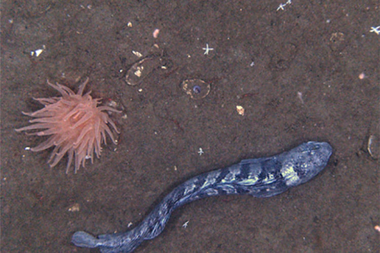
HabCam is a great way to survey the bottom without disturbing the habitat and animals. Here are some of my best pictures from this leg.
After HabCam-ing for a couple days in the lab, we did some dredging. I really enjoyed this change of pace because most of the work is on deck. The weather was overall fairly foggy by then, but during the day we did get sunshine. Some of the catches were full of mussels, empty shells, and rocks. It’s fairly easy to sort through samples from this type of bottom. You just need to take your time to not miss tiny scallops, fish, or crabs.
A couple of catches were mostly of brittle stars. Seeing this catch on deck may make you look twice. All the brittle star arms are slowly moving. It’s similar to how I imagine a pile of worms would move. These are a bit tricky to work through because all the starfish kind of stick together, but if you take your time you’ll get through it! Overall, it was a great survey, and I’m looking forward to going out again next year!
Christine Kircun
2021 Scallop Survey Leg 2
Aboard the R/V Hugh R. Sharp


